
 United Kingdom
 France
 Germany
 Netherlands
 Sweden
 USA
USA
 Italy
Italy
 Spain
Spain
More From Contributor


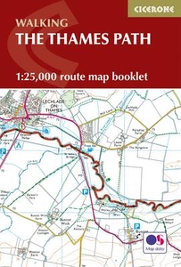
The Thames Path Map Booklet
The Thames Path from the the river`s source to Erith in south-east London on mapping at 1:25, 000 from the Ordnance Survey’s Explorer series in a pocket-size booklet from Cicerone Press. The 288km / 180-mile trail is presented with a route profile, plus summaries for each section showing GPS coordinates for the start and finish, distance and approximate walking time in either direction.Mapping in the pocket booklets from Cicerone Press is identical to the OS Explorer Series, but with the route more prominently highlighted: contours at 5m or 10m intervals, extensive range of symbols for tourist information including campsites, pubs, castles and forts, museums, etc, and for GPS users the lines of the British National Grid at 1km intervals.To see other titles in this series please
click on the series link.
click on the series link.

Product Description
Reviews/Comments
Add New
Vouchers
No voucher codes found.
Do you know a voucher code for this product or supplier? Add it to Insights for others to use.
Do you know a voucher code for this product or supplier? Add it to Insights for others to use.
 Denmark