
 United Kingdom
 France
 Germany
 Netherlands
 Sweden
 USA
USA
 Italy
Italy
 Spain
Spain
More From Contributor


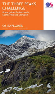
The Three Peaks Challenge: Snowdon 25K Ordnance Survey Map
The mountains of the Three Peaks Challenge - Ben Nevis, Scafell Pike and Snowdon – on extracts from the Ordnance Survey 1:25, 000 Explorer series, with enlargements of the summits, extracts from regional mapping to show road access, and an overview road map linking the three peaks.The area around each peak is presented on a 36x36cm panel with an extract from the OS Explorer series with an overprint highlighting the route(s). Starting point(s) are clearly marked and the peak area is presented in greater clarity on an enlargement. As on the Explorer mapping, contours are at 10m or 5m intervals, with a range of symbols highlighting various local facilities and places of interest. Each panel has the lines of the British National Grid at 1km intervals and includes notes about the peak
and local hazards of the challenge. Accompanying the 25K extracts are three maps of the surrounding area showing road access to the starting point(s), plus an overview map showing motorways and ‘A’ roads between Ben Nevis, Scafell Pike and Snowdon.PLEASE NOTE: the same map is also available under ISBNs 9780319090466 or 9780319089378.
and local hazards of the challenge. Accompanying the 25K extracts are three maps of the surrounding area showing road access to the starting point(s), plus an overview map showing motorways and ‘A’ roads between Ben Nevis, Scafell Pike and Snowdon.PLEASE NOTE: the same map is also available under ISBNs 9780319090466 or 9780319089378.

Product Description
Reviews/Comments
Add New
Vouchers
No voucher codes found.
Do you know a voucher code for this product or supplier? Add it to Insights for others to use.
Do you know a voucher code for this product or supplier? Add it to Insights for others to use.
 Denmark