
 United Kingdom
 France
 Germany
 Netherlands
 Sweden
 USA
USA
 Italy
Italy
 Spain
Spain
More From Contributor


Tipton 1904
Tipton in 1904 in a fascinating series of reproductions of old Ordnance Survey plans in the Alan Godfrey Editions, ideal for anyone interested in the history of their neighbourhood or family. The map covers an industrial area in the northern part of Tipton, extending northward to Bloomfield, Tibbington, Summer Hill, Princes End, Walbrook, and westward to Foxyards Colliery. There are numerous old coal shafts and other reminders that this was once a busy coalfield. Features include LNWR Stour Valley line with Tipton station, GWR OWW line with Tipton and Princes End stations, Birmingham Canal (Wolverhampton Level), Foxyards Inn, Toll End Locks, Horseley Colliery (disused), Moat Colliery, several brick works, industrial tramways, Rounds Hill Colliery, Tipton UDC offices,
Workhouse Lane Bridge, LNWR Princes End Branch with Princes End station, St John`s church, Factory Locks, several other factories (not always named), etc. About the Alan Godfrey Editions of the 25” OS Series:Selected towns in Great Britain and Ireland are covered by maps showing the extent of urban development in the last decades of the 19th and early 20th century. The plans have been taken from the Ordnance Survey mapping and reprinted at about 15 inches to one mile (1:4, 340). On the reverse most maps have historical notes and many also include extracts from contemporary directories. Most maps cover about one mile (1.6kms) north/south, one and a half miles (2.4kms) across; adjoining sheets can be combined to provide wider coverage.FOR MORE INFORMATION AND A COMPLETE LIST OF ALL
AVAILABLE TITLES PLEASE CLICK ON THE SERIES LINK.

Product Description
Reviews/Comments
Add New
Intelligent Comparison
Archived Product

Skipton 1907 Stanfords
£3.50
Archived Product

Flixton 1904 Stanfords
£3.50
Archived Product
Flixton 1904 Stanfords
£2.95
Archived Product
Ripon 1908 Stanfords
£2.95
Archived Product
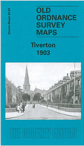
Tiverton 1903 Stanfords
£3.50
Archived Product
Tiverton 1903 Stanfords
£2.95
Archived Product
Paignton 1904 Stanfords
£2.95
Archived Product
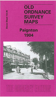
Paignton 1904 Stanfords
£3.50
Vouchers
No voucher codes found.
Do you know a voucher code for this product or supplier? Add it to Insights for others to use.
Do you know a voucher code for this product or supplier? Add it to Insights for others to use.
 Denmark