More From Contributor
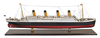
£8.50
Tisza Lake at 1:50, 000 on a waterproof & tear-resistant recreational map from Cartographia in Budapest, highlighting kayaking routes on the lake & recommended cycling trails in the surrounding area, plus a street plan of Tiszafüred. On the lake navigation channels are marked, as well as navigation aids & obstacles, mooring places, etc. On l&, where topography is indicated by contours at & colouring/graphics for different types of vegetation, seven cycling routes are marked, from 18 to 68km long, with locations of cycle hire and/or repair facilities, fishing permit offices, beaches, etc. The map has no geographical coordinates. Map legend is in Hungarian & German only. On the reverse is a street plan of Tiszafüred, addresses of cycle hire and/or repair workshops, plus Hungarian language text about the area. ...
Archived Product
£8.50
The Tisza between Szeged & Tokaj presented in ten sections on a detailed map at 1:100, 000 from Cartographia, with an overprint highlighting a cycling route plus information for navigating along the river. Local towns are annotated with symbols indicating what facilities can be found there & places of interest are also highlighted. The map has no geographical coordinates. Map legend is in Hungarian & German only ...
Archived Product
£6.95
Topographic coverage of mainland Spain at 1:50, 000 in the MTN50 (Mapa Topográfico Nacional) series from the Centro Nacional de Información Geografica, the country’s civilian survey organization. The maps have contours at 20m intervals, enhanced by relief shading, plus colouring and/or graphics to show different types of terrain, vegetation or land use. Boundaries of national parks & other protected areas are marked. In addition to all the usual information featured on topographic mapping at this scale, detailed presentation of the road & rail networks, rural tracks & paths, etc, the maps also show campsites & mountain refuges. On more recent editions some GRs, the official long-distance hiking routes, are also marked (although not as clearly as on hiking maps from other publishers). Each map covers 29.5x 18.5 km (with adjustments in the border or coastal areas). The maps have a 1-km UTM grid, plus margin ticks for latitude & longitude at 1` intervals. Map legend is in Spanish only.HOW TO CHOOSE THE RIGHT 50K MAP: all the titles in CNIG’s 200K Provincial Road Maps series at 1:200, 000 are overprinted with the grid for the 1:50, 000 maps & can be used to see the area covered by each 50K title. TO SEE THE LIST OF TITLES IN THIS SERIES PLEASE CLICK ON THE SERIES LINK.PLEASE NOTE
- MAP TITLES: the grids shown on our website serve both the civilian & the military 1:50, 000 topographic series. Although the areas covered by maps in both series are identical (apart from some border or coastal sheets), occasionally map titles differ – only one title is shown on the grid, usually the military one. In Galicia, the Basque country & in the Catalan speaking areas the tendency now is to use local place names rather than the often better known Castilian ones. Where possible, both versions are included in our titles. Map titles listed on our website are based on information received by us at the time of publication, but sometimes maps arrive showing a completely different title! As long as the map number is as ordered, the correct map has been supplied.
...
Archived Product
£9.99
An anthology that draws from eight decades of literature, newspaper articles, essays, poems, letters, songs, & trial transcripts all relating to the Titanic. Contributors include: Joseph Conrad, H.G Wells, Thomas Hardy, George Bernard Shaw & Arthur Conan Doyle. ...
Archived Product
£6.99
This text provides a record of one of the most traumatic events in maritime history
- the sinking of the Titanic. Not only does
...
Archived Product
£7.99
It boasted libraries, palm tress, swimming pools, a 50-phone switchboard & was nearly as tall as the Eiffel Tower. No, she`s not a skyscraper, she`s the Titanic! To commemorate the centenary of the sinking of the White Star Liner RMS Titanic in 2012, Titanic, A Very Peculiar History delves into the human stories of both crew & passengers & the incredible feats of engineering & design involved in her construction. The book also takes a look at events that occurred once the ship was wrecked, from discovering what dead passengers had tried to take with them to assessing the likelihood of us ever being able to raise the wreck for more study. Featuring a colour insert with a guide to the many decks on board, letters from the liner`s passengers & crew & and an in-depth look at the events that led to the ship`s unpredictable sinking, Titanic, A Very Peculiar History is a great all-round look at the quirky, scary & amazing facts & stories surrounding the Titanic`s conception, construction & maiden voyage. ...
Archived Product
£710.00
A scale model of Titanic, handmade by craftsmen.

Includes::
hundreds of tiny windows, rigging, even little

...
Archived Product
£9.99
Marking the centenary of the Titanic disaster, ` Titanic Lives` is a fresh investigation of the lives of the passengers & crew on board the most famous ship in history. On the night of 14 April 1912, midway through her maiden voyage, the seemingly unsinkable Titanic hit an iceberg, sustaining a 300-feet gash as six compartments were wrenched open to the Atlantic Ocean. In little over two hours, the palatial liner nose-dived to the bottom of the sea. More than 1, 500 people perished in the freezing waters. But who were they? In this impeccably researched & utterly riveting social history, Richard Davenport-Hines brings to life the stories of the men who built & owned the Titanic, the crew who serviced her & the passengers of all classes who sailed on her. We are introduced to this fascinating cast of characters & follow their lives on board the ship through to the supreme dramatic climax of the disaster. Universally critically acclaimed, ` Titanic Lives` is the must-read Titanic book of the centenary year. ...
Archived Product
£16.99
Titanic Reference Map from the National Geographic, folded format, presenting on one side a map of the Atlantic annotated with shipping routes, sea currents, iceberg lines, etc, plus very extensive text on all aspects relating to the sinking of the ship; on the reverse is more information about the ship itself plus notes about the lost & the saved, the legacy of the disaster, & more. On one side the map shows the route of the Titanic from Southampton, via Cherbourg in France & Queenstown (now Cobh) in Irel&, to the point where the ship issued its distress signal, together with shipping lanes before & after 1913, as well as sights of notable shipwrecks & landmarks. On l&, on both sides of the Atlantic, the map shows locations of various institutions & memorials connected with the Titanic. The map of the Atlantic is surrounded by several panels providing further information: Icebergs, Shipping News, Women & Children First, In Memoriam, & The Wreck Discovered – illustrated with a more detailed map of the area & colour photos. Also included is a graph showing iceberg frequency, a table with a breakdown of losses among passengers & the crew of the ship, time chart from commissioning the design of the Titanic to the death of the last survivor in 2009, etc. On the reverse, are detailed drawings of the ship’s decks & the ships’ profile, information about selected victims & survivors, comparisons of its size with other famous ships & buildings, a list of films, plays & documentaries inspired by the disaster, etc. This map is also available as a wall map, on paper or encapsulated. ...
Archived Product
£6.95
Titanic Reference Map is a double sided, colour, info-graphic foldout sheet illustrating the story of the doomed ocean liner from a geographic perspective. The first complete map of the world’s most famous shipwreck, has been revised & updated. Map side: the routes of the 1912 shipping lanes are indicated before & after the disaster; the journey of the fateful iceberg is mapped; statistics & charts feature from the original hearings into the disaster; deep-ocean diagrams illustrate the search process; sites of Titanic related points of interest are shown. Ship side: colour-coded deck plans; cutaway view ship plans & escape routes; portraits of noted passengers & crew members both lost & saved; Titanic statistics; debates & cultural legacy. ...
Archived Product

Titanic

When Titanic set sail in 1912, she was the largest, most luxurious and most technologically advanced man-made moving object in the world. Built by the great industrial communities that made Britain the pre-eminent superpower of the age, the famous ocean liner signalled the high-water mark of our nation's manufacturing industry. Accompanying a landmark Channel 4 documentary series, Titanic: The Mission, this book tells the untold stories of the men and women who made the 'ship of dreams' a reality: the fearless riveters who risked deafness from their incessant hammering of the millions of rivets that held together the fortress-like steel hull; the engineers charged with the Herculean task of fitting engines that would power the massive ship across the Atlantic at a speed of 23 knots;
the electricians who installed state-of-the-art communications systems and enormous steam- driven generators, each capable of powering the equivalent of 400 modern homes; and, the highly skilled carpenters, cabinet-makers and artists who attended to every last detail of the opulent staterooms.Titanic, of course, was destined to sink on her maiden voyage, but the achievement of the thousands of people who built and fitted out this astonishing ship lives on.
RIP - This product is no longer available on our network. It was last seen on 25.09.2019

This page now acts as a permanent archive for this product. Add more information using the comments box below to ensure it can still be found by future generations.

Use our search facility to see if it is available from an alternative contributor.
  • Availability: Out Of Stock
  • Supplier: Stanfords
  • SKU: 9781905026715
Availability: In Stock
£20.00

Product Description

When Titanic set sail in 1912, she was the largest, most luxurious & most technologically advanced man-made moving object in the world. Built by the great industrial communities that made Britain the pre-eminent superpower of the age, the famous ocean liner signalled the high-water mark of our nation's manufacturing industry. Accompanying a landmark Channel 4 documentary series, Titanic: The Mission, this book tells the untold stories of the men & women who made the 'ship of dreams' a reality: the fearless riveters who risked deafness from their incessant hammering of the millions of rivets that held together the fortress-like steel hull; the engineers charged with the Herculean task of fitting engines that would power the massive ship across the Atlantic at a speed of 23 knots; the electricians who installed state-of-the-art communications systems & enormous steam- driven generators, each capable of powering the equivalent of 400 modern homes; &, the highly skilled carpenters, cabinet-makers & artists who attended to every last detail of the opulent staterooms. Titanic, of course, was destined to sink on her maiden voyage, but the achievement of the thousands of people who built & fitted out this astonishing ship lives on.

Reviews/Comments

Add New

Intelligent Comparison

Oooops!
We couldn't find anything!
Perhaps this product's unique.... Or perhaps we are still looking for comparisons!
Click to bump this page and we'll hurry up.

Price History

Vouchers

No voucher codes found.
Do you know a voucher code for this product or supplier? Add it to Insights for others to use.

Facebook

Jargon Buster

Steel - An alloy made predominately of Iron combined with <2% carbon
water - A chemical substance. Chemical formula H2O.
Steam - Steam - water in gas form, water vapour. Commonly seen coming from a kettle
World - A physical grouping, commonly used to describe earth and everything associated with ti
speed - A measurement of how fast an object travels between two points
Set - a group of items usually related to one another. Some objects cannot function without the complete set of items.

Supplier Information

Stanfords
Stanfords was established in 1853 and opened their iconic Covent Garden flagship store in 1901. They have become the top retailer of maps, travel books and accessories in the UK and arguably offer the largest selection of maps and travel books worldwide. Famous names such as Captain Robert Falcon Scott, Ranulph Fiennes and Michael Palin have purchased from Stanfords. They now have a shop in Bristol and both stores together with other venues operate a calendar of events including talks, book signings and exhibitions. As a specialist map retailer, the map selection is comprehensive and includes road maps, street maps and walking maps from worldwide destinations, as well as a selection of world atlases and wall maps. Books include travel guides and travel literature. Stanfords also stock globes, from miniatures made of blue marble to magnificent floor-standing globes. The website features a selection of interesting articles on travel topics.
Page Updated: 2023-11-12 20:15:36

Community Generated Product Tags

Oh No! The productWIKI community hasn't generated any tags for this product yet!
Menu