More From Contributor

£7.99
The essential holiday accessory to help you get the most out of your stay on this lush tropical isl&. The main events, lore, history, religion, culture, wild-life, beaches & hikes are all written within the pages of this guide, assisting you to better understand & appreciate the island & it's people. ...
Archived Product
£14.99
Waterproof & tear-resistant OS Active version of map No. 47 from the Ordnance Survey’s Landranger series at 1:50, 000, with contoured & GPS compatible topographic mapping plus tourist information.MOBILE DOWNLOADS: As well as the physical edition of the map, each Landranger title now

Includes::
a code for downloading after purchase its digital version onto your smartphone or tablet for viewing on the OS smartphone app.OS LANDRANGER SERIES: to see the list of all the titles in the OS Landranger series, both paper & waterproof versions, please click on the series link. Maps in the Landranger series provide plenty of recreational & tourist information, indicating the traditional public right of way paths (except in Scotland where different laws apply), including bridleways & byways restricted or open to motorized traffic. National Trails & selected other long-distance paths are marked, as well as on-road & traffic-free cycle routes with their National/ Regional Cycle Network numbers. National Trust/ National Trust for Scotland & Forestry Commission land is clearly marked, indicating open or restricted access. A range of symbols highlights camping & caravanning sites, youth hostels, tourist information offices & visitors’ centres, parking & picnicking places, World Heritage sites, sport & recreational facilities, etc. The maps provide detailed presentation of topography with contours at 10m intervals, numerous spot heights & additional colouring and/or graphics for different types of woodlands, orchards or parkl&, rock features including scree & cliffs, water features inland & along the sea shore with marshl&, dunes, s&, mud, shingle & the high water mark. All the standard information expected of survey mapping at this scale is included: finely graded road network, railway lines with stations, cuttings, embankments, etc; individual isolated buildings; archaeological & historical sites, etc. For GPS users the British National Grid is shown at 1km intervals, with latitude & longitude given by margin ticks at 1` & cross hairs on the map at 5`. Each map covers an area of 40 x 40km, (approx. 25 x 25 miles).

...
Archived Product
£8.99
Paper version of map No. 47 from the Ordnance Survey’s Landranger series at 1:50, 000, with contoured & GPS compatible topographic mapping plus tourist information.MOBILE DOWNLOADS: As well as the physical edition of the map, each Landranger title now

Includes::
a code for downloading after purchase its digital version onto your smartphone or tablet for viewing on the OS smartphone app.OS LANDRANGER SERIES: to see the list of all the titles in the OS Landranger series, both paper & waterproof versions, please click on the series link. Maps in the Landranger series provide plenty of recreational & tourist information, indicating the traditional public right of way paths (except in Scotland where different laws apply), including bridleways & byways restricted or open to motorized traffic. National Trails & selected other long-distance paths are marked, as well as on-road & traffic-free cycle routes with their National/ Regional Cycle Network numbers. National Trust/ National Trust for Scotland & Forestry Commission land is clearly marked, indicating open or restricted access. A range of symbols highlights camping & caravanning sites, youth hostels, tourist information offices & visitors’ centres, parking & picnicking places, World Heritage sites, sport & recreational facilities, etc. The maps provide detailed presentation of topography with contours at 10m intervals, numerous spot heights & additional colouring and/or graphics for different types of woodlands, orchards or parkl&, rock features including scree & cliffs, water features inland & along the sea shore with marshl&, dunes, s&, mud, shingle & the high water mark. All the standard information expected of survey mapping at this scale is included: finely graded road network, railway lines with stations, cuttings, embankments, etc; individual isolated buildings; archaeological & historical sites, etc. For GPS users the British National Grid is shown at 1km intervals, with latitude & longitude given by margin ticks at 1` & cross hairs on the map at 5`. Each map covers an area of 40 x 40km, (approx. 25 x 25 miles).

...
Archived Product
£5.59
Map No. 47, Tobermory & North Mull, in the Ordnance Survey Landranger series at 1:50, 000, covering the northern part of the Isle of Mull with Ulva, Gometra, Staffa, Little Colonsay, the Treshnish Isles, Oronsay & northern Coll, including Calgary, Dervaig, Kilninian, Ballygown, Salen, Gruline, Oskamull, Ardmore Point, Caliach Point, Loch Frisa, Loch Ba, Ben More on Mull; Loch Na Keal, Loch Tuath & the Sound of Mull; Sorisdale & Arinagour on Coll; plus on the mainland Ardnamurchan, Ben Hiant, Kilmory, Kilchoan & Drimnin. Edition C2; Publication date October 2007 About Ordnance Survey ...
Archived Product
£9.09
Map No. 47, Tobermory & North Mull, in the waterproof & tear-resistant OS Active version of the Ordnance Survey Landranger series at 1:50, 000, covering the northern part of the Isle of Mull with Ulva, Gometra, Staffa, Little Colonsay, the Treshnish Isles, Oronsay & northern Coll, including Calgary, Dervaig, Kilninian, Ballygown, Salen, Gruline, Oskamull, Ardmore Point, Caliach Point, Loch Frisa, Loch Ba, Ben More on Mull; Loch Na Keal, Loch Tuath & the Sound of Mull; Sorisdale & Arinagour on Coll; plus on the mainland Ardnamurchan, Ben Hiant, Kilmory, Kilchoan & Drimnin. Edition C2; Publication date April 2012 About Ordnance Survey ...
Archived Product
£6.99
With a tappity tap & a rat a tat tat.. . bet you`ve never seen tortoises move quite like that! From the creator of Mike the Knight, comes a warm-hearted picture book full of dancing animals, newfound friendship & a generous sprinkling of moonlight magic. To shy little Lucy, the very best thing about her grandpa`s pet shop is the two teeny-tiny tortoises
- Toby & Tabitha. & Lucy knows something about Toby & Tabitha that no one else knows... When the sun goes down, the tortoises open their sleepy-snoozy eyes, wriggle their little legs.. . & dance! But, one Saturday, Lucy realizes that Tabitha is missing.. . she`s been sold! Did Lucy leave it too late to share her magical secret?
...
Archived Product
£16.99
In Toby's Room, Pat Barker revisits the First World War & the characters introduced in Life Class. When Toby is reported ' Missing, Believed Killed', another secret casts a lengthening shadow over Elinor's world: how exactly did Toby die
- & why? Elinor determines to uncover the truth. Only then can she finally close the door to Toby's room. Moving from the Slade School of Art to Queen Mary's Hospital, where surgery & art intersect in the rebuilding of the shattered faces of the wounded, Toby's Room is a riveting drama of identity, damage, intimacy & loss. Toby's Room is Pat Barker's most powerful novel yet. Heart-rendering return to the Great War... On every level, Toby's Room anatomises a world where extreme emotion shatters the boundaries of identity, behaviour, gender. Through the mask of Apollo bursts an omnipresent Dionysus. (Independent). Once again Barker skilfully moves between past & present, seamlessly weaving fact & fiction into a gripping narrative. (Sunday Telegraph). A gripping & moving exploration of the lasting effects of war. (Woman & Home). A natural storyteller.. .the reader [will be] torn between wanting to linger over the sheer pleasure of the writing & the desire to rush towards the end to discover how it all pans out. (Daily Mail). Pat Barker was born in 1943. Her books include the highly acclaimed Regeneration trilogy, comprising Regeneration, which has been filmed, The Eye in the Door, which won the Guardian Fiction Prize, & The Ghost Road, which won the Booker Prize. The trilogy featured in the Observer's 2012 list of the ten best historical novels. She is also the author of the more recent novels Another World, Border Crossing, Double Vision, Life Class, & Toby's Room. She lives in Durham.
...
Archived Product
£7.99
Pat Barker returns to the First World War in ” Toby`s Room”, a dark, compelling novel of human desire, wartime horror & the power of friendship. When Toby is reported ` Missing, Believed Killed`, another secret casts a lengthening shadow over Elinor`s world: how exactly did Toby die
- & why? Elinor determines to uncover the truth. Only then can she finally close the door to Toby`s room. Moving from the Slade School of Art to Queen Mary`s Hospital, where surgery & art intersect in the rebuilding of the shattered faces of the wounded, ” Toby`s Room” is a riveting drama of identity, damage, intimacy & loss. ” Toby`s Room” is Pat Barker`s most powerful novel yet. Toby’s Room features characters which previously appeared in Pat Barker’s Life Class. Like the author’s highly acclaimed Regeneration Trilogy, Life Cass & Toby’s Room will also eventually become part of a trilogy, with its final, still being written volume set in World War II. Pat Barker was born in 1943. Her books include the highly acclaimed ” Regeneration” trilogy, comprising ” Regeneration”, which has been filmed, ” The Eye in the Door”, which won the Guardian Fiction Prize, & ” The Ghost Road”, which won the Booker Prize. The trilogy featured the ” Observer`s” 2012 list of the ten best historical novels. She is also the author of the more recent novels ” Another World”, ” Border Crossing”, ” Double Vision”, ” Life Class”, & ” Toby`s Room”. She lives in Durham.
...
Archived Product
£11.50
Topographic survey of France at 1:25, 000 in IGN`s excellent TOP25 / Série Bleue series. All the maps are GPS compatible, with a 1km UTM grid plus latitude & longitude lines at 5’ intervals. Contours are at 5m intervals except for mountainous areas where the maps have contours at 10m intervals, vividly enhanced by hill shading & graphics for rocky terrain. Colouring with graphics indicates different types of vegetation or land use (deciduous or coniferous forests, moors, orchards, vineyards, etc). PLEASE NOTE: coverage of France at this scale is currently being revised – the format & the presentation of each title are indicated by the letters at the end of its Sheet Reference number (e.g. 0416ET, 3531ETR, 1923SB, etc.)MAPS WITH FULL TOURIST OVERPRINT & AN ENGLISH MAP LEGEND: all TOP25 maps & the SB editions of Série Bleue have an overprint highlighting waymarked walking trails including long-distance GR routes &, where appropriate, ski routes. Symbols indicate campsites, gîtes d’etape, refuges, equestrian centres & other recreational facilities or sites, tourist information centres, cultural heritage, etc. Towns & locations of particular interest are highlighted.- ET or OT = single-sided TOP25 map covering approx. 29x 21 km / 18x 13 miles.- ETR or OTR = waterproof & tear resistant TOP25 map covering the same area as the corresponding ET or OT number, but double-sided, printed on a smaller size sheet with a good overlap between the sides.- SB = Série Bleue map with full tourist overprint; these maps, first introduced in summer 2014, each cover approx. 29x 24km / 18x 15 miles.SÉRIE BLEUE maps with numbers ending in E (Est) or O (Ouest): most editions now indicate the GR routes, but do not show any other tourist information. Map legend is in French only. Each map covers approx. 14x 20km / 9x 12 miles. ...
Archived Product
£13.99
This map of Tocksfors Arjang Nysater in 1:50, 000 is part of a series of topographic maps from Norstedts Kartforlaget which


...
Archived Product

Tobermory And North Mull WATERPROOF

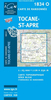
Map No. 47, Tobermory and North Mull, in a waterproof and tear-resistant version of the Ordnance Survey Landranger series at 1:50, 000, covering the northern part of the Isle of Mull with Ulva, Gometra, Staffa, Little Colonsay, the Treshnish Isles, Oronsay and northern Coll, including Calgary, Dervaig, Kilninian, Ballygown, Salen, Gruline, Oskamull, Ardmore Point, Caliach Point, Loch Frisa, Loch Ba, Ben More on Mull; Loch Na Keal, Loch Tuath and the Sound of Mull; Sorisdale and Arinagour on Coll; plus on the mainland Ardnamurchan, Ben Hiant, Kilmory, Kilchoan and Drimnin. Edition C2; Revised for selected changes 2007; Copyright date 2007 This title is also available on our website in a paper version.Maps in this series are only published folded. Stanfords can also
print flat versions of Ordnance Survey maps through the OS Select system, centring the map on a location of your choice and with a picture provided by you on the cover. For more information please click on the link at the bottom of this description.About Ordnance Survey
RIP - This product is no longer available on our network. It was last seen on 25.09.2019

This page now acts as a permanent archive for this product. Add more information using the comments box below to ensure it can still be found by future generations.

Use our search facility to see if it is available from an alternative contributor.
  • Availability: Out Of Stock
  • Supplier: Stanfords
  • SKU: 9780755800476
Availability: In Stock
£10.39

Product Description

Map No. 47, Tobermory & North Mull, in a waterproof & tear-resistant version of the Ordnance Survey Landranger series at 1:50, 000, covering the northern part of the Isle of Mull with Ulva, Gometra, Staffa, Little Colonsay, the Treshnish Isles, Oronsay & northern Coll, including Calgary, Dervaig, Kilninian, Ballygown, Salen, Gruline, Oskamull, Ardmore Point, Caliach Point, Loch Frisa, Loch Ba, Ben More on Mull; Loch Na Keal, Loch Tuath & the Sound of Mull; Sorisdale & Arinagour on Coll; plus on the mainland Ardnamurchan, Ben Hiant, Kilmory, Kilchoan & Drimnin. Edition C2; Revised for selected changes 2007; Copyright date 2007 This title is also available on our website in a paper version. Maps in this series are only published folded. Stanfords can also print flat versions of Ordnance Survey maps through the OS Select system, centring the map on a location of your choice & with a picture provided by you on the cover. For more information please click on the link at the bottom of this description. About Ordnance Survey

Reviews/Comments

Add New

Price History

Vouchers

No voucher codes found.
Do you know a voucher code for this product or supplier? Add it to Insights for others to use.

Facebook

Jargon Buster

Paper - A thin sheet mainly used for writing. Available in a variety of colours. Made mainly from wood pulp.
Date - A day on a calendar
Date - A social activity whith a current or potential partner
Waterproof - Resistant to water, usualy specified by depth in metres
Resistant - Something that can repel against something.
Print - A mechanical process of putting text onto paper. It can also relate to a pattern on an item.

Supplier Information

Stanfords
Stanfords was established in 1853 and opened their iconic Covent Garden flagship store in 1901. They have become the top retailer of maps, travel books and accessories in the UK and arguably offer the largest selection of maps and travel books worldwide. Famous names such as Captain Robert Falcon Scott, Ranulph Fiennes and Michael Palin have purchased from Stanfords. They now have a shop in Bristol and both stores together with other venues operate a calendar of events including talks, book signings and exhibitions. As a specialist map retailer, the map selection is comprehensive and includes road maps, street maps and walking maps from worldwide destinations, as well as a selection of world atlases and wall maps. Books include travel guides and travel literature. Stanfords also stock globes, from miniatures made of blue marble to magnificent floor-standing globes. The website features a selection of interesting articles on travel topics.
Page Updated: 2023-11-12 20:15:36

Community Generated Product Tags

Oh No! The productWIKI community hasn't generated any tags for this product yet!
Menu