
 United Kingdom
 France
 Germany
 Netherlands
 Sweden
 USA
USA
 Italy
Italy
 Spain
Spain
More From Contributor


Tokyo Borch
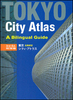
Laminated waterproof street plan of Tokyo at 1:17, 000, with maps of Tokyo Bay and Shinagawa (1:19, 000), and greater Tokyo (1:1, 300, 000). There are maps of the Tokyo Subway, and a small map of Japan showing administrative and time zone boundaries.The main map shows the street network with Tokyo sub and railway lines marked, as well as Tokyo water cruise routes. Points of interest such as museums, theaters, places of worship are shown; the map also includes 30 ‘Top Sights’ that are also indexed.The reverse of the map shows Tokyo Bay and Shinagawa, with a similar level of detail to the main map; the map of greater Tokyo shows the main road network of the region, with some points of interest marked.A small inset is also included with information on climate, emergency contact
numbers/websites, population, and more.
numbers/websites, population, and more.

Product Description
Reviews/Comments
Add New
Intelligent Comparison
Archived Product

Toronto Borch Stanfords
£8.99
Vouchers
No voucher codes found.
Do you know a voucher code for this product or supplier? Add it to Insights for others to use.
Do you know a voucher code for this product or supplier? Add it to Insights for others to use.
 Denmark