More From Contributor
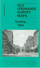
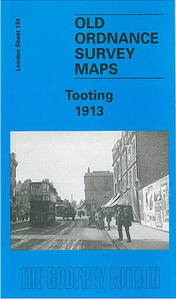
£5.99
Summer is over & Benito the bear cub needs a new cubbyhole. His old one is just too small & winter is coming fast. Benito searches high & low, far & wide for the perfect new home. Fox holes, rabbit burrows & ant holes will just not do. Benito needs a cubbyhole just right for a not-so-little bear. Then one day, Benito discovers his perfect cubbyhole by accident. It was right under his nose. ...
Archived Product
£9.95
The Toolshed Colouring Book is perhaps the first colouring book aimed at men, & features 50 illustrations drawn from Lee Phillips` attention-grabbing Shed Project. Started in 2013, originally as one drawing a day, Phillips` Shed Project documents item-by-item the contents of his late grandfather`s shed. The project has received national coverage in the media & has generated profiles of Phillips & his work as far apart as Belgium, Japan & Australia. A sister project to the Toolshed Journal, the Toolshed Colouring Book is both a cool activity book for men but also a fascinating glimpse into The Shed Project itself. ...
Archived Product
£9.95
The Toolshed Journal is a beautifully designed journal, featuring three different stocks & 40 illustrations (both full-page & details) drawn from Lee Phillips` attention-grabbing Shed Project. Started in 2013, originally as one drawing a day, Phillips` Shed Project documents item-by-item the contents of his late grandfather`s shed. The project has received national coverage in the media & has generated profiles of Phillips & his work as far apart as Belgium, Japan & Australia. Featuring a leatherette cover, a page of stickers & a mixture of illustrated & blank pages to write on, The Toolshed Journal is the perfect man gift! ...
Archived Product
£4.99
Small yet perfectly formed, these antibacterial brush guards protect your toothbrush while on the move. Designed to fit snugly over the head of any standard or electric toothbrush, they keep dirt out & stop bristles becoming out of shape & ineffective. The `snap-lock` secure fastening keeps the toothbrush cover in place, helping to prolong the life of your toothbrush & keep your wash bag clean & dry. ...
Archived Product
£3.50
Tooting in 1894 in a fascinating series of reproductions of old Ordnance Survey plans in the Alan Godfrey Editions, ideal for anyone interested in the history of their neighbourhood or family. Two versions for this area have been published to show how it developed across the years; coverage is less complete on the 1913 map where the Surrey part of the map is left blank. The 1894 map covers the area from Wimbledon cemetery & Cromwell Road eastward to St Nicholas` church, Mitcham Road & Vant Road, & from Maskell Road & Huntspill Road southward to Cowper Road & Trevelyan Road. Features include Fountain Hospital; Lambeth, Wimbledon & Streatham cemeteries; Tooting Graveney, Merton Road, High Street, Mitcham Road, St Clement Danes Almshouses, tramways along Upper Tooting Road; a stretch of the River Wandle with industries, including Garratt Printing Works; Durnsford Lodge Hospital, Haydon`s Road station. The map has street directory extracts for Bickersteth Road, Blackshaw Road, Broadway, Garratt Lane, Hereward Road, Mellison Road, Merton Road & Mitcham Road. The 1913 map (published by the OS as London Sheet XII.4) has Surrey
- the area west of Lambeth Cemetery
- left blank. In this version the marginal London sheet XII.8 to the south is provided as an inset for completion. The map excludes Haydons Road station, Wimbledon cemetery & the River Wandle area, but it does cover the massive Grove Hospital, more extensive tramways, & more streets, especially between Backshaw Road & Garratt Lane. Street directories are included for Defoe Road, Garratt Lane, Tooting High Street, Mitcham Road, Selkirk Street & a few others. About the Alan Godfrey Editions of the 25” OS Series Selected towns in Great Britain & Ireland are covered by maps showing the extent of urban development in the last decades of the 19th & early 20th century. The plans have been taken from the Ordnance Survey mapping & reprinted at about 15 inches to one mile (1:4, 340). On the reverse most maps have historical notes & many also include extracts from contemporary directories. Most maps cover about one mile (1.6kms) north/south, one & a half miles (2.4kms) across; adjoining sheets can be combined to provide wider coverage.FOR MORE INFORMATION & A COMPLETE LIST OF ALL AVAILABLE TITLES PLEASE CLICK ON THE SERIES LINK.

...
Archived Product
£8.99
An unbeatable, pocket-sized guide to Amsterdam, packed with insider tips & ideas, colour maps, top 10 lists, & a laminated pull-out map
- all designed to help you see the very best of Amsterdam. Take an Amsterdam walking tour, see remarkable world treasures at the Amsterdam Museum, explore the canals & waterways, admire the wooden vaulted ceiling & magnificent organ in Oude Kerk, or step back in time at the Anne Frank Museum. From Top 10 performing arts venues to Top 10 things to do for free
- discover the best of Amsterdam with this easy-to-use travel guide. Inside Top 10 Amsterdam:- Ten easy-to-follow itineraries, perfect for a day trip, a weekend, or a four-day trip- Top 10 lists showcase the best Amsterdam attractions, covering the Rijksmuseum, van Gogh Museum, Anne Frank`s House, & more- Free laminated pull-out map of Amsterdam, plus over 7 colour neighbourhood maps- In-depth neighbourhood guides explore Amsterdam`s most interesting areas, with the best places for shopping, going out & sightseeing- Colour-coded chapters divided by area make it easy to find information quickly & plan your day
- Essential travel tips including our expert choices of where to stay, eat, shop & sightsee, plus useful transport, visa & health information- Colour maps help you navigate with ease- Covers Oude Zijde, Nieuwe Zijde, Western Canal Ring, Central Canal Ring, Eastern Canal Ring, Museum Quarter, Plantage, & more Staying for longer & looking for a comprehensive guide to Amsterdam? Try DK Eyewitness Travel Guide Amsterdam or DK Eyewitness Travel Guide The Netherlands. About DK Eyewitness Travel: DK`s Top 10 guides take the work out of planning a short trip, with easy-to-read maps, tips & tours to inform & enrich your weekend trip or cultural break. DK is the world`s leading illustrated reference publisher, producing beautifully designed books for adults & children in over 120 countries.


...
Archived Product
£8.99
An unbeatable, pocket-sized guide to Bangkok, packed with insider tips & ideas, colour maps, top 10 lists, & a laminated pull-out map
- all designed to help you see the very best of Bangkok. Explore gleaming treasures at the National Museum, wander Bangkok`s canals & waterways, marvel at the spectacular Grand Palace or visit the bustling Chatuchak Market. From the Top 10 Buddhist temples to the Top 10 festivals
- discover the best of Bangkok with this easy-to-use travel guide. Inside Top 10 Bangkok:- Seven easy-to-follow itineraries, perfect for a day trip, a weekend or a four-day tip- Top 10 lists showcase Bangkok`s best attractions, covering the Grand Palace, Damnoen Saduak Floating Market, Wat Arun, Jim Thompson House & many more- Free laminated pull-out map of Bangkok, plus five colour neighbourhood maps- In-depth neighbourhood guides explore Bangkok`s most interesting areas, with the best places for shopping, going out & sightseeing
- Colour-coded chapters divided by area make it easy to find information quickly & plan your day
- Essential travel tips including our expert choices of where to stay, eat, shop & sightsee, plus useful transport, visa & health information- Colour maps help you navigate with ease- Covers the Old City, Chinatown, Downtown, Greater Bangkok & more Staying for longer as part of a bigger trip around Thailand? Try our DK Eyewitness Travel Guide Thail&. About DK Eyewitness Travel: DK`s Top 10 guides take the work out of planning a short trip, with easy-to-read maps, tips & tours to inform & enrich your weekend trip or cultural break. DK is the world`s leading illustrated reference publisher, producing beautifully designed books for adults & children in over 120 countries.


...
Archived Product
£8.99
An unbeatable, pocket-sized guide to Barcelona, packed with insider tips & ideas, colour maps, top 10 lists, & a laminated pull-out map
- all designed to help you see the very best of Barcelona. Wander the stately Museu Nacional d` Art de Catalunya, stroll down thriving thoroughfare La Rambla, admire some of the world`s finest Modernista architecture at the Sagrada Familia, or sample world-renowned cuisine & enjoy a buzzing nightlife. From Top 10 museums & galleries to the Top 10 most fascinating markets, discover the best of Barcelona with this easy-to-use travel guide. Inside Top 10 Barcelona:- Nine easy-to-follow itineraries, perfect for a day trip, a weekend, or a week- Top 10 lists showcase the best Barcelona attractions, covering Parc Guell, the Museu Picasso, La Pedrera, Palau de la Musica Catalana, & more- Free laminated pull-out map of Barcelona, plus seven colour neighbourhood maps- In-depth neighbourhood guides explore Barcelona`s most interesting areas, with the best places for shopping, going out & sightseeing
- Colour-coded chapters divided by area make it easy to find information quickly & plan your day
- Essential travel tips including our expert choices of where to stay, eat, shop & sightsee, plus useful transport, visa & health information- Colour maps help you navigate with ease- Covers Barri Gotic & La Ribera, El Raval, Montjuic, The Seafront, Eixample, Gracia, Tibi & more Staying for longer & looking for a more comprehensive guide to Barcelona? Try our DK Eyewitness Travel Guide Barcelona or DK Eyewitness Travel Guide Spain. About DK Eyewitness Travel: DK`s Top 10 guides take the work out of planning a short trip, with easy-to-read maps, tips, & tours to inform & enrich your weekend trip or cultural break. DK is the world`s leading illustrated reference publisher, producing beautifully designed books for adults & children in over 120 countries.


...
Archived Product
£8.99
An unbeatable, pocket-sized guide to Beijing, packed with insider tips & ideas, colour maps, top 10 lists, & a laminated pull-out map
- all designed to help you see the very best of Beijing. Explore the iconic Forbidden City, take a rickshaw tour through the back lanes of Hou Hai, clamber the slopes of the Great Wall of China or wander the cutting-edge 798 Art District. From Top 10 markets & malls, to the Top 10 Beijing dishes
- discover the best of Beijing with this easy-to-use travel guide. Inside Top 10 Beijing:- Nine easy-to-follow itineraries, perfect for a day trip, a weekend or a four-day trip- Top 10 lists showcase Beijing`s best attractions, covering the Temple of Heaven, Bei Hai Park, the Ming Tombs, Tian`an Men Square, the Summer Palace, & many more- Free laminated pull-out map of Beijing, plus seven colour neighbourhood maps- In-depth neighbourhood guides explore Beijing`s most interesting areas, with the best places for shopping, going out & sightseeing
- Colour-coded chapters divided by area make it easy to find information quickly & plan your day
- Essential travel tips including our expert choices of where to stay, eat, shop & sightsee, plus useful transport, visa & health information- Colour maps help you navigate with ease- Covers Tian`an Men Square & the Forbidden City, Eastern, Western & Greater Beijing & more Staying for longer & looking for a comprehensive guide to the region? Try our DK Eyewitness Travel Guide Beijing & Shanghai for more in-depth information. About DK Eyewitness Travel: DK`s Top 10 guides take the work out of planning a short trip, with easy-to-read maps, tips & tours to inform & enrich your weekend trip or cultural break. DK is the world`s leading illustrated reference publisher, producing beautifully designed books for adults & children in over 120 countries.


...
Archived Product
£8.99
An unbeatable, pocket-sized guide to Berlin, packed with insider tips & ideas, colour maps, top 10 lists, & a laminated pull-out map
- all designed to help you see the very best of Berlin. Take a stroll along Unter den Linden, discover world-class treasures at Museumsinsel, have a picnic in the vast Tiergarten, visit the royal stomping grounds of the Charlottenburg Palace or enjoy the vibrant nightlife in Kreuzberg. From Top 10 art galleries to Top 10 lounges & clubs
- discover the best of Berlin with this easy-to-use travel guide. Inside Top 10 Berlin:- Twelve easy-to-follow itineraries, perfect for a day trip, a weekend, or a week- Top 10 lists showcase the best Berlin attractions, covering Brandenburger Tor & Pariser Platz, the Reichstag, Museumsinsel, Kurfurstendamm, Kulturforum, & more- Free laminated pull-out map of Berlin, plus ten colour neighbourhood maps- In-depth neighbourhood guides explore Berlin`s most interesting areas, with the best places for shopping, going out & sightseeing
- Colour-coded chapters divided by area make it easy to find information quickly & plan your day
- Essential travel tips including our expert choices of where to stay, eat, shop & sightsee, plus useful transport, visa & health information- Colour maps help you navigate with ease- Covers Unter den Linden, Scheunenviertel, Alexanderplatz, the Tiergarten & Federal District, Charlottenburg, Spandau, Kreuzberg & the Berlin Wall, Potsdam, & more Staying for longer & looking for a more comprehensive guide to Berlin? Try our DK Eyewitness Travel Guide Berlin. About DK Eyewitness Travel: DK`s Top 10 guides take the work out of planning a short trip, with easy-to-read maps, tips, & tours to inform & enrich your weekend trip or cultural break. DK is the world`s leading illustrated reference publisher, producing beautifully designed books for adults & children in over 120 countries.


...
Archived Product

Tooting 1913

Tooting in 1913 in a fascinating series of reproductions of old Ordnance Survey plans in the Alan Godfrey Editions, ideal for anyone interested in the history of their neighbourhood or family. Two versions for this area have been published to show how it developed across the years; coverage is less complete on the 1913 map where the Surrey part of the map is left blank. The 1894 map covers the area from Wimbledon cemetery and Cromwell Road eastward to St Nicholas` church, Mitcham Road and Vant Road, and from Maskell Road and Huntspill Road southward to Cowper Road and Trevelyan Road. Features include Fountain Hospital; Lambeth, Wimbledon and Streatham cemeteries; Tooting Graveney, Merton Road, High Street, Mitcham Road, St Clement Danes Almshouses, tramways along Upper Tooting
Road; a stretch of the River Wandle with industries, including Garratt Printing Works; Durnsford Lodge Hospital, Haydon`s Road station. The map has street directory extracts for Bickersteth Road, Blackshaw Road, Broadway, Garratt Lane, Hereward Road, Mellison Road, Merton Road and Mitcham Road. The 1913 map (published by the OS as London Sheet XII.4) has Surrey - the area west of Lambeth Cemetery - left blank. In this version the marginal London sheet XII.8 to the south is provided as an inset for completion. The map excludes Haydons Road station, Wimbledon cemetery and the River Wandle area, but it does cover the massive Grove Hospital, more extensive tramways, and more streets, especially between Backshaw Road and Garratt Lane. Street directories are included for Defoe Road,
Garratt Lane, Tooting High Street, Mitcham Road, Selkirk Street and a few others. About the Alan Godfrey Editions of the 25” OS SeriesSelected towns in Great Britain and Ireland are covered by maps showing the extent of urban development in the last decades of the 19th and early 20th century. The plans have been taken from the Ordnance Survey mapping and reprinted at about 15 inches to one mile (1:4, 340). On the reverse most maps have historical notes and many also include extracts from contemporary directories. Most maps cover about one mile (1.6kms) north/south, one and a half miles (2.4kms) across; adjoining sheets can be combined to provide wider coverage.FOR MORE INFORMATION AND A COMPLETE LIST OF ALL AVAILABLE TITLES PLEASE CLICK ON THE SERIES LINK.
RIP - This product is no longer available on our network. It was last seen on 25.09.2019

This page now acts as a permanent archive for this product. Add more information using the comments box below to ensure it can still be found by future generations.

Use our search facility to see if it is available from an alternative contributor.
  • External links may include paid for promotion
  • Availability: Out Of Stock
  • Supplier: Stanfords
  • SKU: 9781841510613
Availability: In Stock
£3.50

Product Description

Tooting in 1913 in a fascinating series of reproductions of old Ordnance Survey plans in the Alan Godfrey Editions, ideal for anyone interested in the history of their neighbourhood or family. Two versions for this area have been published to show how it developed across the years; coverage is less complete on the 1913 map where the Surrey part of the map is left blank. The 1894 map covers the area from Wimbledon cemetery & Cromwell Road eastward to St Nicholas` church, Mitcham Road & Vant Road, & from Maskell Road & Huntspill Road southward to Cowper Road & Trevelyan Road. Features include Fountain Hospital; Lambeth, Wimbledon & Streatham cemeteries; Tooting Graveney, Merton Road, High Street, Mitcham Road, St Clement Danes Almshouses, tramways along Upper Tooting Road; a stretch of the River Wandle with industries, including Garratt Printing Works; Durnsford Lodge Hospital, Haydon`s Road station. The map has street directory extracts for Bickersteth Road, Blackshaw Road, Broadway, Garratt Lane, Hereward Road, Mellison Road, Merton Road & Mitcham Road. The 1913 map (published by the OS as London Sheet XII.4) has Surrey
- the area west of Lambeth Cemetery
- left blank. In this version the marginal London sheet XII.8 to the south is provided as an inset for completion. The map excludes Haydons Road station, Wimbledon cemetery & the River Wandle area, but it does cover the massive Grove Hospital, more extensive tramways, & more streets, especially between Backshaw Road & Garratt Lane. Street directories are included for Defoe Road, Garratt Lane, Tooting High Street, Mitcham Road, Selkirk Street & a few others. About the Alan Godfrey Editions of the 25” OS Series Selected towns in Great Britain & Ireland are covered by maps showing the extent of urban development in the last decades of the 19th & early 20th century. The plans have been taken from the Ordnance Survey mapping & reprinted at about 15 inches to one mile (1:4, 340). On the reverse most maps have historical notes & many also include extracts from contemporary directories. Most maps cover about one mile (1.6kms) north/south, one & a half miles (2.4kms) across; adjoining sheets can be combined to provide wider coverage.FOR MORE INFORMATION & A COMPLETE LIST OF ALL AVAILABLE TITLES PLEASE CLICK ON THE SERIES LINK.

Reviews/Comments

Add New

Price History

Vouchers

No voucher codes found.
Do you know a voucher code for this product or supplier? Add it to Insights for others to use.

Facebook

Jargon Buster

Contemporary - Modern era design
Contemporary - A design reference to indicate post war modern design
History - Anything that happens in the past. An acedemic subject.
Road - a manmade lane or a path that is used to speed up travel.
Contemporary - An object that is living in the same time.
Ideal - Something that satisfies a perfect criteria.
Family - A group of people that live together made up from parents and children.

Supplier Information

Stanfords
Stanfords was established in 1853 and opened their iconic Covent Garden flagship store in 1901. They have become the top retailer of maps, travel books and accessories in the UK and arguably offer the largest selection of maps and travel books worldwide. Famous names such as Captain Robert Falcon Scott, Ranulph Fiennes and Michael Palin have purchased from Stanfords. They now have a shop in Bristol and both stores together with other venues operate a calendar of events including talks, book signings and exhibitions. As a specialist map retailer, the map selection is comprehensive and includes road maps, street maps and walking maps from worldwide destinations, as well as a selection of world atlases and wall maps. Books include travel guides and travel literature. Stanfords also stock globes, from miniatures made of blue marble to magnificent floor-standing globes. The website features a selection of interesting articles on travel topics.
Page Updated: 2023-11-12 20:15:36

Community Generated Product Tags

Oh No! The productWIKI community hasn't generated any tags for this product yet!
Menu