More From Contributor

£16.50
One of the titles in a series of contoured physical maps covering the coastal areas of Greenl&. The maps have the same cartography as the 1:250, 000 series by this publisher, reproduced here at half the original scale. The reduction means that some place names, symbols & fine detail are harder to read than on the original 1:250, 000 series. Main peaks, bays, channels etc. are named, & settlements, airstrips, & anchorages are shown. Glaciers, moraine & low-lying coastal plains are also distinguished. Lines of longitude & latitude are drawn at 1° & 15` intervals respectively. There is no map legend. ...
Archived Product
£13.95
Topographic survey of Greenland at 1:250, 000 from Sagamaps in a series which along the western coast extends past Thule to the latitude of 78°, plus covers selected areas of the east coast including the Stauning Alps. Relief is shown by contours at 50m intervals, augmented by frequent spot heights. Main peaks are named, along with many other physical features, e.g. bays & islands. Glaciers, moraine & low-lying coastal plains are also indicated & contours continue for a limited extent into the icecap region. The maps show settlements, roads, airstrips & heliports, anchorages & selected other landmarks. Lines of longitude & latitude are drawn at 1° & 15` intervals respectively. Map legend which

Includes::
English is provided in a separate sheet. Saga’s topographic mapping of Greenland at 1:250, 000 is available either as 22 smaller sheets, sold separately or in sets of four maps, plus as three larger maps covering the western coast up to approx 65°. Selected titles are also published with a historical guide on the reverse illustrated with old photos, drawings & maps; all the text is in English. To see the full list of titles in this series please click on the series link.

...
Archived Product
£14.99
Paul Green`s photographic record of the Urban Paint Festival (UPFEST) in Bristol captures the event from its inception in 2008 to the present day. UPFEST takes place every summer around the Tobacco Factory in South Bristol & has transformed the area into a stunning canvas of street art & graffiti. The emphasis at UPFEST is to attract international artists as well as the best painters from Bristol`s thriving street art scene. Paul Green has been photographing UPFEST since the start & has produced a book of stunning book of images. ...
Archived Product
£2.95
Upholland in 1907 in a fascinating series of reproductions of old Ordnance Survey plans in the Alan Godfrey Editions, ideal for anyone interested in the history of their neighbourhood or family. Selected towns in Great Britain & Ireland are covered by maps showing the extent of urban development in the last decades of the 19th & early 20th century. In this title: the map covers the village of Upholl&, originally part of Wigan parish but today in West Lancashire. Coverage stretches from the village centre around St Thomas church, northward to St Joseph's RC College at Walthew Park, & from the Abbey Lakes Hotel westward to the disused Windmill Colliery. This is largely a rural map but features include the village centre (now a Conservation area), Hall Green, Upholland Corn Mill, Holland House, Holland Windmill, Newgate etc. On the reverse is a 1918 directory of Upholland & Orrell. About the Alan Godfrey Editions of the 25 ...
Archived Product
£3.50
Upholland South in 1907 in a fascinating series of reproductions of old Ordnance Survey plans in the Alan Godfrey Editions, ideal for anyone interested in the history of their neighbourhood or family. The map covers the southern part of Upholland & western part of Orrell. Coverage runs from Orrell station westward to Upholland station, & from the ` Abbey Lakes` fishpond southward to Pimbo Lane. Features include L&YR railway from Orrell to Upholland with tunnel, mineral railways, Far Moor area, Tontine area, New Fold area, Lawns Works & tramway, Grammar School, Sandbrook Mill, St James RC church, Upholland Brick Works, Pimbo Lane Brick Works, Pimbo Lane Colliery & tramway, old shafts, etc. On the reverse is a section of the 1927 version, showing the New Fold & Pimbo Lane areas at a later stage. Features now include Mountain Mine Colliery. About the Alan Godfrey Editions of the 25” OS Series: Selected towns in Great Britain & Ireland are covered by maps showing the extent of urban development in the last decades of the 19th & early 20th century. The plans have been taken from the Ordnance Survey mapping & reprinted at about 15 inches to one mile (1:4, 340). On the reverse most maps have historical notes & many also include extracts from contemporary directories. Most maps cover about one mile (1.6kms) north/south, one & a half miles (2.4kms) across; adjoining sheets can be combined to provide wider coverage.FOR MORE INFORMATION & A COMPLETE LIST OF ALL AVAILABLE TITLES PLEASE CLICK ON THE SERIES LINK. ...
Archived Product
£29.99
Map No. 2820, Upington, in South Africa’s official topographic survey at 1:250, 000 from the country’s national survey organization, the Chief Directorate of Surveys & Mapping. The maps have altitude colouring & contours at 50m or 100m intervals, depending on the map edition, plus spot heights. Deserts, marshes, dry pans, perennial & seasonal water features, etc, as well as protected areas are shown. The maps present the country’s road & rail networks & include the usual information expected on topographic mapping at this scale, although in more rapidly developing areas road information may not necessarily be up to date. Also indicated are magisterial district & provincial boundaries. Latitude & longitude values are shown in the margins at 5` intervals together with South African grid co-ordinates. Typically, each sheet covers an area of one degree of latitude & two degrees of longitude. The projection used is Gauss Conformal. The legend is in English & Afrikaans. ...
Archived Product
£7.95
Upland Corinth area in a series of waterproof & tear-resistant hiking maps at scales varying from 1:50, 000 to 1:10, 000, with a UTM grid for GPS users. Contour interval varies depending on the scale, on most maps it is 20m. Relief shading, spot heights, springs, seasonal streams &, in most titles, landscape/l&-use variations, e.g. forests, orchards, or vineyards provide additional information on the terrain. Place names are given in both Greek & Latin script. Local footpaths, hostels & mountain huts are clearly marked. For road users intermediate driving distances & petrol stations are shown. Symbols highlight places of interest, including archaeological sites, churches & monasteries, etc. The maps have a UTM grid & margin ticks for latitude & longitude. Map legend

Includes::
English. In this title: the map is centred on Mt Ziria & extends out to Xilokastro on the coast &, in the south-west, the village of Komi. On the reverse is an index of villages.

...
Archived Product
£3.50
Upney in 1915 in a fascinating series of reproductions of old Ordnance Survey plans in the Alan Godfrey Editions, ideal for anyone interested in the history of their neighbourhood or family. Three versions have been published for this area. The maps cover the eastern side of Barking but they are from different series, the ` Old` (map no. 74.09) & ` New` (maps no. 68.04) Essex Series, so the sheetlines are somewhat different. The ` New` Series maps link up more conveniently with the London Series. The Barking & Upney 1897 (No. 74.09) map is on different sheetlines than the other two versions, showing much the same area but stretching somewhat further west & south. This means that it does cover part of central Barking, including the station, Local Board Offices on East Street, Ripple Road, St Paul`s Road & southward to Morley Road. Along the southern part of the map are Greatfield, Mowers House, Eastbury House & the cemetery. The village of Upney is top centre. The map

Includes::
a commercial directory for Barking 1894. The Upney 1915 (No. 86.04a) map captures the eastern side of Barking showing the streets off Longbridge Road gradually being built up: Cecil Avenue, Wilmington Gardens, Hulse Avenue etc. North of this is Barking Park. From here coverage extends a mile eastward into open country. The hamlet of Upney is bottom centre, with its Isolation Hospital, Manor Farm is to the north-east. The LTS railway crosses the map west-east but no stations are shown. A directory listing of private residents in Barking in 1895 & 1920 is included. The Upney 1939 (No. 86.04b) map provides a strong contrast, for the area is now largely built up, with many roads now developed off Longbridge Road. Upney station is now open, & other features include Lodge Avenue & streets to its east, Sandringham Road, Barking Park, isolation hospital (no longer very isolated!) Extracts from a 1933 directory are included. About the Alan Godfrey Editions of the 25” OS Series: Selected towns in Great Britain & Ireland are covered by maps showing the extent of urban development in the last decades of the 19th & early 20th century. The plans have been taken from the Ordnance Survey mapping & reprinted at about 15 inches to one mile (1:4, 340). On the reverse most maps have historical notes & many also include extracts from contemporary directories. Most maps cover about one mile (1.6kms) north/south, one & a half miles (2.4kms) across; adjoining sheets can be combined to provide wider coverage.FOR MORE INFORMATION & A COMPLETE LIST OF ALL AVAILABLE TITLES PLEASE CLICK ON THE SERIES LINK.

...
Archived Product
£17.99
Upper Mustang area at 1:900, 000 in the Nepa Maps series which provides extensive coverage of trekking areas of Nepal on detailed contoured maps with trekking routes & hiking trails, huts & camp sites, local places of interest & other tourist information. The map shows trekking routes in the northern part of the Annapurna Conservation Area, from Jomosom & Muktinath to Lo-Manthang, & further north to the Kora La pass on the Tibetan border. Also shown are several spurs eastwards, including the Mustag – Phu trek & the Damodar Kunda trek. Contours are at 40m intervals, with relief shading & vegetation colouring. The index lists places, peaks, passes, lakes & base camps. Margin ticks show latitude & longitude at intervals of 5’. Additional information

Includes::
a plan of the Walled City of Lo-Manthang, a profile of the route, plus tables showing the route in stages with altitudes in metres & feet & trekking times.PLEASE NOTE: the same coverage, extending marginally further south & east, is also provided on the publishers’ map No. NA518, Upper & Lower Mustang at 1:90, 000. Titles in this series have cartography based on the country’s topographic survey, with contours usually at 40m or 50m intervals, enhanced by relief shading, colouring & graphics to show various features of the terrain, including glaciers, forested or cultivated areas, etc. Numerous peaks, with additional spot heights, plus names of glaciers & mountain ranges are prominently shown. The network of rivers, streams & lakes is shown in great detail, with many smaller rivers & lakes named. Overprint highlights main trekking routes & numerous local trails, with symbols indicating various places of interest & tourist facilities. Most maps are indexed & include additional information such as route profiles, glossaries, etc. All the information is in English & heights are given in metres.

...
Archived Product

Upholland 1907

Upholland in 1907 in a fascinating series of reproductions of old Ordnance Survey plans in the Alan Godfrey Editions, ideal for anyone interested in the history of their neighbourhood or family. The map covers the village of Upholland, originally part of Wigan parish but today in West Lancashire. Coverage stretches from the village centre around St Thomas church, northward to St Joseph`s RC College at Walthew Park, and from the Abbey Lakes Hotel westward to the disused Windmill Colliery. This is largely a rural map but features include the village centre (now a Conservation area), Hall Green, Upholland Corn Mill, Holland House, Holland Windmill, Newgate, etc. On the reverse is a 1918 directory of Upholland and Orrell. About the Alan Godfrey Editions of the 25” OS
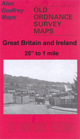
Series:Selected towns in Great Britain and Ireland are covered by maps showing the extent of urban development in the last decades of the 19th and early 20th century. The plans have been taken from the Ordnance Survey mapping and reprinted at about 15 inches to one mile (1:4, 340). On the reverse most maps have historical notes and many also include extracts from contemporary directories. Most maps cover about one mile (1.6kms) north/south, one and a half miles (2.4kms) across; adjoining sheets can be combined to provide wider coverage.FOR MORE INFORMATION AND A COMPLETE LIST OF ALL AVAILABLE TITLES PLEASE CLICK ON THE SERIES LINK.
RIP - This product is no longer available on our network. It was last seen on 25.09.2019

This page now acts as a permanent archive for this product. Add more information using the comments box below to ensure it can still be found by future generations.

Use our search facility to see if it is available from an alternative contributor.
  • Availability: Out Of Stock
  • Supplier: Stanfords
  • SKU: 9781847843043
Availability: In Stock
£3.50

Product Description

Upholland in 1907 in a fascinating series of reproductions of old Ordnance Survey plans in the Alan Godfrey Editions, ideal for anyone interested in the history of their neighbourhood or family. The map covers the village of Upholl&, originally part of Wigan parish but today in West Lancashire. Coverage stretches from the village centre around St Thomas church, northward to St Joseph`s RC College at Walthew Park, & from the Abbey Lakes Hotel westward to the disused Windmill Colliery. This is largely a rural map but features include the village centre (now a Conservation area), Hall Green, Upholland Corn Mill, Holland House, Holland Windmill, Newgate, etc. On the reverse is a 1918 directory of Upholland & Orrell. About the Alan Godfrey Editions of the 25” OS Series: Selected towns in Great Britain & Ireland are covered by maps showing the extent of urban development in the last decades of the 19th & early 20th century. The plans have been taken from the Ordnance Survey mapping & reprinted at about 15 inches to one mile (1:4, 340). On the reverse most maps have historical notes & many also include extracts from contemporary directories. Most maps cover about one mile (1.6kms) north/south, one & a half miles (2.4kms) across; adjoining sheets can be combined to provide wider coverage.FOR MORE INFORMATION & A COMPLETE LIST OF ALL AVAILABLE TITLES PLEASE CLICK ON THE SERIES LINK.

Reviews/Comments

Add New

Intelligent Comparison

Oooops!
We couldn't find anything!
Perhaps this product's unique.... Or perhaps we are still looking for comparisons!
Click to bump this page and we'll hurry up.

Price History

Vouchers

No voucher codes found.
Do you know a voucher code for this product or supplier? Add it to Insights for others to use.

Facebook

Jargon Buster

Contemporary - Modern era design
Contemporary - A design reference to indicate post war modern design
Hotel - An establishment which provides lodging for a fee
History - Anything that happens in the past. An acedemic subject.
Contemporary - An object that is living in the same time.
Mill - A building which can grind grain into flour.
Hall - A room at the inside of an entrance of a house.
Ideal - Something that satisfies a perfect criteria.
Family - A group of people that live together made up from parents and children.

Supplier Information

Stanfords
Stanfords was established in 1853 and opened their iconic Covent Garden flagship store in 1901. They have become the top retailer of maps, travel books and accessories in the UK and arguably offer the largest selection of maps and travel books worldwide. Famous names such as Captain Robert Falcon Scott, Ranulph Fiennes and Michael Palin have purchased from Stanfords. They now have a shop in Bristol and both stores together with other venues operate a calendar of events including talks, book signings and exhibitions. As a specialist map retailer, the map selection is comprehensive and includes road maps, street maps and walking maps from worldwide destinations, as well as a selection of world atlases and wall maps. Books include travel guides and travel literature. Stanfords also stock globes, from miniatures made of blue marble to magnificent floor-standing globes. The website features a selection of interesting articles on travel topics.
Page Updated: 2023-11-12 20:15:36

Community Generated Product Tags

Oh No! The productWIKI community hasn't generated any tags for this product yet!
Menu