More From Contributor

£5.95
Warwickshire in a series of colourful reproductions of attractive county maps by John Speede from about 1610-1611, printed on thick art paper & ideal for framing. Each title, 58 x 45cm / approx. 23” x 18”, is decorated with additional notes, drawings, coats of arms, street plans, etc. Little drawings are used to show locations of towns, larger villages, hills & woodlands or parks. Rivers & lakes are also drawn, as are boundaries of the administrative subdivisions with the names of the Hundreds. Surrounding the county are decorative panels filled with additional information which differs from title to title: street plans, coats of arms of notable local families, geographical features, notes about local history, etc. ...
Archived Product
£7.99
Warwickshire & The South Midlands Cycle Map at 1:110, 000 approx from Sustrans, including the Lias Line, the South Midlands Cycle Route, & the Grand Union Canal, plus five day rides: the Cotswold Tour, Long Buckby Circular, Royal Leamington Spa & Southam, Bicester to Winslow & return, & Kings Sutton Loop. Street plans show Coventry, Leamington Spa, Milton Keynes, Northampton & Rugby. Maps is this Sustrans series show all the National & Regional Cycle Network routes clearly numbered & have the colouring distinguishing between the on-road & traffic-free sections. The publishers’ own recommendations are shown in contrasting colour &, in most titles, are in addition presented on the reverse side on separate panels where each circuit is annotated with useful notes. The maps have contours & altitude colouring to show the topography, with additional gradient markings. Towns along the routes are annotated with symbols indicating what facilities can be found there. Also marked are various places of interest, on or near the routes, & railway lines are shown with stations for access to the routes by rail. On the reverse each title also provides large, clear city centre street plans of main towns, highlighting the Cycle Network and/or the recommended routes. Also included are contact details of tourist information centres. To see the list of titles in this series please click on the series link. ...
Archived Product
£9.99
Warwickshire & West Midlands in the AA 50 Walks series; comprising an extensive range of walking guides helping you to explore the best walking routes in Great Britain. Each guide covers a total of 50 walks, many of which are circular, between 2-10 miles & also that are suitable for a range of different walking standards. Every walk in the guides has an information box showing clear details of distance, minimum time, level of difficulty, any ascents, the nature of the terrain & landscape, suggested Ordnance Survey map, grid references for starting & finishing points, dog friendliness, parking & any public toilets en route. There are also suggestions of what to look out for & recommended places to eat & drink. Detailed walk descriptions are accompanied by clear mapping of the route ahead, in addition to colour photographs illustrating the highlights of selected routes. ...
Archived Product
£11.99
Walking is one of Britain`s favourite leisure activities, & this fantastic walking guide to Warwickshire & the West Midlands features a variety of mapped walks to suit all abilities. The book features all the practical detail you need, accompanied by fascinating background reading on the history & wildlife of the area, as well as other local points of interest. All walks are annotated with local points of interest & places to stop for refreshments & every walk is given a summary of distance, time, gradient, level of difficulty, type of surface & access, landscape, dog friendliness, parking & public toilets. ...
Archived Product
£7.95
This book features twenty circular walks varying in length between 7 & 12 miles, & based around good local pubs. It


...
Archived Product
£7.95
The twenty circular walks in this volume combine some of the most beautiful scenery in Warwickshire, including country houses, waterways, castles & picturesque villages, with the opportunity to visit a collection of irresistible taverns & teashops. The walks vary in length between two & six miles, & offer a wealth of local places to see & explore. There are the wonderful grounds around Kenilworth Castle; the town of Henley-in-Arden that has won prizes in many ' Towns in Bloom' competitions; Ufton Fields Nature Reserve, where unusual plants can be seen flourishing in the lime-rich soil; Mary Arden's House & Museum in Wilmcote; & Edge Hill, of battlefield fame, where Hornton stone was once quarried. Other routes include the tiny village of Barcheston, well-known as the home of English tapestry; the glorious woodland of Hartshill Hayes Country Park, once part of the vast Forest of Arden; Coughton Court, renowned as one of England's great Tudor houses; the celebrated Hatton Flight, a series of twenty one locks carrying the Grand Union Canal to the 350ft high Midlands Plateau; & a delightful teashop in Wellesbourne, housed in an 18th century timber-framed barn. Each walk is carefully described & is accompanied by a sketch map of the route. There are details on how to get to the start & where to park, & notes on the places of interest en route. Practical information on the teashops & pubs including their opening times, regular menus & house specialities are also provided. For those walks where the teashop closes or has restricted hours in the winter months, other refreshment places are recommended. ...
Archived Product
£7.95
Waterside Walks in Warwickshire features twenty circular walks in the county, all between 2 & 5.5 miles in length, with routes alongside rivers, canals, reservoirs & lakes, including the River Avon & the Grand Union canal. Each walk

Includes::
details on how to get to the starting point, where to park, & what pub food & drink are available locally. For greater clarity, route descriptions are divided into numbered paragraphs which correspond with the numbers on the accompanying sketch maps. Separate sections are included on nearby or en-route places of interest to visit.

...
Archived Product
£2.95
Warwickshire 1610 Replica Map by the Old Map Company is a reproduction of the map created for the famous atlas of the period by the master map maker John Speede Esq. The Old Map Company has recreated the antique maps of British counties, European cities & World countries originally crafted by master map maker John Speede Esq. whose work had accuracy & quality not surpassed for centuries. Each map is treated & presented on specially crafted paper then h&-treated giving it texture & an aged appearance before being beautifully engraved & detailed. ...
Archived Product
£80.00
Warwickshire, an original antique map by G. Cole / J. Roper published in London, 1810-1843. Copperplate, coloured. Map size 17 x 23 cm, overall mounted size 32.5 x 38.5 cm. This detailed map of Warwickshire is from Dugdale's England & Wales Delineated. The map was drawn by G. Cole & engraved by John Roper for publication first in The Beauties Of England & Wales, issued in parts, from c.1804. Such was the success of the publication that the maps were re-used in other publications, as here. The maps show accurate geographical detail, including the turnpike, mail coach & principal roads, sites of Roman & other historical remains, as well as the seats of the nobility & the gentry, & market towns with their distances from London. The maps also show the division of the counties into hundreds or wapontakes. They are representative of the functional nineteenth-century approach to cartography, yet are not unattractive. Antique maps from various original publishers are presented on the Stanford ...
Archived Product
£180.00
Warwickshire, an original antique map by B. Clarke / H.G. Collins, published in London, c. 1848 -1852. A lithograph engraving, coloured. Map size 35 x 41 cm with a mount size of 49.5 x 57 cm.A detailed nineteenth-century map of Warwickshire that was published in the atlas, The British Gazetteer, Political, Commercial, Ecclesiastical, & Historical.. . in 1852. These lithograph maps bear the imprint of H.G. Collins in Paternoster Row & show accurate geographical detail, including the expanding railway network, surrounded by a floral border. Information also

Includes::
the turnpike & mail coach roads as well as parliamentary boundaries & polling places, the seats of the nobility & the gentry, & market towns with their distances from London. The maps are lithographic version of Robert Rowe's county maps that were published from engraved copperplates between 1814 & 1842. Collins also published these lithograph versions in 1848 in the New British Atlas & they were subsequently reused by Phillips in his County Atlas.. . in the 1860s
- their use in a variety of publications is testament to their popularity. Antique maps from various original publishers are presented on the Stanford


...
Archived Product

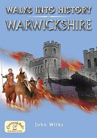
Warwickshire - Walks Into History

The fourteen routes in this guide take the walker on a journey to the key sites connected with Warwickshire`s colourful and stormy past. The lively and informative routes in this guide are all between 3 - 8 miles and explore the beautiful and historic countryside of Warwickshire.
RIP - This product is no longer available on our network. It was last seen on 25.09.2019

This page now acts as a permanent archive for this product. Add more information using the comments box below to ensure it can still be found by future generations.

Use our search facility to see if it is available from an alternative contributor.
  • Availability: Out Of Stock
  • Supplier: Stanfords
  • SKU: 9781846741869
Availability: In Stock
£7.99

Product Description

The fourteen routes in this guide take the walker on a journey to the key sites connected with Warwickshire`s colourful & stormy past. The lively & informative routes in this guide are all between 3
- 8 miles & explore the beautiful & historic countryside of Warwickshire.

Reviews/Comments

Add New

Price History

Vouchers

No voucher codes found.
Do you know a voucher code for this product or supplier? Add it to Insights for others to use.

Facebook

Jargon Buster

Key - A physical or virtual device or code used for opening something
History - Anything that happens in the past. An acedemic subject.

Supplier Information

Stanfords
Stanfords was established in 1853 and opened their iconic Covent Garden flagship store in 1901. They have become the top retailer of maps, travel books and accessories in the UK and arguably offer the largest selection of maps and travel books worldwide. Famous names such as Captain Robert Falcon Scott, Ranulph Fiennes and Michael Palin have purchased from Stanfords. They now have a shop in Bristol and both stores together with other venues operate a calendar of events including talks, book signings and exhibitions. As a specialist map retailer, the map selection is comprehensive and includes road maps, street maps and walking maps from worldwide destinations, as well as a selection of world atlases and wall maps. Books include travel guides and travel literature. Stanfords also stock globes, from miniatures made of blue marble to magnificent floor-standing globes. The website features a selection of interesting articles on travel topics.
Page Updated: 2023-11-12 20:15:36

Community Generated Product Tags

Oh No! The productWIKI community hasn't generated any tags for this product yet!
Menu