
 United Kingdom
 France
 Germany
 Netherlands
 Sweden
 USA
USA
 Italy
Italy
 Spain
Spain
More From Contributor


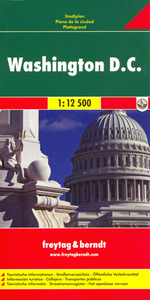
Washington DC F&B
Central Washington DC at 1:12, 500 on street plan from Freytag & Berndt clearly showing locations of various government institutions, US and international organizations, numerous foreign embassies, cultural centres, educational establishments and other and places of interest. Metro and railway stations are prominently marked and for drivers access to and from highways is clearly laid out.Coverage extends north beyond the Howard University Campus to the National Zoological Park; east across the Potomac to Arlington, including the National Cemetery, Fort Myer and the Pentagon; south to the Ronal Reagan Airport; and west just beyond the Anacostia River. Street index is on the reverse. Multilingual map legend includes English.

Product Description
Reviews/Comments
Add New
Intelligent Comparison
Archived Product
Washington DC Stanfords
£8.95
Archived Product

Washington DC Stanfords
£6.99
Archived Product
Washington DC Stanfords
£10.39
Archived Product
Washington DC Stanfords
£4.99
Archived Product

Washington DC Stanfords
£12.99
Archived Product
Washington, DC Stanfords
£6.50
Archived Product

Washington DC Borch Stanfords
£8.99
Archived Product

Washington DC PopOut Stanfords
£4.99
Vouchers
No voucher codes found.
Do you know a voucher code for this product or supplier? Add it to Insights for others to use.
Do you know a voucher code for this product or supplier? Add it to Insights for others to use.
 Denmark