-
Home
-
Contributors
-
International
-
Account
-
Information
More From Contributor
- Goat Haunt (Montana) in a series of detailed hiking maps of the Canadian Rockies, covering the most popular ...
Includes:: contributions from Nigel Calder. Detailed navigation, anchorages, Goin’ Ashore information, over 120 charts & bonus sections on the Florida Keys & Bahamas are included in this new spiral bound guidebook. ...
- Chelmer & Blackwater Navigation, Grand Union Canal, Lee & Stort Navigations, River Medway, Oxford Canal, River Thames. Guide
Includes:; * Detailed Ordnance Survey (R) maps * Descriptive text describing the canals * Comprehensive navigational notes Published for over 40 years, the Collins/ Nicholson guides to the waterways have always been a vital part of journeys along Britain`s canals & rivers. They are designed for anyone & everyone with an interest in Britain`s inland waterways
- from experienced boaters to those planning their first boat trip, as well as walkers, cyclists & visitors. This practical A5 guide features `lie flat` spiral binding & `book mark` back cover flap for ease of reference. In print for over 40 years, the Collins/ Nicholson guides to the waterways have always been a vital part of journeys along Britain`s canals & rivers. These bestselling guides are designed for anyone & everyone with an interest in Britain`s inland waterways
- from experienced boaters to those planning their first boat trip, as well as walkers, cyclists & visitors. Nicholson`s
- The bestselling guides to Britain`s Waterways Comprehensive navigational notes include: * Maximum
Dimensions & low bridges. * Mileages, advice & potential hazards. * Navigation authorities & contact details. Waterways covered in this guide
- Chelmer & Blackwater Navigation, Grand Union Canal, Lee & Stort Navigations, River Medway, Oxford Canal, River Thames. ...

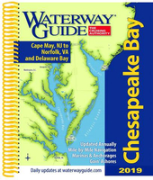
Waterway Guide Chesapeake Bay 2019
This page now acts as a permanent archive for this product. Add more information using the comments box below to ensure it can still be found by future generations.
Use our search facility to see if it is available from an alternative contributor.
- External links may include paid for promotion
- Availability: Out Of Stock
- Supplier: Stanfords
- SKU: 9780998586366
Product Description
Waterway Guide Chesapeake Bay 2019, updated annually, is the indispensable cruising companion for boaters exploring the Chesapeake Bay, the Delaware Bay & the Delmarva Atlantic coast from Cape May to Norfolk. This comprehensive guide features mile-by-mile navigation information, aerial photography with marked routes, marina listings & locator charts, anchorage information & expanded ” Goin` Ashore” articles on ports along the way. Helpful cruising data like GPS waypoints, detailed planning maps, distance charts & bridge tables help get cruisers there safely. Flexible spiral binding & heavy laminated covers with bookmarker flaps ensure durability & easy use in the cockpit & at the helm.
Reviews/Comments
Add New
Intelligent Comparison
We couldn't find anything!
Perhaps this product's unique.... Or perhaps we are still looking for comparisons!
Click to bump this page and we'll hurry up.
Price History
Vouchers
Do you know a voucher code for this product or supplier? Add it to Insights for others to use.


 United Kingdom
 France
 Germany
 Netherlands
 Sweden
 USA
USA
 Italy
Italy
 Spain
Spain


 Denmark