
 United Kingdom
 France
 Germany
 Netherlands
 Sweden
 USA
USA
 Italy
Italy
 Spain
Spain
More From Contributor


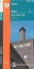


Wath Upon Dearne 1901
Wath upon Dearne in 1901 in a fascinating series of reproductions of old Ordnance Survey plans in the Alan Godfrey Editions, ideal for anyone interested in the history of their neighbourhood or family. The map covers the town of Wath upon Dearne, the village of West Melton, and the hamlets of Newhill, Gore Hill and Brampton. A short stretch of the GCR railway is shown, including Wath station. The Dearne & Dove Canal runs across the map. Features at Wath include All Saints church, Town Hall, Church Street, cemetery, Wath Brewery, Burlington House, High Street, etc. To the east is Gore Hill, with St James Mission Church, South Yorkshire Oil Soap Works, Green Ings. Eastward is West Melton, including High Street, Old Hall Farm, streets around Melton Road and Winterwell Road.
To the south is Newhill with Newhill Hall, Newhill Grange. On the reverse is a portion of the adjacent sheet 283.06 showing the rest of West Melton, including Christ Church, Melton Green, brick works, Firth Road, and extending to Brampton with Brampton Hall and Brampton House, plus extracts from a directory of Wath.About the Alan Godfrey Editions of the 25” OS Series:Selected towns in Great Britain and Ireland are covered by maps showing the extent of urban development in the last decades of the 19th and early 20th century. The plans have been taken from the Ordnance Survey mapping and reprinted at about 15 inches to one mile (1:4, 340). On the reverse most maps have historical notes and many also include extracts from contemporary directories. Most maps cover about one mile
(1.6kms) north/south, one and a half miles (2.4kms) across; adjoining sheets can be combined to provide wider coverage.FOR MORE INFORMATION AND A COMPLETE LIST OF ALL AVAILABLE TITLES PLEASE CLICK ON THE SERIES LINK.

Product Description
Reviews/Comments
Add New
Intelligent Comparison
Archived Product

Bolton Upon Dearne 1901 Stanfords
£3.50
Vouchers
No voucher codes found.
Do you know a voucher code for this product or supplier? Add it to Insights for others to use.
Do you know a voucher code for this product or supplier? Add it to Insights for others to use.
 Denmark