
 United Kingdom
 France
 Germany
 Netherlands
 Sweden
 USA
USA
 Italy
Italy
 Spain
Spain
More From Contributor


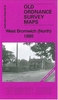
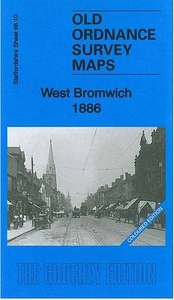
West Bromwich 1886 (Colour Edition)
West Bromwich in 1886 in a fascinating series of reproductions of old Ordnance Survey plans in the Alan Godfrey Editions, ideal for anyone interested in the history of their neighbourhood or family. Two versions have been published for this area. The maps cover most of West Bromwich, stretching from Bond Street and St John`s church northward to West Bromwich Workhouse, and from Claypit Lane eastward to Dartmouth Park. Features on the 1886 version include the town centre, Christ Church, St Andrew`s church, Scale & Spring Balance Works, Town Hall, GWR railway with West Bromwich and Swan Village stations, part of Dartmouth Park, tramway, Guns Village area, Ireland Green Colliery; several disused collieries including Cordley, Cutlers End, Whyley, Tantany and Cronehills
Collieries; Albion Bluebrick Works, Victoria Bluebrick Works, Albion football ground, Lyndon, Workhouse, etc. The 1886 version is in colour, taken from the beautiful hand-coloured 1st Edition.About the Alan Godfrey Editions of the 25” OS Series:Selected towns in Great Britain and Ireland are covered by maps showing the extent of urban development in the last decades of the 19th and early 20th century. The plans have been taken from the Ordnance Survey mapping and reprinted at about 15 inches to one mile (1:4, 340). On the reverse most maps have historical notes and many also include extracts from contemporary directories. Most maps cover about one mile (1.6kms) north/south, one and a half miles (2.4kms) across; adjoining sheets can be combined to provide wider coverage.FOR MORE
INFORMATION AND A COMPLETE LIST OF ALL AVAILABLE TITLES PLEASE CLICK ON THE SERIES LINK.
 "Pin It")
Product Description
Reviews/Comments
Add New
Intelligent Comparison
Archived Product

West Bromwich North 1885 (Colour Edition) Stanfords
£4.50
Archived Product

Dorchester 1886 (Colour Edition) Stanfords
£4.50
Archived Product
Exeter 1888 (Colour Edition) Stanfords
£3.50
Archived Product
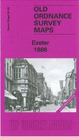
Exeter 1888 (Colour Edition) Stanfords
£4.50
Archived Product
Bath 1883 (Colour Edition) Stanfords
£4.50
Archived Product
Hereford 1885 (Colour Edition) Stanfords
£3.50
Archived Product
Taunton 1886 (Colour Edition)) Stanfords
£4.50
Archived Product
Hereford 1885 (Colour Edition) Stanfords
£4.50
Vouchers
No voucher codes found.
Do you know a voucher code for this product or supplier? Add it to Insights for others to use.
Do you know a voucher code for this product or supplier? Add it to Insights for others to use.
 Denmark