More From Contributor

£4.99
Street by Street Wigan Midi has been fully updated, in a handy glovebox size. Quick to navigate & easy-to-use, the maps clearly show AA recommended restaurants, pubs, hotels, one-way streets & car parks. Featuring a clever use of colour to ensure it can be read under street lighting, & National Grid referencing, Street by Street Wigan Midi is all you need to keep you on the move. ...
Archived Product
£2.95
Wigan in 1907 in a fascinating series of reproductions of old Ordnance Survey plans in the Alan Godfrey Editions, ideal for anyone interested in the history of their neighbourhood or family. Selected towns in Great Britain & Ireland are covered by maps showing the extent of urban development in the last decades of the 19th & early 20th century. In this title: two maps have been published for this area, covering central Wigan, plus part of Ince in Makerfield. Coverage stretches from Wallgate eastward to Belle Green Lane, & from the Gidlow Mill (extreme top left corner) southward to Chapel Lane. Features include the town centre, with Market Hall, church, Mining College, Standishgate, Wallgate, Hallgate, King Street, Library Street etc; railways, including the NW, Wallgate & Central stations, with track layouts given; part of the LNWR Springs Branch & Lancashire Union lines, including Round House Junction & part of Round House Branch; Leeds & Liverpool Canal with a flight of locks; Rose Bridge Collieries, Ince Hall Colliery (East Pit), Round House Colliery, old shafts, Clarington Forge; Kirkless Hall, Ince Hall, Peel Hall, Manchester Road, Higher Ince, tramways, Scholes, Longshoot, Central Park football ground. On the reverse is a list of private residents from a 1918 directory (1907 map) & further historical material from the directory (1928 map). About the Alan Godfrey Editions of the 25 ...
Archived Product
£3.50
Wigan in 1907 in a fascinating series of reproductions of old Ordnance Survey plans in the Alan Godfrey Editions, ideal for anyone interested in the history of their neighbourhood or family. Two maps have been published for this area, covering central Wigan, plus part of Ince in Makerfield. Coverage stretches from Wallgate eastward to Belle Green Lane, & from the Gidlow Mill (extreme top left corner) southward to Chapel Lane. Features include the town centre, with Market Hall, church, Mining College, Standishgate, Wallgate, Hallgate, King Street, Library Street, etc; railways, including the NW, Wallgate & Central stations, with track layouts given; part of the LNWR Springs Branch & Lancashire Union lines, including Round House Junction & part of Round House Branch; Leeds & Liverpool Canal with a flight of locks; Rose Bridge Collieries, Ince Hall Colliery (East Pit), Round House Colliery, old shafts, Clarington Forge; Kirkless Hall, Ince Hall, Peel Hall, Manchester Road, Higher Ince, tramways, Scholes, Longshoot, Central Park football ground, etc. On the reverse is a list of private residents from a 1918 directory (1907 map) & further historical material from the directory (1928 map). About the Alan Godfrey Editions of the 25” OS Series: Selected towns in Great Britain & Ireland are covered by maps showing the extent of urban development in the last decades of the 19th & early 20th century. The plans have been taken from the Ordnance Survey mapping & reprinted at about 15 inches to one mile (1:4, 340). On the reverse most maps have historical notes & many also include extracts from contemporary directories. Most maps cover about one mile (1.6kms) north/south, one & a half miles (2.4kms) across; adjoining sheets can be combined to provide wider coverage.FOR MORE INFORMATION & A COMPLETE LIST OF ALL AVAILABLE TITLES PLEASE CLICK ON THE SERIES LINK. ...
Archived Product
£2.95
Wigan in 1928 in a fascinating series of reproductions of old Ordnance Survey plans in the Alan Godfrey Editions, ideal for anyone interested in the history of their neighbourhood or family. Selected towns in Great Britain & Ireland are covered by maps showing the extent of urban development in the last decades of the 19th & early 20th century. In this title: two maps have been published for this area, covering central Wigan, plus part of Ince in Makerfield. Coverage stretches from Wallgate eastward to Belle Green Lane, & from the Gidlow Mill (extreme top left corner) southward to Chapel Lane. Features include the town centre, with Market Hall, church, Mining College, Standishgate, Wallgate, Hallgate, King Street, Library Street etc; railways, including the NW, Wallgate & Central stations, with track layouts given; part of the LNWR Springs Branch & Lancashire Union lines, including Round House Junction & part of Round House Branch; Leeds & Liverpool Canal with a flight of locks; Rose Bridge Collieries, Ince Hall Colliery (East Pit), Round House Colliery, old shafts, Clarington Forge; Kirkless Hall, Ince Hall, Peel Hall, Manchester Road, Higher Ince, tramways, Scholes, Longshoot, Central Park football ground. On the reverse is a list of private residents from a 1918 directory (1907 map) & further historical material from the directory (1928 map). About the Alan Godfrey Editions of the 25 ...
Archived Product
£3.50
Wigan in 1928 in a fascinating series of reproductions of old Ordnance Survey plans in the Alan Godfrey Editions, ideal for anyone interested in the history of their neighbourhood or family. Two maps have been published for this area, covering central Wigan, plus part of Ince in Makerfield. Coverage stretches from Wallgate eastward to Belle Green Lane, & from the Gidlow Mill (extreme top left corner) southward to Chapel Lane. Features include the town centre, with Market Hall, church, Mining College, Standishgate, Wallgate, Hallgate, King Street, Library Street, etc; railways, including the NW, Wallgate & Central stations, with track layouts given; part of the LNWR Springs Branch & Lancashire Union lines, including Round House Junction & part of Round House Branch; Leeds & Liverpool Canal with a flight of locks; Rose Bridge Collieries, Ince Hall Colliery (East Pit), Round House Colliery, old shafts, Clarington Forge; Kirkless Hall, Ince Hall, Peel Hall, Manchester Road, Higher Ince, tramways, Scholes, Longshoot, Central Park football ground, etc. On the reverse is a list of private residents from a 1918 directory (1907 map) & further historical material from the directory (1928 map). About the Alan Godfrey Editions of the 25” OS Series: Selected towns in Great Britain & Ireland are covered by maps showing the extent of urban development in the last decades of the 19th & early 20th century. The plans have been taken from the Ordnance Survey mapping & reprinted at about 15 inches to one mile (1:4, 340). On the reverse most maps have historical notes & many also include extracts from contemporary directories. Most maps cover about one mile (1.6kms) north/south, one & a half miles (2.4kms) across; adjoining sheets can be combined to provide wider coverage.FOR MORE INFORMATION & A COMPLETE LIST OF ALL AVAILABLE TITLES PLEASE CLICK ON THE SERIES LINK. ...
Archived Product
£3.50
Wigan North in 1907 in a fascinating series of reproductions of old Ordnance Survey plans in the Alan Godfrey Editions, ideal for anyone interested in the history of their neighbourhood or family. The map covers the northern part of Wigan, stretching from Swinley Lane eastward to New Springs, & from Whelley station northward to Leyland Mill Brow. Features include Lindsay Pit, Alexandra Pit, Leeds & Liverpool Canal, railway (Lancashire Union Line), Dairy Pit, Bridge Pit, Haigh Saw Mill, Wigan Sanatorium, New Springs, Bottling Wood, Whelley station (disused), Haigh Lower Plantations, Mariebonne, Swinley, Infirmary, Whitley Reservoir, Haigh Foundries, tramways, several old shafts, etc. Directories of Aspull & Haigh are on the reverse. About the Alan Godfrey Editions of the 25” OS Series: Selected towns in Great Britain & Ireland are covered by maps showing the extent of urban development in the last decades of the 19th & early 20th century. The plans have been taken from the Ordnance Survey mapping & reprinted at about 15 inches to one mile (1:4, 340). On the reverse most maps have historical notes & many also include extracts from contemporary directories. Most maps cover about one mile (1.6kms) north/south, one & a half miles (2.4kms) across; adjoining sheets can be combined to provide wider coverage.FOR MORE INFORMATION & A COMPLETE LIST OF ALL AVAILABLE TITLES PLEASE CLICK ON THE SERIES LINK. ...
Archived Product
£2.95
Wigan North West in 1907 in a fascinating series of reproductions of old Ordnance Survey plans in the Alan Godfrey Editions, ideal for anyone interested in the history of their neighbourhood or family. Selected towns in Great Britain & Ireland are covered by maps showing the extent of urban development in the last decades of the 19th & early 20th century. In this title: the map covers the north-western part of Wigan, stretching from the Gidlow Works westward to Standish Lower Ground, & northward to Gidlow New Houses. Features include Giants Hall Colliery, Douglas Bank Colliery, Springfield Park, Standish Washery, Gidlow pits, Rylands Sidings, Martland Mill Bridge with tramway, Leeds & Liverpool Canal. The Beech Hill Avenue area is shown under development. A directory of Shevington, Beech Hill Lane, Woodhouse Lane is on the reverse. About the Alan Godfrey Editions of the 25 ...
Archived Product
£4.95
Wigan Street Atlas at 1:15, 840 / 4 to a mile, in an indexed, glove box size paperback format, with national grid referencing. Street atlas covers Wigan, Ashton-in-Makerfield, Leigh, Skelmersdale, Aspull, Atherton, Billinge, Boothstown, Golborne, Haydock, Hindley, Newton-le-Willows, Rainford, Shevington, Standish & Westhoughton, with an enlargement of Wigan town centre at a scale of 1:7, 920 / 8 ...
Archived Product
£3.50
Wigan West in 1908 in a fascinating series of reproductions of old Ordnance Survey plans in the Alan Godfrey Editions, ideal for anyone interested in the history of their neighbourhood or family. The map covers the western part of Wigan, including some central features such as the Rectory (Wigan Hall), Mesnes Park & ` Wigan Pier`. Coverage stretches from Lyon Street & Trencherfield Mill westward to Marsh Green, & from Throstle Nest Avenue southward to Swan Meadow Road. Features include tramways with two depots, Workhouse, Victoria Mills, Leeds & Liverpool Canal, Newtown, Swan Meadow Mills, Miry Lane Depot, Winstanley Colliery Railway, Bull Hey, stretches of railway west from Wallgate station, including old & new loco depots, Newtown Colliery, Meadows Colliery, Norley Colliery Pits 4 & 5, Laithwaite House, Hall Worsley, Pagefield works; the map shows the long overhead tramway from Newtown Colliery to Meadows Colliery, the real ` Wigan Pier`, & it also

Includes::
the wharf area now normally regarded as the pier. A Pemberton directory is on the reverse. About the Alan Godfrey Editions of the 25” OS Series: Selected towns in Great Britain & Ireland are covered by maps showing the extent of urban development in the last decades of the 19th & early 20th century. The plans have been taken from the Ordnance Survey mapping & reprinted at about 15 inches to one mile (1:4, 340). On the reverse most maps have historical notes & many also include extracts from contemporary directories. Most maps cover about one mile (1.6kms) north/south, one & a half miles (2.4kms) across; adjoining sheets can be combined to provide wider coverage.FOR MORE INFORMATION & A COMPLETE LIST OF ALL AVAILABLE TITLES PLEASE CLICK ON THE SERIES LINK.

...
Archived Product
£15.95
Wight Hazards by Peter Bruce, which complements the well-known Solent Hazards, provides a fund of interesting & useful wisdom for those who venture by sea to the enchanting but exposed south side of the Isle of Wight. Accurate & detailed information on the obvious & less obvious dangers is supplied in the form of text as well as aerial & sea level photographs, taken at extreme low water spring tides, that greatly enhance the scant information available from other sources. Racing yachts will gain a tremendous advantage from this information. Moreover, motor or sailing yachtsmen, in search of peaceful new anchorages or landing places, will be tempted by this book to explore an especially interesting coast, which they may have previously overlooked. The third edition of this original book adds yet more local knowledge & many new illustrations. ...
Archived Product

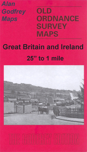
Wigan Marcus Bridge 1897

Wigan Marcus Bridge in 1897 in a fascinating series of reproductions of old Ordnance Survey plans in the Alan Godfrey Editions, ideal for anyone interested in the history of their neighbourhood or family. The map covers the south-western area of Wigan, stretching from Hawkley Hall southward to Park Lane Collieries. The Warrington Road runs north-south through the map. Features include Park Lane Collieries, Hawkley Hall, Ben Johnson Inn, Derbyshire House, Tan Pit Cottages, Cranberry Ley, LNWR Pemberton Branch, Hatton Hosue Far, tramways, Worthington Fold, etc. On the reverse is a six inches to the mile map for 1907, covering this area but also eastward to Bamfurlong Colliery and Moss Pits. About the Alan Godfrey Editions of the 25” OS Series:Selected towns in Great Britain
and Ireland are covered by maps showing the extent of urban development in the last decades of the 19th and early 20th century. The plans have been taken from the Ordnance Survey mapping and reprinted at about 15 inches to one mile (1:4, 340). On the reverse most maps have historical notes and many also include extracts from contemporary directories. Most maps cover about one mile (1.6kms) north/south, one and a half miles (2.4kms) across; adjoining sheets can be combined to provide wider coverage.FOR MORE INFORMATION AND A COMPLETE LIST OF ALL AVAILABLE TITLES PLEASE CLICK ON THE SERIES LINK.
RIP - This product is no longer available on our network. It was last seen on 25.09.2019

This page now acts as a permanent archive for this product. Add more information using the comments box below to ensure it can still be found by future generations.

Use our search facility to see if it is available from an alternative contributor.
  • Availability: Out Of Stock
  • Supplier: Stanfords
  • SKU: 9781847842510
Availability: In Stock
£3.50

Product Description

Wigan Marcus Bridge in 1897 in a fascinating series of reproductions of old Ordnance Survey plans in the Alan Godfrey Editions, ideal for anyone interested in the history of their neighbourhood or family. The map covers the south-western area of Wigan, stretching from Hawkley Hall southward to Park Lane Collieries. The Warrington Road runs north-south through the map. Features include Park Lane Collieries, Hawkley Hall, Ben Johnson Inn, Derbyshire House, Tan Pit Cottages, Cranberry Ley, LNWR Pemberton Branch, Hatton Hosue Far, tramways, Worthington Fold, etc. On the reverse is a six inches to the mile map for 1907, covering this area but also eastward to Bamfurlong Colliery & Moss Pits. About the Alan Godfrey Editions of the 25” OS Series: Selected towns in Great Britain & Ireland are covered by maps showing the extent of urban development in the last decades of the 19th & early 20th century. The plans have been taken from the Ordnance Survey mapping & reprinted at about 15 inches to one mile (1:4, 340). On the reverse most maps have historical notes & many also include extracts from contemporary directories. Most maps cover about one mile (1.6kms) north/south, one & a half miles (2.4kms) across; adjoining sheets can be combined to provide wider coverage.FOR MORE INFORMATION & A COMPLETE LIST OF ALL AVAILABLE TITLES PLEASE CLICK ON THE SERIES LINK.

Reviews/Comments

Add New

Intelligent Comparison

Oooops!
We couldn't find anything!
Perhaps this product's unique.... Or perhaps we are still looking for comparisons!
Click to bump this page and we'll hurry up.

Price History

Vouchers

No voucher codes found.
Do you know a voucher code for this product or supplier? Add it to Insights for others to use.

Facebook

Jargon Buster

Contemporary - Modern era design
Contemporary - A design reference to indicate post war modern design
History - Anything that happens in the past. An acedemic subject.
Road - a manmade lane or a path that is used to speed up travel.
Contemporary - An object that is living in the same time.
Hall - A room at the inside of an entrance of a house.
Ideal - Something that satisfies a perfect criteria.
Family - A group of people that live together made up from parents and children.

Supplier Information

Stanfords
Stanfords was established in 1853 and opened their iconic Covent Garden flagship store in 1901. They have become the top retailer of maps, travel books and accessories in the UK and arguably offer the largest selection of maps and travel books worldwide. Famous names such as Captain Robert Falcon Scott, Ranulph Fiennes and Michael Palin have purchased from Stanfords. They now have a shop in Bristol and both stores together with other venues operate a calendar of events including talks, book signings and exhibitions. As a specialist map retailer, the map selection is comprehensive and includes road maps, street maps and walking maps from worldwide destinations, as well as a selection of world atlases and wall maps. Books include travel guides and travel literature. Stanfords also stock globes, from miniatures made of blue marble to magnificent floor-standing globes. The website features a selection of interesting articles on travel topics.
Page Updated: 2023-11-12 20:15:36

Community Generated Product Tags

Oh No! The productWIKI community hasn't generated any tags for this product yet!
Menu