
 United Kingdom
 France
 Germany
 Netherlands
 Sweden
 USA
USA
 Italy
Italy
 Spain
Spain
More From Contributor
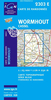


Worsley Hall 1904
Worsley Hall in 1904 in a fascinating series of reproductions of old Ordnance Survey plans in the Alan Godfrey Editions, ideal for anyone interested in the history of their neighbourhood or family. Selected towns in Great Britain and Ireland are covered by maps showing the extent of urban development in the last decades of the 19th and early 20th century.In this title: the map is double-sided. The main map covers the area around Worsley Hall, stretching from Worsley Bridge and Court House westward to Booth's Hall. Ellenbrook with Mosley Common Collieries and St Mary's church is in the top left corner. Other features include Booth's Hall Farm, Bridgewater Collieries Railway to the canal basin, a stretch of the Bridgewater Canal, Booth's Bank, Middle Wood, Worsley Hall, Worsley Old
Hall, St Mark's church, Kempnough Hall, Worsley Hall Farm, etc. On the reverse is a good section of adjacent sheet 103.06 extending coverage southward across the moss; there are few buildings but this map does show the Moss Canal with a horse tramway to transport spoil. About the Alan Godfrey Editions of the 25
Hall, St Mark's church, Kempnough Hall, Worsley Hall Farm, etc. On the reverse is a good section of adjacent sheet 103.06 extending coverage southward across the moss; there are few buildings but this map does show the Moss Canal with a horse tramway to transport spoil. About the Alan Godfrey Editions of the 25

Product Description
Reviews/Comments
Add New
Intelligent Comparison
Archived Product

Worsley Hall 1904 Stanfords
£3.50
Archived Product
Worsley 1904 Stanfords
£2.95
Archived Product

Worsley 1904 Stanfords
£3.50
Archived Product

Mossley Hill 1905 Stanfords
£3.50
Archived Product

Wordsley 1901 Stanfords
£3.50
Archived Product
Wordsley 1901 Stanfords
£2.95
Vouchers
No voucher codes found.
Do you know a voucher code for this product or supplier? Add it to Insights for others to use.
Do you know a voucher code for this product or supplier? Add it to Insights for others to use.
 Denmark