More From Contributor

£15.95
Touring Club Italiano's Agriturismo e Vacanze in Campagna 2012 Guide, (all the text is in Italian only), with over 2000 farms, country-houses & rural retreats offering holiday accommodation & B&B facilities by the sea, hills & mountains. The guide is divided into 20 regional sections listing all entries alphabetically. Each establishment has a brief description & information such as number of rooms & apartments, price guide, services & leisure activities, contact information & website addresses. Additional symbols indicate wheelchair accessibility, camping sites, house produces & discounts to members of TCI. Each regional section also

Includes::
photographs & a selection of recommended rural restaurants, with contact details, etc. A map at the beginning of each region helps locate the places listed in the guide.A perfect guide to the charm of Italian countryside.ALL THE TEXT IS IN ITALIAN ONLY.

...
Archived Product
£9.95
Touring Club's guide is the ultimate reference to agriturismo retreats, country-houses & farms, run usually on a family basis, offering welcoming high-quality service, home-made food & a quiet & relaxing atmosphere. The guide is divided in 20 regional sections listing all entries alphabetically. Each establishment is shown in a colour photo with a brief description, plus information & details of the rooms, prices & facilities offered. Most agriturismi will also sell their produce, so details on produce & harvests including organic farming are indicated.A map at the beginning of each region helps locate the establishments. Please note: the English edition of this guide was last published in 2003. A more recent version is offered on our website in its original Italian edition, as shown below. ...
Archived Product
£17.99
Topographic mapping from Mexico’s national survey agency, Instituto Nacional de Estadística, Geografía e Informática. The maps have contours at 20m intervals with relief shading & indicate various types of terrain & vegetation, e.g. dense vegetation, cultivated areas, swamps, sand dunes, salt pans, etc. UTM grid is at 10km intervals, with latitude & longitude shown by margin ticks at intervals of 5`. Map legend is in Spanish only. To see the other titles in this series please click on the series link. ...
Archived Product
£12.99
One of the titles in a series of road maps of the administrative states of Mexico, highlighting places of interest. The maps show four different grades of roads, with intermediate driving distances on main routes, railways, local airports, ferry connections & administrative boundaries. Topographic information is limited to names of main mountain ranges, spot heights for main peaks, rivers & lakes. The maps have no geographical coordinates. Map legend is in Spanish only. On the reverse each title has a black & white version of the same map, highlighting places of interest with brief notes in Spanish only. ...
Archived Product
£17.99
Topographic survey of Portugal at 1:50, 000 from the Instituto Geográfico do Exército, the country’s military survey organisation. The maps have contours at 20m intervals & in addition to the standard features shown on topographic mapping at this scale also indicate various types of terrain or vegetation (s&, terraces, rocks, woodlands, vineyards, etc). Each sheet covers an area of 32 x 20km (20 x 12.5 miles approx). The maps have a 1-km UTM grid plus latitude & longitude coordinates for the map corners. Map legend & a glossary of terms used on the maps include English.EDITION DATES: most titles in this series date from 1990s or later. To see all the titles in this series please click on the series link. ...
Archived Product
£17.99
Topographic survey of Portugal at 1:50, 000 from the Instituto Geográfico Português, the country’s civilian survey organisation. The maps have contours at 25m intervals & in addition to the standard features shown on topographic mapping at this scale also indicate various types of vegetation (vineyards, olive groves, etc). Each sheet covers an area of 32 x 20km (20 x 12.5miles approx). The maps have latitude & longitude margin ticks at 1’ intervals & UTM coordinates for the map corners – each sheet also shows conversion details from BBLx (Bessel-Bonnie system, Datum Lisbon) to UTM. Map legend is in Portuguese only.EDITION DATES: most titles in this series have now been updated in the 1990s or later. To see all the titles in this series please click on the series link. ...
Archived Product
£17.99
Topographic survey of Portugal at 1:50, 000 from the Instituto Geográfico do Exército, the country’s military survey organisation. The maps have contours at 20m intervals & in addition to the standard features shown on topographic mapping at this scale also indicate various types of terrain or vegetation (s&, terraces, rocks, woodlands, vineyards, etc). Each sheet covers an area of 32 x 20km (20 x 12.5 miles approx). The maps have a 1-km UTM grid plus latitude & longitude coordinates for the map corners. Map legend & a glossary of terms used on the maps include English.EDITION DATES: most titles in this series date from 1990s or later. To see all the titles in this series please click on the series link. ...
Archived Product
£17.99
Topographic survey of Portugal at 1:50, 000 from the Instituto Geográfico Português, the country’s civilian survey organisation. The maps have contours at 25m intervals & in addition to the standard features shown on topographic mapping at this scale also indicate various types of vegetation (vineyards, olive groves, etc). Each sheet covers an area of 32 x 20km (20 x 12.5miles approx). The maps have latitude & longitude margin ticks at 1’ intervals & UTM coordinates for the map corners – each sheet also shows conversion details from BBLx (Bessel-Bonnie system, Datum Lisbon) to UTM. Map legend is in Portuguese only.EDITION DATES: most titles in this series have now been updated in the 1990s or later. To see all the titles in this series please click on the series link. ...
Archived Product
£6.95
Topographic coverage of mainland Spain at 1:50, 000 in the MTN50 (Mapa Topográfico Nacional) series from the Centro Nacional de Información Geografica, the country’s civilian survey organization. The maps have contours at 20m intervals, enhanced by relief shading, plus colouring and/or graphics to show different types of terrain, vegetation or land use. Boundaries of national parks & other protected areas are marked. In addition to all the usual information featured on topographic mapping at this scale, detailed presentation of the road & rail networks, rural tracks & paths, etc, the maps also show campsites & mountain refuges. On more recent editions some GRs, the official long-distance hiking routes, are also marked (although not as clearly as on hiking maps from other publishers). Each map covers 29.5x 18.5 km (with adjustments in the border or coastal areas). The maps have a 1-km UTM grid, plus margin ticks for latitude & longitude at 1` intervals. Map legend is in Spanish only.HOW TO CHOOSE THE RIGHT 50K MAP: all the titles in CNIG’s 200K Provincial Road Maps series at 1:200, 000 are overprinted with the grid for the 1:50, 000 maps & can be used to see the area covered by each 50K title. TO SEE THE LIST OF TITLES IN THIS SERIES PLEASE CLICK ON THE SERIES LINK.PLEASE NOTE
- MAP TITLES: the grids shown on our website serve both the civilian & the military 1:50, 000 topographic series. Although the areas covered by maps in both series are identical (apart from some border or coastal sheets), occasionally map titles differ – only one title is shown on the grid, usually the military one. In Galicia, the Basque country & in the Catalan speaking areas the tendency now is to use local place names rather than the often better known Castilian ones. Where possible, both versions are included in our titles. Map titles listed on our website are based on information received by us at the time of publication, but sometimes maps arrive showing a completely different title! As long as the map number is as ordered, the correct map has been supplied.
...
Archived Product

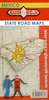
Aguascalientes State - Aguascalientes City

Road maps of Mexico’s states from Ediciones Independencia highlighting numerous places of interest and tourist facilities, with each title also providing a large street plan of the provincial capital plus maps of other local towns, popular tourist resorts and/or archaeological sites.The state maps show the road and rail networks on a clear base, with topography indicated by rivers and areas liable to inundation, plus names of main mountain ranges and peaks (no heights). National parks and other protected areas are brightly highlighted. A range of symbols provides information for tourists: accommodation including campsites and trailer parks, historical and archaeological sites, beaches and spas, sport and leisure centres, natural curiosities, etc. The maps show latitude and
longitude as margin ticks and crosshairs, mostly at 30’ or 1° intervals. Map legend includes English. Most maps have no index. Each title includes a large street plan of the provincial capital, plus plans of selected other towns. In addition to street names, the plans also show names of local districts. Plans of the state capital usually have a list of various locations, facilities and/or places on interest highlighted on it, and some include an enlargement showing the town centre in greater detail. Each title also has a table of distances, plus a table showing various facilities and places of interest in the main towns of the state.
RIP - This product is no longer available on our network. It was last seen on 25.09.2019

This page now acts as a permanent archive for this product. Add more information using the comments box below to ensure it can still be found by future generations.

Use our search facility to see if it is available from an alternative contributor.
  • External links may include paid for promotion
  • Availability: Out Of Stock
  • Supplier: Stanfords
  • SKU: 9781586111649
Availability: In Stock
£13.99

Product Description

Road maps of Mexico’s states from Ediciones Independencia highlighting numerous places of interest & tourist facilities, with each title also providing a large street plan of the provincial capital plus maps of other local towns, popular tourist resorts and/or archaeological sites. The state maps show the road & rail networks on a clear base, with topography indicated by rivers & areas liable to inundation, plus names of main mountain ranges & peaks (no heights). National parks & other protected areas are brightly highlighted. A range of symbols provides information for tourists: accommodation including campsites & trailer parks, historical & archaeological sites, beaches & spas, sport & leisure centres, natural curiosities, etc. The maps show latitude & longitude as margin ticks & crosshairs, mostly at 30’ or 1° intervals. Map legend

Includes::
English. Most maps have no index. Each title

Includes::
a large street plan of the provincial capital, plus plans of selected other towns. In addition to street names, the plans also show names of local districts. Plans of the state capital usually have a list of various locations, facilities and/or places on interest highlighted on it, & some include an enlargement showing the town centre in greater detail. Each title also has a table of distances, plus a table showing various facilities & places of interest in the main towns of the state.

Reviews/Comments

Add New

Intelligent Comparison

Oooops!
We couldn't find anything!
Perhaps this product's unique.... Or perhaps we are still looking for comparisons!
Click to bump this page and we'll hurry up.

Price History

Vouchers

No voucher codes found.
Do you know a voucher code for this product or supplier? Add it to Insights for others to use.

Facebook

Jargon Buster

Natural - not manmade
Large - something that takes up more space than normal.
Road - a manmade lane or a path that is used to speed up travel.
Accommodation - A room in which someone can live in, for example in a hotel
Popular - Something that is admired and liked by many people.

Supplier Information

Stanfords
Stanfords was established in 1853 and opened their iconic Covent Garden flagship store in 1901. They have become the top retailer of maps, travel books and accessories in the UK and arguably offer the largest selection of maps and travel books worldwide. Famous names such as Captain Robert Falcon Scott, Ranulph Fiennes and Michael Palin have purchased from Stanfords. They now have a shop in Bristol and both stores together with other venues operate a calendar of events including talks, book signings and exhibitions. As a specialist map retailer, the map selection is comprehensive and includes road maps, street maps and walking maps from worldwide destinations, as well as a selection of world atlases and wall maps. Books include travel guides and travel literature. Stanfords also stock globes, from miniatures made of blue marble to magnificent floor-standing globes. The website features a selection of interesting articles on travel topics.
Page Updated: 2023-11-12 20:15:36

Community Generated Product Tags

Oh No! The productWIKI community hasn't generated any tags for this product yet!
Menu