
 United Kingdom
 France
 Germany
 Netherlands
 Sweden
 USA
USA
 Italy
Italy
 Spain
Spain
More From Contributor


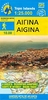
Aigüestortes I Estany De Sant Maurici National Park 2-Map Set
Editorial Alpina
Aigüestortes i Estany de Sant Maurici National Park on a 2-map set from Editorial Alpina containing two of the publishers’ 1:25, 000 maps: Val de Boi and Sant Maurici. Both maps have contours at 10m intervals, enhanced by relief shading with plenty of spot heights, plus colouring for different types of vegetation and/or land use. An overprint highlights walking paths, indicating where appropriate their PR or GR numbers. Symbols show various types of accommodation (hotels, farms, refuges, campsites, etc), picturesque locations and other places of interest. The maps have a 1km UTM grid plus latitude and longitude margin ticks at 1’ intervals. Map legend includes English.PLEASE NOTE: each of the two maps is also available separately, accompanied by a booklet with English
language descriptions of several recommended hiking trails, other recreational information, contact details for mountain refuges, etc.To see the list of currently available titles in this extensive Editorial Alpina hiking series please click on the series link.
language descriptions of several recommended hiking trails, other recreational information, contact details for mountain refuges, etc.To see the list of currently available titles in this extensive Editorial Alpina hiking series please click on the series link.
Product Description
Reviews/Comments
Add New
Vouchers
No voucher codes found.
Do you know a voucher code for this product or supplier? Add it to Insights for others to use.
Do you know a voucher code for this product or supplier? Add it to Insights for others to use.
 Denmark