-
Home
-
Contributors
-
International
-
Account
-
Information
More From Contributor
- 160 lightly ruled pages
- Portable pocket-size is great for trips
- Personal data page
- Sewn binding
- Elastic band closure
- Fold out city map
- Perforated pages
- Shrink-wrapped ...
- Getting Started, Background, Neighbourhoods, Shopping, Eating, Drinking & Nightlife, The Arts, Sports & Activities, Gay & Lesbian, Sleeping & Day Trips & Excursions. The Background section details the history, arts, architecture, environment, media, fashion & government & politics of the city. An ...

Amsterdam Borch
stops, and ferry links on the Ij. A map of the Amsterdam conurbation shows the motorways network and the road access to the city from Schiphol Airport. The two plans and the road map are indexed, listing both streets/localities and places of interest. Also included is a map of the tram and metro routes, a small administrative map of the whole of the Netherlands, and information on the city’s climate.
This page now acts as a permanent archive for this product. Add more information using the comments box below to ensure it can still be found by future generations.
Use our search facility to see if it is available from an alternative contributor.
- Availability: Out Of Stock
- Supplier: Stanfords
- SKU: 9783866093393
Product Description
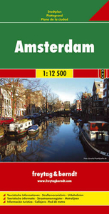
Laminated & waterproof map for visitors to Amsterdam from Borch, highlighting top 30 sights & combining a street plan of the inner districts of the city with a more detailed plan of its historic centre & a road map of the environs. The main plan at 1:11, 000 covers the city within the canal girdle & the old walls, extending west to Rembrandt Park & the Einsteinweg motorway & east to include most of the Zeeburg district & the Entrepotdok. Coverage southwards extends to include the whole of the Vondelpark & the De Pijp district. On the reverse the old city centre from the Singel canal to the Botanical Gardens is shown in greater detail at 1:6, 000. Both plans highlight places of interest, museums, theatres, selected hotels, etc. & show metro stations, tram lines with stops, & ferry links on the Ij. A map of the Amsterdam conurbation shows the motorways network & the road access to the city from Schiphol Airport. The two plans & the road map are indexed, listing both streets/localities & places of interest. Also included is a map of the tram & metro routes, a small administrative map of the whole of the Netherlands, & information on the city’s climate.
Reviews/Comments
Add New
Intelligent Comparison
Price History
Vouchers
Do you know a voucher code for this product or supplier? Add it to Insights for others to use.


 United Kingdom
 France
 Germany
 Netherlands
 Sweden
 USA
USA
 Italy
Italy
 Spain
Spain


 Denmark