More From Contributor
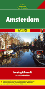
£3.50
Ampthill in 1924 in a fascinating series of reproductions of old Ordnance Survey plans in the Alan Godfrey Editions, ideal for anyone interested in the history of their neighbourhood or family. The map of Ampthill covers the main area of the town around Bedford Street, Church Street, Woburn Street & Dunstable Street. Coverage

Includes::
Ampthill Park to the north of the map along with Russets Plantation & Laurel Wood. Features include St Andrews Church, Police Station, Brewery, Drill Hall, Friends Meeting House, Ampthill House, Coopers Hill & the Cinema. On the reverse is an extract from a commercial directory & a list of private residents About the Alan Godfrey Editions of the 25” OS Series: Selected towns in Great Britain & Ireland are covered by maps showing the extent of urban development in the last decades of the 19th & early 20th century. The plans have been taken from the Ordnance Survey mapping & reprinted at about 15 inches to one mile (1:4, 340). On the reverse most maps have historical notes & many also include extracts from contemporary directories. Most maps cover about one mile (1.6kms) north/south, one & a half miles (2.4kms) across; adjoining sheets can be combined to provide wider coverage.FOR MORE INFORMATION & A COMPLETE LIST OF ALL AVAILABLE TITLES PLEASE CLICK ON THE SERIES LINK.

...
Archived Product
£8.50
The islands of Amrum, Föhr & Langeness in the German North Frisian Islands, on a detailed, GPS compatible map at 1:35, 000 from Kompass with local & long-distance footpaths, cycling routes, accommodation, etc, printed on durable, waterproof & tear-resistant synthetic paper.KOMPASS HIKING & RECREATIONAL MAPS: this title is part of an extensive series covering Austria, much of Germany & the Slovenian Alps. Kompass are Europe’s largest publishers of hiking maps; their mapping of other countries, including expanding coverage of Italy, is listed on our website separately.CARTOGRAPHY: the maps are contoured with additional shading, graphic relief & colouring to provide a more detailed picture of the terrain, vegetation and/or land use. Contour interval varies from 10m in the coastal areas of Northern Germany to 40 or 50 metres in the mountainous regions. All the maps highlight local & long-distance waymarked footpaths, including climbing trails. Most titles also show cycling routes, mountain bike trails, &, the in mountainous areas, ski routes. The maps indicate various types of accommodation (selected inns & hotels, youth hostels, campsites, mountain refuges), as well as recreational facilities, places of interest, etc. Latest editions also show access by public transport with bus stops and/or Park+ Ride facilities.GEOGRAPHICAL COORDINATES: unless indicated to the contrary in the individual description, the maps have a UTM grid for GPS users. MAP LEGEND: most maps now include full English legend, particularly titles covering the Alpine areas. Some maps covering mainly eastern Austria or the less popular parts of Germany may still have a legend in German only.OTHER

Features:
selected titles include on the reverse panorama drawings of their area with names of villages, peaks, valleys, etc. and/or have a booklet with pictures of local wild flowers with their Latin names. Many titles are now published as competitively priced sets of two or more maps, offering a wider coverage.BOOKLETS: PLEASE NOTE BEFORE ORDERING
- many titles come with a booklet describing the area and/or various hiking routes. Unless indicated in the individual description that the booklet

Includes::
English, these booklets are IN GERMAN only. The booklets are not necessary to use the maps since, as stated above, full English language map legend is provided.


...
Archived Product
£12.99
Map No. 1212, Amsteg, in the topographic survey of Switzerland at 1:25, 000 from Bundesamt für Landestopographie (swisstopo), covering the whole country on 247 small format sheets, with special larger maps published for popular regions including some titles now available in hiking versions. Highly regarded for their superb use of graphic relief & hill shading, the maps give an almost 3-D picture of Switzerland`s mountainous terrain. Contours are at 10 m intervals, with 20m intervals in the mountainous areas. All the maps have a 1-km grid for Swiss national coordinates (datum CH 1903). * Small format sheets (Nos. 1011
- 1374)* Map legend in the language of the area covered by the map. Additional margin ticks show latitude & longitude in steps of 2`. The area covered by each map is 17 x 12 km (11 x 7 miles approx). * Special larger sheets (Nos. from 2501 onwards) – STANDARD editions:* No map legend is included but a separate leaflet can be provided instead. The area covered by each map is 25 x 17 km (15 x 11 miles approx).* Special larger sheets (Nos. from 2501 onwards) – HIKING editions:* An overprint highlights hiking, mountain & alpine paths, including regional & national long-distance trails. The maps also show bus routes with bus stops, plus inns in remote locations. The area covered by each map is 25 x 17 km (15 x 11 miles approx).
...
Archived Product
£6.95
Central Amsterdam on a waterproof & tear-resistant tourist map from Map Easy with a collection of street plans designed for visitors aiming to eat, drink &, most of all, shop their way across this beautiful city rather than to explore its unique layout & architecture. The plans, with their characteristic h&-drawn style, are clearly laid out but do not always reflect the relative size of the streets, with small passages drawn as wide as the main traffic arteries. Some smaller canals are also missing. On one side is a plan of the oldest part of the city covering the Dam
- Red Light District area with the adjoining canals to the east & south. This plan is then extended on the reverse to show the central part of the canal girdle & part of the Jordaan (with the whole area wrongly described as the Jordaan). The plans are annotated with numerous, colour-coded names of restaurants & bars indicating their price range, shops & various places of interest. A separate inset shows Amsterdam's main up-market shopping street, P.C. Hooftstraat, with yet more shops. A more general plan of central Amsterdam (curiously described as Greater Amsterdam) shows the relative locations of these more detailed plans, with additional coverage to include the city
...
Archived Product
£6.95
Amsterdam with an enlargement for its historic centre on a tourist street plan from Red Maps presented in a handy concertina format & printed on thick high quality paper, with thematic indexes for sights, hotels, shopping, etc. The map offers two street plans: the city central districts including the museum quarter, extending east to include the eastern docks with KNSM island for examples of modern Dutch architecture, plus an enlargement showing in much greater detail Amsterdam ...
Archived Product
£10.99
Amsterdam in the Blue Guides series focuses primarily on cultural tourism for the visitor who wishes to understand more of what they might see &, as such, the title provides thorough & objective reference information covering art, history & architecture. The guide features illustrations aimed to inform rather than just decorate, such as maps, diagrams, floor plans, architectural details & photographs. Cross referenced indexing means information is accessible & layout navigable. Selective listings of restaurants & accommodation are chosen in the belief that good, practical recommendations will contribute to the enjoyment of good art & culture.. ...
Archived Product
£3.99
Amsterdam in a series of street plans from Rough Guides published on very light waterproof & tear-resistant plastic paper, indexed, with recommendations for shopping, eating, drinking & cultural or sport venues. The plan is folded to only 9x 19cm when detached from its protective cover, & can be easily rolled or folded into smaller size without any damage or creases. On one side is a plan of central districts of the city at 1:7, 500, including the whole of the Jordaan, the Museum Quarter with Vondelpark & De Pijp, accompanied a street index. The plan shows tram & main bus routes indicating line numbers, metro stations, & the route & stops of the Canal Hopper service. Famous buildings, cultural institutions, etc. are highlighted & named. On the reverse the city centre & the canal girdle are shown in greater detail enlarged to 1:5, 000, in addition annotated with colour-coded markers indicating publishers ...
Archived Product
£10.39
Amsterdam in the Countries, Regions & Cities series from Rough Guides; comprehensively detailed guidebooks specifically designed for independent travellers & serving a range of worldwide destinations. Widely recognised for their free editorial style, Rough Guide authors are allowed to express their personal opinions on a range of subjects. Although sometimes controversial, this editorial stance allows readers to experience more detailed & personal takes on each destination, a feature often more limited in other guidebooks. Cultural & historical nuances are explored in significant depth throughout the text & descriptions on the ambience of individual settings alongside personal recommendations, particularly in cities, are notably prevalent. Each Rough Guide in the Countries, Regions & Cities series has a similar layout. A ...
Archived Product
£7.95
The Central Amsterdam waterproof & tear-resistant Map Easy tourist map features street plans for visitors wishing to eat, drink & shop their way across the stunning Dutch capital. The plans, with their characteristic h&-drawn style, are clearly laid out & quirkily illustrated, which makes navigating this sometimes-confusing city a breeze. On one side is a plan of the oldest part of the city covering the Dam & Red Light District with the adjoining canals to the east & south. This plan is extended on the reverse to show the central part of the Canal Ring & part of Jordaan. The plans are annotated with colour-coded names of restaurants, bars, shops & various places of interest. A separate inset shows Amsterdam's main upmarket shopping street: P.C. Hooftstraat. A more general plan of central Amsterdam shows the relative locations of these more detailed plans, with additional coverage to include the city ...
Archived Product
£8.99
On a chilly February day two old friends meet in the throng outside a crematorium to pay their last respects to Molly Lane. Both Clive Linley & Vernon Halliday had been Molly`s lovers in the days before they reached their current eminence, Clive as Britain`s most successful modern composer, Vernon as editor of the quality broadsheet, The Judge. Gorgeous, feisty Molly had had other lovers too, notably Julian Garmony, Foreign Secretary, a notorious right-winger tipped to be the next prime minister. In the days that follow Molly`s funeral Clive & Vernon will make a pact that will have consequences neither has foreseen. Each will make a disastrous moral decision, their friendship will be tested to its limits & Julian Garmony will be fighting for his political life. ...
Archived Product

Amsterdam

Central Amsterdam at 1:16, 650 on a laminated, waterproof and tear-resistant street plan from the AA with on the reverse a mini guide to the city highlighting its top 25 sights, recommendations for eating out, shopping and entertainment, plus general tourist information.The plan extends well beyond the city
RIP - This product is no longer available on our network. It was last seen on 25.09.2019

This page now acts as a permanent archive for this product. Add more information using the comments box below to ensure it can still be found by future generations.

Use our search facility to see if it is available from an alternative contributor.
  • Availability: Out Of Stock
  • Supplier: Stanfords
  • SKU: 9780749552329
Availability: In Stock
£4.99

Product Description

Central Amsterdam at 1:16, 650 on a laminated, waterproof & tear-resistant street plan from the AA with on the reverse a mini guide to the city highlighting its top 25 sights, recommendations for eating out, shopping & entertainment, plus general tourist information. The plan extends well beyond the city

Reviews/Comments

Add New

Price History

Vouchers

No voucher codes found.
Do you know a voucher code for this product or supplier? Add it to Insights for others to use.

Facebook

Jargon Buster

Waterproof - Resistant to water, usualy specified by depth in metres
Entertainment - Something that provides amusement
Resistant - Something that can repel against something.
Laminated - A thin layer of plastic that gives a coating and shine to a material.

Supplier Information

Stanfords
Stanfords was established in 1853 and opened their iconic Covent Garden flagship store in 1901. They have become the top retailer of maps, travel books and accessories in the UK and arguably offer the largest selection of maps and travel books worldwide. Famous names such as Captain Robert Falcon Scott, Ranulph Fiennes and Michael Palin have purchased from Stanfords. They now have a shop in Bristol and both stores together with other venues operate a calendar of events including talks, book signings and exhibitions. As a specialist map retailer, the map selection is comprehensive and includes road maps, street maps and walking maps from worldwide destinations, as well as a selection of world atlases and wall maps. Books include travel guides and travel literature. Stanfords also stock globes, from miniatures made of blue marble to magnificent floor-standing globes. The website features a selection of interesting articles on travel topics.
Page Updated: 2023-11-12 20:15:36

Community Generated Product Tags

Oh No! The productWIKI community hasn't generated any tags for this product yet!
Menu