
 United Kingdom
 France
 Germany
 Netherlands
 Sweden
 USA
USA
 Italy
Italy
 Spain
Spain
More From Contributor


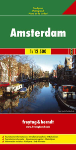
Amsterdam
Central Amsterdam on a waterproof and tear-resistant tourist map from MapEasy with a collection of street plans designed for visitors aiming to eat, drink and, most of all, shop their way across this beautiful city rather than to explore its unique layout and architecture.The plans, with their characteristic hand-drawn style, are clearly laid out but do not always reflect the relative size of the streets, with small passages drawn as wide as the main traffic arteries. Some smaller canals are also missing.On one side is a plan of the oldest part of the city covering the Dam - Red Light District area with the adjoining canals to the east and south. This plan is then extended on the reverse to show the central part of the canal girdle and part of the Jordaan (with the whole area wrongly
described as the Jordaan). The plans are annotated with numerous, colour-coded names of restaurants and bars indicating their price range, shops and various places of interest. A separate inset shows Amsterdam's main up-market shopping street, P.C. Hooftstraat, with yet more shops. A more general plan of central Amsterdam (curiously described as Greater Amsterdam) shows the relative locations of these more detailed plans, with additional coverage to include the city
described as the Jordaan). The plans are annotated with numerous, colour-coded names of restaurants and bars indicating their price range, shops and various places of interest. A separate inset shows Amsterdam's main up-market shopping street, P.C. Hooftstraat, with yet more shops. A more general plan of central Amsterdam (curiously described as Greater Amsterdam) shows the relative locations of these more detailed plans, with additional coverage to include the city
Product Description
Reviews/Comments
Add New
Intelligent Comparison
Archived Product
Amsterdam Stanfords
£6.95
Archived Product
Amsterdam Stanfords
£7.95
Archived Product
Amsterdam Stanfords
£4.99
Archived Product
Amsterdam Stanfords
£10.99
Archived Product
Amsterdam Stanfords
£3.99
Archived Product
Amsterdam Stanfords
£10.39
Archived Product

Amsterdam Stanfords
£8.99
Archived Product
Amsterdam F&B Stanfords
£9.99
Vouchers
No voucher codes found.
Do you know a voucher code for this product or supplier? Add it to Insights for others to use.
Do you know a voucher code for this product or supplier? Add it to Insights for others to use.
 Denmark