More From Contributor

£6.95
Topographic coverage of mainland Spain at 1:50, 000 in the MTN50 (Mapa Topográfico Nacional) series from the Centro Nacional de Información Geografica, the country’s civilian survey organization. The maps have contours at 20m intervals, enhanced by relief shading, plus colouring and/or graphics to show different types of terrain, vegetation or land use. Boundaries of national parks & other protected areas are marked. In addition to all the usual information featured on topographic mapping at this scale, detailed presentation of the road & rail networks, rural tracks & paths, etc, the maps also show campsites & mountain refuges. On more recent editions some GRs, the official long-distance hiking routes, are also marked (although not as clearly as on hiking maps from other publishers). Each map covers 29.5x 18.5 km (with adjustments in the border or coastal areas). The maps have a 1-km UTM grid, plus margin ticks for latitude & longitude at 1` intervals. Map legend is in Spanish only.HOW TO CHOOSE THE RIGHT 50K MAP: all the titles in CNIG’s 200K Provincial Road Maps series at 1:200, 000 are overprinted with the grid for the 1:50, 000 maps & can be used to see the area covered by each 50K title. TO SEE THE LIST OF TITLES IN THIS SERIES PLEASE CLICK ON THE SERIES LINK.PLEASE NOTE
- MAP TITLES: the grids shown on our website serve both the civilian & the military 1:50, 000 topographic series. Although the areas covered by maps in both series are identical (apart from some border or coastal sheets), occasionally map titles differ – only one title is shown on the grid, usually the military one. In Galicia, the Basque country & in the Catalan speaking areas the tendency now is to use local place names rather than the often better known Castilian ones. Where possible, both versions are included in our titles. Map titles listed on our website are based on information received by us at the time of publication, but sometimes maps arrive showing a completely different title! As long as the map number is as ordered, the correct map has been supplied.
...
Archived Product
£6.50
Topographic coverage of mainland Spain at 1:25, 000 published by the Centro Nacional de Información Geograficá, the country’s civilian survey organization. The maps have contours at 10m intervals & colouring and/or graphics to show different types of vegetation or land use. Boundaries of national parks & other protected areas are marked. In addition to all the usual information shown on topographic maps at this scale, detailed presentation of the road & rail networks, rural tracks & paths, etc, the maps also show campsites. The maps have a 1-km UTM grid, with margin ticks for latitude & longitude at 1` intervals. Map legend is in Spanish only.PLEASE NOTE: our grid for the whole of Spain is in preparation
- in the meantime, for areas other than those shown on the attached grid please use CNIG’s topographic survey at 1:50, 000 by searching for ‘SI00000832’. Each 25K map covers one quarter of the corresponding 50K map, with the numbering system: I = NW quarter, II = NE quarter, III = SW quarter & IV = SE quarter. CNIG maps in the Provincial Road Maps series at 1:200, 000 are overprinted with the grid for the 1:50, 000 survey & can be used to see the area covered by each 50K or 25K title in more detail. To see the list of titles in this series please click on the series grid
- for map numbers not yet listed on our website please contact us by email.

...
Archived Product
£11.99
Anterselva/ Antholz
- Valle di Casies/ Gsies area at 1:25, 000 on a durable, waterproof & tear-resistant map from Kompass in
...
Archived Product
£8.95
Map No. 057, Anterselva/ Antholz
- Valle di Casies/ Gsies, including a panorama map on the reverse, from Kompass in a series
...
Archived Product
£10.99
Chris, Ikem & Beatrice are like-minded friends working under the military regime of His Excellency, the Sandhurst-educated President of Kangan. In the pressurized atmosphere of oppression & intimidation they are simply trying to live & love
- & remain friends. But in a world where each day brings a new betrayal, hope is hard to cling on to. Anthills of the Savannah (1987), Achebe`s candid vision of contemporary African politics, is a powerful fusion of angry voices. It continues the journey that Achebe began with his earlier novels, tracing the history of modern Africa through colonialism & beyond, & is a work ultimately filled with hope.
...
Archived Product
£12.99
This beautifully illustrated collection tells the awe-inspiring stories of 50 women who have pushed the boundaries of human excellence & endeavour. Standing out for their achievements in sport, science, the arts, politics, & history, these women have made huge contributions to today`s society. Featuring incredible women from the past & present such as Beyonce, Sheryl Sandberg, Mary Anning, Emmeline Pankhurst & Malala. The Anthology of Amazing Women is a wonderful read for anyone wanting to read up on the incredible women who have lived & changed our lives. ...
Archived Product
£10.99
Kitchen Confidential: Adventures in the Culinary Underbelly After twenty-five years of `sex, drugs, bad behaviour & haute cuisine`, chef & novelist Anthony Bourdain has decided to tell all. From his first oyster in the Gironde to his lowly position as a dishwasher in a honky tonk fish restaurant in Provincetown; from the kitchen of the Rainbow Room atop the Rockefeller Center to drug dealers in the East Village, from Tokyo to Paris & back to New York again, Bourdain`s tales of the kitchen are as passionate as they are unpredictable, as shocking as they are funny. A Cook`s Tour: In Search of the Perfect Meal Bourdain sets off to eat his way around the world. But this was never going to be a conventional culinary tour. He heads to Saigon where he eats the still-beating heart of a live cobra, & travels into Khmer Rouge territory to find the rumoured Wild West of Cambodia. He also dines with gangsters in Russia, finds a medieval pig slaughter & feast in Portugal, & returns to the fishing village where he first ate oysters as a child. Written with his inimitable machismo & humour, this is an adventure story sure to give you indigestion. ...
Archived Product
£5.50
Photoluminescent Vinyl
- 150mm x 150mm. Stanfords is an official distributor of Maritime Progress safety signs. We are able to
...
Archived Product
£12.00
The harmful effects of anti-fouling systems were considered by the International Maritime Organization`s Marine Environment Protection Committee (MEPC) for the first time in 1988, when the Paris Commission requested the MEPC to consider the need for measures to restrict the use of tributyltin (TBT) compounds on seagoing vessels. As a first step, the Committee at its thirtieth session in 1990 adopted resolution MEPC.46 (30) on ” Measures to control potential adverse impacts associated with the use of tributyltin compounds in anti-fouling paints”, which recommends that IMO Member Governments adopt measures to eliminate the use of anti-fouling paint containing TBT on non-aluminium-hulled vessels of less than 25m in length & eliminate the use of TBT-based anti-fouling paints with an average leaching rate of more than four micrograms of organotin per square centimetre per day. These recommendations were intended to be interim measures until IMO could consider a possible total prohibition of TBT compounds in anti-fouling systems. From 1990 onwards, MEPC was presented with TBT monitoring results which reconfirmed the toxicity of TBT compounds, as well as with information on existing alternatives, including their effectiveness & the risk posed to the marine environment by these systems. The twenty-first session of the IMO Assembly in 1999 adopted resolution A.895 (21) urging MEPC to work towards the expeditious development of a global legally binding instrument to address the harmful effects of anti-fouling systems used on ships. The resolution states that the global instrument, to be developed by MEPC, should ensure a global prohibition of the application of organotin compounds which act as biocides in anti-fouling systems on ships by 1 January 2003 & a complete prohibition on the presence of organotin compounds which act as biocides in anti-fouling systems on ships by 1 January 2008. A working group was established at MEPC, which took on the task of developing such a draft instrument. In accordance with Article 2 (b) of the Convention on the International Maritime Organization, the MEPC at its forty-third session recommended, & the twentieth extraordinary session of the Council decided, to convene a diplomatic conference to consider the adoption of a legal instrument on the control of harmful anti-fouling systems on ships. In accordance with the decision of the Council, the International Conference on the Control of Harmful Anti-Fouling Systems for Ships, 2001, was convened by IMO & held in London at its Headquarters from 1 to 5 October 2001. The Conference adopted the International Convention on the Control of Harmful Anti-Fouling Systems on Ships, 2001 (the AFS Convention), together with four Conference resolutions, relating to the early & effective application of the AFS Convention, future work by the Organization pertaining to the AFS Convention, approval & test methodologies for anti-fouling systems on ships & the promotion of technical co-operation. Article 11 (1) (b) & (2) & regulation 1 (4) (a) of annex 4 of the AFS Convention refer to the following guidelines to be developed by the Organization:- Guidelines for survey & certification of anti-fouling systems on ships;- Guidelines for brief sampling of anti-fouling systems on ships; &- Guidelines for inspection of ships anti-fouling systems on ships. Conference resolution 2 urges the Organization to develop the above-mentioned guidelines as a matter of urgency for them to be adopted before the entry into force of the AFS Convention, with a view to facilitating global & uniform implementation of the AFS Convention. This 2005 edition, reproduces the texts of the International Convention on the Control of Harmful Anti-Fouling Systems on Ships, 2001, the four Conference resolutions, & the Guidelines developed & adopted by the Organization. ...
Archived Product
£36.95
Military topographic survey mapping with contours. These maps are designed primarily as flying charts for aircraft, but they are useful as general topographical maps where nothing else is available. Contours are shown in feet, with elevation colouring & spot heights. Towns, villages, major roads, railways & airports are shown (but please note that many of the smaller settlements are not named, & the road information is not necessarily up to date). Some air navigation information also appears on the map, such as radio beacons & restricted flying zones. Double-sided sheet. ...
Archived Product

Anthisnes - Comblain-au-Pont

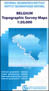
Topographical survey of Belgium at 1:20, 000 from Nationaal Geografisch Instituut / Institut Géographique National, the country’s national survey organization. Each 20K map covers one quarter of the corresponding 1:50, 000 map (with adjustments in the border and coastal areas). The maps provide all the information expected of topographic mapping at this scale and additionally have an unusually large amount of vegetation and/or land use information (different types of woodlands, gardens, orchards, heath, etc). The maps have a 1-km UTM grid, with margin ticks for latitude and longitude at intervals of 1`. Map legend and a glossary of terms used on the maps include English.Stanfords keeps as regular stock 20K maps for the World War I battlefields around the Ypres, Messines and
Passchendaele, and for the area of the Battle of Waterloo. The 1:20, 000 survey covers the whole of Belgium and maps for other regions can be supplied as special orders. To see the list of titles in this series please click on the series link.PLEASE NOTE: the Long-Distance Footpaths Map of Belgium at 1:300, 000 which shows the division of Belgium into the 50K survey sheets can also be used to see in more detail coverage by the 20K maps.
RIP - This product is no longer available on our network. It was last seen on 25.09.2019

This page now acts as a permanent archive for this product. Add more information using the comments box below to ensure it can still be found by future generations.

Use our search facility to see if it is available from an alternative contributor.
  • Availability: Out Of Stock
  • Supplier: Stanfords
  • SKU: 9781129302343
Availability: In Stock
£9.50

Product Description

Topographical survey of Belgium at 1:20, 000 from Nationaal Geografisch Instituut / Institut Géographique National, the country’s national survey organization. Each 20K map covers one quarter of the corresponding 1:50, 000 map (with adjustments in the border & coastal areas). The maps provide all the information expected of topographic mapping at this scale & in addition have an unusually large amount of vegetation and/or land use information (different types of woodlands, gardens, orchards, heath, etc). The maps have a 1-km UTM grid, with margin ticks for latitude & longitude at intervals of 1`. Map legend & a glossary of terms used on the maps include English. Stanfords keeps as regular stock 20K maps for the World War I battlefields around the Ypres, Messines & Passchendaele, & for the area of the Battle of Waterloo. The 1:20, 000 survey covers the whole of Belgium & maps for other regions can be supplied as special orders. To see the list of titles in this series please click on the series link.PLEASE NOTE: the Long-Distance Footpaths Map of Belgium at 1:300, 000 which shows the division of Belgium into the 50K survey sheets can also be used to see in more detail coverage by the 20K maps.

Reviews/Comments

Add New

Intelligent Comparison

Oooops!
We couldn't find anything!
Perhaps this product's unique.... Or perhaps we are still looking for comparisons!
Click to bump this page and we'll hurry up.

Price History

Vouchers

No voucher codes found.
Do you know a voucher code for this product or supplier? Add it to Insights for others to use.

Facebook

Jargon Buster

World - A physical grouping, commonly used to describe earth and everything associated with ti
Km - Kilometre. A unit of measurement equal to 1000 metres.
Large - something that takes up more space than normal.

Supplier Information

Stanfords
Stanfords was established in 1853 and opened their iconic Covent Garden flagship store in 1901. They have become the top retailer of maps, travel books and accessories in the UK and arguably offer the largest selection of maps and travel books worldwide. Famous names such as Captain Robert Falcon Scott, Ranulph Fiennes and Michael Palin have purchased from Stanfords. They now have a shop in Bristol and both stores together with other venues operate a calendar of events including talks, book signings and exhibitions. As a specialist map retailer, the map selection is comprehensive and includes road maps, street maps and walking maps from worldwide destinations, as well as a selection of world atlases and wall maps. Books include travel guides and travel literature. Stanfords also stock globes, from miniatures made of blue marble to magnificent floor-standing globes. The website features a selection of interesting articles on travel topics.
Page Updated: 2023-11-12 20:15:36

Community Generated Product Tags

Oh No! The productWIKI community hasn't generated any tags for this product yet!
Menu