More From Contributor
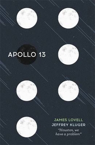
£15.99
Let`s be honest: who doesn`t want to be a little bit Italian? To glide through Rome on a Vespa like Marcello Mastroianni, wearing an impeccable suit? Or sit in St Mark`s Square in Venice at dusk, nibbling cicchetti & sipping an Aperol spritz? This is la dolce vita, & this is aperitivo
- Italy`s take on drinks & small snacks. Aperitivo brings together 80 recipes from across Italy, & tells the stories behind the food & the drinks that shape the aperitif hour. The book opens with the aperitivi themselves
- Campari & Aperol
- as well as recipes for classic Italian cocktails (including the perfect Negroni) & a guide to Italian wine. Kay then introduces simple recipes for Antipasto & Pinzimonio; Tramezzini; Bruschette & Crostini; Seafood; Meat & Fowl; Vegetables, Dairy & Eggs; Bread & Baking; & Dolci. So let`s cinch in our waists, pop on some cat`s eye sunglasses, & make like Sophia Loren. It`s time for Aperitivo.


...
Archived Product
£13.95
” Aphrodite`s Island” is a bold new account of the European discovery of Tahiti, the Pacific island of mythic status that has figured so powerfully in European imaginings about sexuality, the exotic, & the nobility or bestiality of `savages.` In this groundbreaking book, Anne Salmond takes readers to the center of the shared history to furnish rich insights into Tahitian perceptions of the visitors while illuminating the full extent of European fascination with Tahiti. As she discerns the impact & meaning of the European effect on the islands, she demonstrates how, during the early contact period, the mythologies of Europe & Tahiti intersected & became entwined. Drawing on Tahitian oral histories, European manuscripts & artworks, collections of Tahitian artifacts, & illustrated with contemporary sketches, paintings, & engravings from the voyages, ” Aphrodite`s Island” provides a vivid account of the Europeans` Tahitian adventures. At the same time, the book`s compelling insights into Tahitian life significantly change the way we view the history of this small island during a period when it became a crossroads for Europe. ...
Archived Product
£6.95
Topographic coverage of mainland Spain at 1:50, 000 in the MTN50 (Mapa Topográfico Nacional) series from the Centro Nacional de Información Geografica, the country’s civilian survey organization. The maps have contours at 20m intervals, enhanced by relief shading, plus colouring and/or graphics to show different types of terrain, vegetation or land use. Boundaries of national parks & other protected areas are marked. In addition to all the usual information featured on topographic mapping at this scale, detailed presentation of the road & rail networks, rural tracks & paths, etc, the maps also show campsites & mountain refuges. On more recent editions some GRs, the official long-distance hiking routes, are also marked (although not as clearly as on hiking maps from other publishers). Each map covers 29.5x 18.5 km (with adjustments in the border or coastal areas). The maps have a 1-km UTM grid, plus margin ticks for latitude & longitude at 1` intervals. Map legend is in Spanish only.HOW TO CHOOSE THE RIGHT 50K MAP: all the titles in CNIG’s 200K Provincial Road Maps series at 1:200, 000 are overprinted with the grid for the 1:50, 000 maps & can be used to see the area covered by each 50K title. TO SEE THE LIST OF TITLES IN THIS SERIES PLEASE CLICK ON THE SERIES LINK.PLEASE NOTE
- MAP TITLES: the grids shown on our website serve both the civilian & the military 1:50, 000 topographic series. Although the areas covered by maps in both series are identical (apart from some border or coastal sheets), occasionally map titles differ – only one title is shown on the grid, usually the military one. In Galicia, the Basque country & in the Catalan speaking areas the tendency now is to use local place names rather than the often better known Castilian ones. Where possible, both versions are included in our titles. Map titles listed on our website are based on information received by us at the time of publication, but sometimes maps arrive showing a completely different title! As long as the map number is as ordered, the correct map has been supplied.
...
Archived Product
£20.00
Explore the iconic Apollo space missions & moon landings through these stunning infographics & data visualisations. If you ...
Archived Product
£12.99
Apollo: Through the Eyes of the Astronauts is a visual celebration of the most heralded space flights in history & a record of one of the most significant episodes in the history of photography. Apollo: Through the Eyes of the Astronauts is distinguished by the participation of the astronauts who flew the missions, making & recording history. Each of the twenty-one surviving astronauts from the Apollo missions has chosen a favorite photograph from his mission & contributed thoughtful commentary especially for this book. These landmark photographs are accompanied by other iconic Apollo images. Foreword by Stephen Hawking with Lucy Hawking; Introduction by Michael Cabbage, Mission accounts by Robert Jacobs, Photographs selected by the surviving Apollo astronauts ...
Archived Product
£9.99
Map No. 235, Apostle Isles National Lakeshore in Wisconsin, at 1:50, 000 in an extensive series of GPS compatible, contoured hiking maps of USA’s national & state parks or forests & other popular recreational areas. Cartography based on the national topographic survey, with additional tourist information. The maps, with most titles now printed on light, waterproof & tear-resistant plastic paper, highlight walking trails along with campsites & other accommodation, picnic sites, areas for various recreational pursuits such as horse riding or skiing, drinking water sources, & many other facilities of interest to the outdoor enthusiast. Cartography is based on information from the USGS (United States Geological Survey
- the country’s national survey organization), revised by the National Geographic Maps in cooperation with the National Park Service, USDA Forest Service, etc. Topography is excellently presented by contours (interval varies according to scale), enhanced by relief shading & colouring/graphics for wood cover, glaciers, etc. All heights are given in feet. The maps have a UTM grid plus latitude & longitude margin ticks & GPS waypoints for selected important locations. Each map is double-sided to give either maximum coverage of the chosen area or additional enlargements of its important sections. Accompanying notes provide useful information on relevant regulations, safety precautions, contact addresses, etc.IMPORTANT
- PLEASE NOTE: the series is very extensive, ranging in scale from 1:400, 000 for the vast national parks of Alaska to 1:25, 000 for local map in several states. We recommend, therefore, viewing the series by state rather than the whole list.

...
Archived Product
£20.00
Peter, Matthew, Thomas, John: Who were these men & what was their relationship to Jesus? Tom Bissell gives us rich & deeply informed answers to those ancient questions. Written with warmth, humour, & a rare acumen, Apostle is a brilliant & exhaustive synthesis of travel writing, centuries of biblical history, & a deep lifelong relationship with Christianity. Bissell explores not just who these renowned & pious men were (and weren`t), but how their identities have taken shape over two millennia. Bissell, in his search for this elusive set of truths, has traveled the world, visiting holy sites from Rome & Jerusalem to Turkey, India, & Kyrgyzstan, & he captures vividly the rich diversity of Christianity`s global reach. Apostle is an unusual, erudite, & hilarious book, an intoxicating combination of religious, intellectual, & personal adventure. ...
Archived Product
£9.99
Peter, Matthew, Thomas, John: who were these men & their fellow Apostles? What was their relationship to Jesus? Tom Bissell gives us rich answers to these ancient & surprisingly enigmatic questions in an unusual, erudite & fascinating book. By visiting holy sites around the world, & examining how the Apostles` identities took shape over the course of two millennia, he explores the story of Christianity & its growth from an obscure Jewish sect to the global faith we know today. ...
Archived Product
£12.99
Appalachian Trail from Springer Mountain in Georgia to Davenport Gap in the Great Smoky Mountains National Park presented in a handy size, waterproof & tear-resistant atlas at 1:63, 360 from the National Geographic with contoured & GPS compatible topographic mapping overprinted with extensive tourist information, plus a list of camping options, etc. Each 11x 24cm atlas in this series covers a section of the trail between 125 & 220 miles (200 & 350 km approx) long, presenting it on mapping with contours at 50 feet intervals with shading & spot heights, plus colouring to indicate national/state parks or forests & other types of protected areas. The course of the Appalachian Trail is prominently highlighted & annotated with sections markers in both directions plus hiking distances which are also shown on other trails in the surrounding mountains. An extensive range of symbols indicate various facilities & places of interest, including different types of accommodation, restaurants & groceries, drinking water & hiking supplies, visitor centres, viewpoints, wildlife viewing areas, etc. Road network indicates enhanced or 4WD roads, etc. as well as scenic byways, roadside pullouts & car parks, etc. Each page has a 1 mile UTM grid with latitude & longitude margin ticks at 1’ intervals, plus provides a route profile. Additional information in each atlas

Includes::
general advice for hikers, a list of camping options along its section, street plans of main locations near the trail indicating local facilities, useful addresses, etc. To see the list of titles in this series please click on the series list.

...
Archived Product
£12.99
A 220 miles long section of the Appalachian Trail, from Bailey Gap to Calf Mountain in Virginia, presented in a handy size, waterproof & tear-resistant atlas at 1:63, 360 from the National Geographic with contoured & GPS compatible topographic mapping overprinted with extensive tourist information, plus a list of camping options, etc. Each 11x 24cm atlas in this series covers a section of the trail between 125 & 220 miles (200 & 350 km approx) long, presenting it on mapping with contours at 50 feet intervals with shading & spot heights, plus colouring to indicate national/state parks or forests & other types of protected areas. The course of the Appalachian Trail is prominently highlighted & annotated with sections markers in both directions plus hiking distances which are also shown on other trails in the surrounding mountains. An extensive range of symbols indicate various facilities & places of interest, including different types of accommodation, restaurants & groceries, drinking water & hiking supplies, visitor centres, viewpoints, wildlife viewing areas, etc. Road network indicates enhanced or 4WD roads, etc. as well as scenic byways, roadside pullouts & car parks, etc. Each page has a 1 mile UTM grid with latitude & longitude margin ticks at 1’ intervals, plus provides a route profile. Additional information in each atlas

Includes::
general advice for hikers, a list of camping options along its section, street plans of main locations near the trail indicating local facilities, useful addresses, etc. To see the list of titles in this series please click on the series list.

...
Archived Product

Apollo 13

April 13, 1970. Astronauts Jim Lovell, Fred Haise and Jack Swigert are hurtling towards the moon in the Apollo 13 spacecraft, when an explosion rocks the ship. The cockpit grows dim, the air grows thin, and the instrument lights wink out. Moments later, the astronauts are forced to abandon the main ship for the tiny lunar module, designed to keep two men alive for just two days. But there are three men aboard and they are four days from home. As the action shifts from the disabled ship to the frantic engineers at Mission Control to Lovell`s anxious family, APOLLO 13 brilliantly recreates the harrowing, heroic mission in all its drama and glory. This gripping story of human endurance is the basis for Ron Howard`s classic film starring Tom Hanks and Kevin Bacon.
RIP - This product is no longer available on our network. It was last seen on 25.09.2019

This page now acts as a permanent archive for this product. Add more information using the comments box below to ensure it can still be found by future generations.

Use our search facility to see if it is available from an alternative contributor.
  • External links may include paid for promotion
  • Availability: Out Of Stock
  • Supplier: Stanfords
  • SKU: 9780340638064
Availability: In Stock
£9.99

Product Description

April 13, 1970. Astronauts Jim Lovell, Fred Haise & Jack Swigert are hurtling towards the moon in the Apollo 13 spacecraft, when an explosion rocks the ship. The cockpit grows dim, the air grows thin, & the instrument lights wink out. Moments later, the astronauts are forced to abandon the main ship for the tiny lunar module, designed to keep two men alive for just two days. But there are three men aboard & they are four days from home. As the action shifts from the disabled ship to the frantic engineers at Mission Control to Lovell`s anxious family, APOLLO 13 brilliantly recreates the harrowing, heroic mission in all its drama & glory. This gripping story of human endurance is the basis for Ron Howard`s classic film starring Tom Hanks & Kevin Bacon.

Reviews/Comments

Add New

Intelligent Comparison

Oooops!
We couldn't find anything!
Perhaps this product's unique.... Or perhaps we are still looking for comparisons!
Click to bump this page and we'll hurry up.

Price History

Vouchers

No voucher codes found.
Do you know a voucher code for this product or supplier? Add it to Insights for others to use.

Facebook

Jargon Buster

Human - A highly developed and adapted mamal and deminant species on earth
Instrument - A wide range of meanings from musical instrument to a measuring instrument
Endurance - A measurement on how long something can last wear and tear.
Home - A place of permanent residence for families.
Classic - Something that is still like it was originally a high quality standard.
Family - A group of people that live together made up from parents and children.

Supplier Information

Stanfords
Stanfords was established in 1853 and opened their iconic Covent Garden flagship store in 1901. They have become the top retailer of maps, travel books and accessories in the UK and arguably offer the largest selection of maps and travel books worldwide. Famous names such as Captain Robert Falcon Scott, Ranulph Fiennes and Michael Palin have purchased from Stanfords. They now have a shop in Bristol and both stores together with other venues operate a calendar of events including talks, book signings and exhibitions. As a specialist map retailer, the map selection is comprehensive and includes road maps, street maps and walking maps from worldwide destinations, as well as a selection of world atlases and wall maps. Books include travel guides and travel literature. Stanfords also stock globes, from miniatures made of blue marble to magnificent floor-standing globes. The website features a selection of interesting articles on travel topics.
Page Updated: 2023-11-12 20:15:36

Community Generated Product Tags

Oh No! The productWIKI community hasn't generated any tags for this product yet!
Menu