More From Contributor

£9.99
April 13, 1970. Astronauts Jim Lovell, Fred Haise & Jack Swigert are hurtling towards the moon in the Apollo 13 spacecraft, when an explosion rocks the ship. The cockpit grows dim, the air grows thin, & the instrument lights wink out. Moments later, the astronauts are forced to abandon the main ship for the tiny lunar module, designed to keep two men alive for just two days. But there are three men aboard & they are four days from home. As the action shifts from the disabled ship to the frantic engineers at Mission Control to Lovell`s anxious family, APOLLO 13 brilliantly recreates the harrowing, heroic mission in all its drama & glory. This gripping story of human endurance is the basis for Ron Howard`s classic film starring Tom Hanks & Kevin Bacon. ...
Archived Product
£9.99
Map No. 235, Apostle Isles National Lakeshore in Wisconsin, at 1:50, 000 in an extensive series of GPS compatible, contoured hiking maps of USA’s national & state parks or forests & other popular recreational areas. Cartography based on the national topographic survey, with additional tourist information. The maps, with most titles now printed on light, waterproof & tear-resistant plastic paper, highlight walking trails along with campsites & other accommodation, picnic sites, areas for various recreational pursuits such as horse riding or skiing, drinking water sources, & many other facilities of interest to the outdoor enthusiast. Cartography is based on information from the USGS (United States Geological Survey
- the country’s national survey organization), revised by the National Geographic Maps in cooperation with the National Park Service, USDA Forest Service, etc. Topography is excellently presented by contours (interval varies according to scale), enhanced by relief shading & colouring/graphics for wood cover, glaciers, etc. All heights are given in feet. The maps have a UTM grid plus latitude & longitude margin ticks & GPS waypoints for selected important locations. Each map is double-sided to give either maximum coverage of the chosen area or additional enlargements of its important sections. Accompanying notes provide useful information on relevant regulations, safety precautions, contact addresses, etc.IMPORTANT
- PLEASE NOTE: the series is very extensive, ranging in scale from 1:400, 000 for the vast national parks of Alaska to 1:25, 000 for local map in several states. We recommend, therefore, viewing the series by state rather than the whole list.

...
Archived Product
£20.00
Peter, Matthew, Thomas, John: Who were these men & what was their relationship to Jesus? Tom Bissell gives us rich & deeply informed answers to those ancient questions. Written with warmth, humour, & a rare acumen, Apostle is a brilliant & exhaustive synthesis of travel writing, centuries of biblical history, & a deep lifelong relationship with Christianity. Bissell explores not just who these renowned & pious men were (and weren`t), but how their identities have taken shape over two millennia. Bissell, in his search for this elusive set of truths, has traveled the world, visiting holy sites from Rome & Jerusalem to Turkey, India, & Kyrgyzstan, & he captures vividly the rich diversity of Christianity`s global reach. Apostle is an unusual, erudite, & hilarious book, an intoxicating combination of religious, intellectual, & personal adventure. ...
Archived Product
£9.99
Peter, Matthew, Thomas, John: who were these men & their fellow Apostles? What was their relationship to Jesus? Tom Bissell gives us rich answers to these ancient & surprisingly enigmatic questions in an unusual, erudite & fascinating book. By visiting holy sites around the world, & examining how the Apostles` identities took shape over the course of two millennia, he explores the story of Christianity & its growth from an obscure Jewish sect to the global faith we know today. ...
Archived Product
£12.99
Appalachian Trail from Springer Mountain in Georgia to Davenport Gap in the Great Smoky Mountains National Park presented in a handy size, waterproof & tear-resistant atlas at 1:63, 360 from the National Geographic with contoured & GPS compatible topographic mapping overprinted with extensive tourist information, plus a list of camping options, etc. Each 11x 24cm atlas in this series covers a section of the trail between 125 & 220 miles (200 & 350 km approx) long, presenting it on mapping with contours at 50 feet intervals with shading & spot heights, plus colouring to indicate national/state parks or forests & other types of protected areas. The course of the Appalachian Trail is prominently highlighted & annotated with sections markers in both directions plus hiking distances which are also shown on other trails in the surrounding mountains. An extensive range of symbols indicate various facilities & places of interest, including different types of accommodation, restaurants & groceries, drinking water & hiking supplies, visitor centres, viewpoints, wildlife viewing areas, etc. Road network indicates enhanced or 4WD roads, etc. as well as scenic byways, roadside pullouts & car parks, etc. Each page has a 1 mile UTM grid with latitude & longitude margin ticks at 1’ intervals, plus provides a route profile. Additional information in each atlas

Includes::
general advice for hikers, a list of camping options along its section, street plans of main locations near the trail indicating local facilities, useful addresses, etc. To see the list of titles in this series please click on the series list.

...
Archived Product
£12.99
A 200 miles long section of the Appalachian Trail, from Calf Mountain in Virginia to Raven Rock in Maryl&, presented in a handy size, waterproof & tear-resistant atlas at 1:63, 360 from the National Geographic with contoured & GPS compatible topographic mapping overprinted with extensive tourist information, plus a list of camping options, etc. Each 11x 24cm atlas in this series covers a section of the trail between 125 & 220 miles (200 & 350 km approx) long, presenting it on mapping with contours at 50 feet intervals with shading & spot heights, plus colouring to indicate national/state parks or forests & other types of protected areas. The course of the Appalachian Trail is prominently highlighted & annotated with sections markers in both directions plus hiking distances which are also shown on other trails in the surrounding mountains. An extensive range of symbols indicate various facilities & places of interest, including different types of accommodation, restaurants & groceries, drinking water & hiking supplies, visitor centres, viewpoints, wildlife viewing areas, etc. Road network indicates enhanced or 4WD roads, etc. as well as scenic byways, roadside pullouts & car parks, etc. Each page has a 1 mile UTM grid with latitude & longitude margin ticks at 1’ intervals, plus provides a route profile. Additional information in each atlas

Includes::
general advice for hikers, a list of camping options along its section, street plans of main locations near the trail indicating local facilities, useful addresses, etc. To see the list of titles in this series please click on the series list.

...
Archived Product
£12.99
Appalachian Trail, from Damascus to Bailey Gap in Virginia, presented in a handy size, waterproof & tear-resistant atlas at 1:63, 360 from the National Geographic with contoured & GPS compatible topographic mapping overprinted with extensive tourist information, plus a list of camping options, etc. Each 11x 24cm atlas in this series covers a section of the trail between 125 & 220 miles (200 & 350 km approx) long, presenting it on mapping with contours at 50 feet intervals with shading & spot heights, plus colouring to indicate national/state parks or forests & other types of protected areas. The course of the Appalachian Trail is prominently highlighted & annotated with sections markers in both directions plus hiking distances which are also shown on other trails in the surrounding mountains. An extensive range of symbols indicate various facilities & places of interest, including different types of accommodation, restaurants & groceries, drinking water & hiking supplies, visitor centres, viewpoints, wildlife viewing areas, etc. Road network indicates enhanced or 4WD roads, etc. as well as scenic byways, roadside pullouts & car parks, etc. Each page has a 1 mile UTM grid with latitude & longitude margin ticks at 1’ intervals, plus provides a route profile. Additional information in each atlas

Includes::
general advice for hikers, a list of camping options along its section, street plans of main locations near the trail indicating local facilities, useful addresses, etc. To see the list of titles in this series please click on the series list.

...
Archived Product
£12.99
Appalachian Trail, from Davenport Gap in the Great Smoky Mountains National Park to Damascus in Virginia, presented in a handy size, waterproof & tear-resistant atlas at 1:63, 360 from the National Geographic with contoured & GPS compatible topographic mapping overprinted with extensive tourist information, plus a list of camping options, etc. Each 11x 24cm atlas in this series covers a section of the trail between 125 & 220 miles (200 & 350 km approx) long, presenting it on mapping with contours at 50 feet intervals with shading & spot heights, plus colouring to indicate national/state parks or forests & other types of protected areas. The course of the Appalachian Trail is prominently highlighted & annotated with sections markers in both directions plus hiking distances which are also shown on other trails in the surrounding mountains. An extensive range of symbols indicate various facilities & places of interest, including different types of accommodation, restaurants & groceries, drinking water & hiking supplies, visitor centres, viewpoints, wildlife viewing areas, etc. Road network indicates enhanced or 4WD roads, etc. as well as scenic byways, roadside pullouts & car parks, etc. Each page has a 1 mile UTM grid with latitude & longitude margin ticks at 1’ intervals, plus provides a route profile. Additional information in each atlas

Includes::
general advice for hikers, a list of camping options along its section, street plans of main locations near the trail indicating local facilities, useful addresses, etc. To see the list of titles in this series please click on the series list.

...
Archived Product
£12.99
A 175 miles long section of the Appalachian Trail across New Jersey & New York State, from Delaware Water Gap to Schaghticoke Mountain, presented in a handy size, waterproof & tear-resistant atlas at 1:63, 360 from the National Geographic with contoured & GPS compatible topographic mapping overprinted with extensive tourist information, plus a list of camping options, etc. Each 11x 24cm atlas in this series covers a section of the trail between 125 & 220 miles (200 & 350 km approx) long, presenting it on mapping with contours at 50 feet intervals with shading & spot heights, plus colouring to indicate national/state parks or forests & other types of protected areas. The course of the Appalachian Trail is prominently highlighted & annotated with sections markers in both directions plus hiking distances which are also shown on other trails in the surrounding mountains. An extensive range of symbols indicate various facilities & places of interest, including different types of accommodation, restaurants & groceries, drinking water & hiking supplies, visitor centres, viewpoints, wildlife viewing areas, etc. Road network indicates enhanced or 4WD roads, etc. as well as scenic byways, roadside pullouts & car parks, etc. Each page has a 1 mile UTM grid with latitude & longitude margin ticks at 1’ intervals, plus provides a route profile. Additional information in each atlas

Includes::
general advice for hikers, a list of camping options along its section, street plans of main locations near the trail indicating local facilities, useful addresses, etc. To see the list of titles in this series please click on the series list.

...
Archived Product
£12.99
A 160 miles long section of the Appalachian Trail across Vermont, from East Mountain in Massachusetts to Hanover in New Hampshire, presented in a handy size, waterproof & tear-resistant atlas at 1:63, 360 from the National Geographic with contoured & GPS compatible topographic mapping overprinted with extensive tourist information, plus a list of camping options, etc. Each 11x 24cm atlas in this series covers a section of the trail between 125 & 220 miles (200 & 350 km approx) long, presenting it on mapping with contours at 50 feet intervals with shading & spot heights, plus colouring to indicate national/state parks or forests & other types of protected areas. The course of the Appalachian Trail is prominently highlighted & annotated with sections markers in both directions plus hiking distances which are also shown on other trails in the surrounding mountains. An extensive range of symbols indicate various facilities & places of interest, including different types of accommodation, restaurants & groceries, drinking water & hiking supplies, visitor centres, viewpoints, wildlife viewing areas, etc. Road network indicates enhanced or 4WD roads, etc. as well as scenic byways, roadside pullouts & car parks, etc. Each page has a 1 mile UTM grid with latitude & longitude margin ticks at 1’ intervals, plus provides a route profile. Additional information in each atlas

Includes::
general advice for hikers, a list of camping options along its section, street plans of main locations near the trail indicating local facilities, useful addresses, etc. To see the list of titles in this series please click on the series list.

...
Archived Product

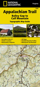
Appalachian Trail: Bailey Gap To Calf Mountain Hiking Atlas, VA

A 220 miles long section of the Appalachian Trail, from Bailey Gap to Calf Mountain in Virginia, presented in a handy size, waterproof and tear-resistant atlas at 1:63, 360 from the National Geographic with contoured and GPS compatible topographic mapping overprinted with extensive tourist information, plus a list of camping options, etc.Each 11x24cm atlas in this series covers a section of the trail between 125 and 220 miles (200 and 350 km approx) long, presenting it on mapping with contours at 50 feet intervals with shading and spot heights, plus colouring to indicate national/state parks or forests and other types of protected areas. The course of the Appalachian Trail is prominently highlighted and annotated with sections markers in both directions plus hiking distances which
are also shown on other trails in the surrounding mountains. An extensive range of symbols indicate various facilities and places of interest, including different types of accommodation, restaurants and groceries, drinking water and hiking supplies, visitor centres, viewpoints, wildlife viewing areas, etc. Road network indicates improved or 4WD roads, etc. as well as scenic byways, roadside pullouts and car parks, etc. Each page has a 1 mile UTM grid with latitude and longitude margin ticks at 1’ intervals, plus provides a route profile. Additional information in each atlas includes general advice for hikers, a list of camping options along its section, street plans of main locations near the trail indicating local facilities, useful addresses, etc.To see the list of
titles in this series please click on the series list.
RIP - This product is no longer available on our network. It was last seen on 25.09.2019

This page now acts as a permanent archive for this product. Add more information using the comments box below to ensure it can still be found by future generations.

Use our search facility to see if it is available from an alternative contributor.
  • External links may include paid for promotion
  • Availability: Out Of Stock
  • Supplier: Stanfords
  • SKU: 9781597756419
Availability: In Stock
£12.99

Product Description

A 220 miles long section of the Appalachian Trail, from Bailey Gap to Calf Mountain in Virginia, presented in a handy size, waterproof & tear-resistant atlas at 1:63, 360 from the National Geographic with contoured & GPS compatible topographic mapping overprinted with extensive tourist information, plus a list of camping options, etc. Each 11x 24cm atlas in this series covers a section of the trail between 125 & 220 miles (200 & 350 km approx) long, presenting it on mapping with contours at 50 feet intervals with shading & spot heights, plus colouring to indicate national/state parks or forests & other types of protected areas. The course of the Appalachian Trail is prominently highlighted & annotated with sections markers in both directions plus hiking distances which are also shown on other trails in the surrounding mountains. An extensive range of symbols indicate various facilities & places of interest, including different types of accommodation, restaurants & groceries, drinking water & hiking supplies, visitor centres, viewpoints, wildlife viewing areas, etc. Road network indicates enhanced or 4WD roads, etc. as well as scenic byways, roadside pullouts & car parks, etc. Each page has a 1 mile UTM grid with latitude & longitude margin ticks at 1’ intervals, plus provides a route profile. Additional information in each atlas

Includes::
general advice for hikers, a list of camping options along its section, street plans of main locations near the trail indicating local facilities, useful addresses, etc. To see the list of titles in this series please click on the series list.

Reviews/Comments

Add New

Intelligent Comparison

Oooops!
We couldn't find anything!
Perhaps this product's unique.... Or perhaps we are still looking for comparisons!
Click to bump this page and we'll hurry up.

Price History

Vouchers

No voucher codes found.
Do you know a voucher code for this product or supplier? Add it to Insights for others to use.

Facebook

Jargon Buster

GPS - Global Positioning System - Global position using satellites
Hiking - An outdoor activity envolving walking in nature
water - A chemical substance. Chemical formula H2O.
Waterproof - Resistant to water, usualy specified by depth in metres
Car - A machine used for transport which runs on roads
Calf - A baby cow
Calf - The part of the leg at the back between the knee and ankle
Size - is the measurement of how big an object is in space.
Network - A link and communication between things. Often computers or people.
Km - Kilometre. A unit of measurement equal to 1000 metres.
Road - a manmade lane or a path that is used to speed up travel.
Resistant - Something that can repel against something.
Accommodation - A room in which someone can live in, for example in a hotel

Supplier Information

Stanfords
Stanfords was established in 1853 and opened their iconic Covent Garden flagship store in 1901. They have become the top retailer of maps, travel books and accessories in the UK and arguably offer the largest selection of maps and travel books worldwide. Famous names such as Captain Robert Falcon Scott, Ranulph Fiennes and Michael Palin have purchased from Stanfords. They now have a shop in Bristol and both stores together with other venues operate a calendar of events including talks, book signings and exhibitions. As a specialist map retailer, the map selection is comprehensive and includes road maps, street maps and walking maps from worldwide destinations, as well as a selection of world atlases and wall maps. Books include travel guides and travel literature. Stanfords also stock globes, from miniatures made of blue marble to magnificent floor-standing globes. The website features a selection of interesting articles on travel topics.
Page Updated: 2023-11-12 20:15:36

Community Generated Product Tags

Oh No! The productWIKI community hasn't generated any tags for this product yet!
Menu