
 United Kingdom
 France
 Germany
 Netherlands
 Sweden
 USA
USA
 Italy
Italy
 Spain
Spain
More From Contributor


Attercliffe 1903
Attercliffe in 1903 in a fascinating series of reproductions of old Ordnance Survey plans in the Alan Godfrey Editions, ideal for anyone interested in the history of their neighbourhood or family. The map covers the Attercliffe area on the north-eastern side of Sheffield, including parts of Brightside, Carbrook and Greenland. Coverage stretches from Stevenson Road eastward to Tinsley Park Cemetery and from Attercliffe GCR station northward to Upwell Street and Brightside Weir. The Sheffield & South Yorkshire Navigation and Sheffield & Tinsley Canal run through the map, as does the River Don. The GCR railway runs through, with Attercliffe and Broughton Lane stations, plus sidings. A short stretch of the Midland Railway cuts across the north-western corner with Brightside Sidings.
Other features include Brown Bayleys Steel Works, Hecla Works, Greenland Branch Steel Works, part of Tinsley Park Collieries, St Bartholomew`s church, Carbrook Saw Mills, Carbrook Park, South Yorkshire Iron Works, Carbrook Forge, Attercliffe Cemetery, Attercliffe Hill, Cyclops Works, Attercliffe Steel Works, Christ Church, Pagoda Works, St Thomas church, plus many streets of terraces close to the industrial premises. On the reverse is a selection of street directory entries, including Attercklioffe Common, Attrercliffe Road and Brightside Lane.About the Alan Godfrey Editions of the 25” OS Series:Selected towns in Great Britain and Ireland are covered by maps showing the extent of urban development in the last decades of the 19th and early 20th century. The plans have
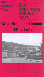
been taken from the Ordnance Survey mapping and reprinted at about 15 inches to one mile (1:4, 340). On the reverse most maps have historical notes and many also include extracts from contemporary directories. Most maps cover about one mile (1.6kms) north/south, one and a half miles (2.4kms) across; adjoining sheets can be combined to provide wider coverage.FOR MORE INFORMATION AND A COMPLETE LIST OF ALL AVAILABLE TITLES PLEASE CLICK ON THE SERIES LINK.
Other features include Brown Bayleys Steel Works, Hecla Works, Greenland Branch Steel Works, part of Tinsley Park Collieries, St Bartholomew`s church, Carbrook Saw Mills, Carbrook Park, South Yorkshire Iron Works, Carbrook Forge, Attercliffe Cemetery, Attercliffe Hill, Cyclops Works, Attercliffe Steel Works, Christ Church, Pagoda Works, St Thomas church, plus many streets of terraces close to the industrial premises. On the reverse is a selection of street directory entries, including Attercklioffe Common, Attrercliffe Road and Brightside Lane.About the Alan Godfrey Editions of the 25” OS Series:Selected towns in Great Britain and Ireland are covered by maps showing the extent of urban development in the last decades of the 19th and early 20th century. The plans have
been taken from the Ordnance Survey mapping and reprinted at about 15 inches to one mile (1:4, 340). On the reverse most maps have historical notes and many also include extracts from contemporary directories. Most maps cover about one mile (1.6kms) north/south, one and a half miles (2.4kms) across; adjoining sheets can be combined to provide wider coverage.FOR MORE INFORMATION AND A COMPLETE LIST OF ALL AVAILABLE TITLES PLEASE CLICK ON THE SERIES LINK.

Product Description
Reviews/Comments
Add New
Vouchers
No voucher codes found.
Do you know a voucher code for this product or supplier? Add it to Insights for others to use.
Do you know a voucher code for this product or supplier? Add it to Insights for others to use.
 Denmark