More From Contributor

£6.99
Bali with Nusa Penida at 1:250, 000 from Periplus, with a more detailed enlargement of south-eastern Bali, plus street plans of the island’s towns & popular tourist resorts, all highlighting accommodation & places of interest. Enlargements & street plans cover/provide:- the more populated south-eastern part of Bali at 1:100, 000 with street plans of Denpasar, the Kuta area with the international airport, Sanur, the Nusa Dua area, Semarapura, Gianyar, Candidasa, the Ubud area, Canggu & Kerobokan, plus Tabanan- four street plans of locations on the northern & north-eastern coast: Singaraja, Lovina Beach, Tulamben, plus Amed. The maps show the topography by bold altitude colouring & relief shading, with names of mountain ranges, etc. Road network emphasizes main routes but also

Includes::
selected local tracks. Ferry connections are also marked. No geographical coordinates are shown & none of the maps or street plans is indexed. All the panels highlight various places of interest, including beaches & diving sites. Street plans in addition show hotels. Map legend

Includes::
English; highlighted sights are named in English.


...
Archived Product
£7.99
Bali in the Encounter Guide Series from Lonely Planet, exploring a range of cities & regions worldwide in a handy, pocket-sized format designed to introduce visitors to the distinctive neighbourhoods of the destination. Frank & informal in style, the guides are renowned for their appeal to independent travellers & are written & researched by local authors. Each guide is organised into 5 distinct sections
- Highlights, Diary, Itineraries, Neighbourhoods & Snapshots
- recommending a series of essential encounters for visitors to the region. Each guide opens with a

...
Archived Product
£8.99
Bali in the Step by Step series by Insight Guides focuses on providing tailor made walks & tours around the country. The guide features sixteen route recommendations that link up better known sights & take you off of the more beaten track; they are written by local experts who have personally selected places to eat & drink en-route & who offer insider tips on culture, shopping & nightlife. The guide has an array of colour photographs which help bring to life the background & descriptive information provided for destinations & attractions. An overview chapter opens the guide & reviews geography, customs & culture, history, food & drink, shopping, culture & entertainment. Next feature the selected itineraries for walks and/or tours, each of which have a good amount of accompanying information & come with a simple route plan. A user friendly alphabetical directory lists practical information to do with day to day basics & listings of h&-picked hotels & restaurants are provided to suit different budgets & tastes. The publisher ...
Archived Product
£12.99
Finding your way around Bali has never been easier! This newly revised Street Atlas from Periplus, Asia`s leading book & map Publisher, is designed for Bali residents & visitors. It is the first & only atlas of Bali produced to world-class cartographic standards. All roads are color-coded with major arteries in bright yellow & orange. All key landmarks are highlighted
- including beaches, temples, hotels, shops, restaurants, shopping malls, consulates, government offices, hospitals, clinics, police stations, schools, parks, banks & golf courses.
...
Archived Product
£14.99
Bali with Nusa Penida at 1:145, 000 on a large map from Periplus with more names of smaller settlements than shown on other maps including the publishers’ tourist map of Bali, plus a vivid presentation of the island’s mountainous areas. Relief shading & altitude colouring used to present Bali’s topography is enhanced by graphic relief to highlight Mount Agung & other main peaks. The map shows the road network graded into six types, & indicates ferry connections. Also marked are administrative boundaries, & various places of interest are highlighted. Latitude & longitude lines are drawn at 10’ intervals. Map legend & names of tourist attractions are in English.PLEASE NOTE: although described by the publishers at “ Bali Wall Map” this title is supplied folded in a protective cover. ...
Archived Product
£8.99
Bali Postcard Colouring Book contains 20 postcards (format 10.5 x 15 cm) of superior 250gsm acid-free & age resistant drawing paper, printed with 20 exceptional designs in very light lines. The printing is done in such a way that, depending on the techniques used, the original outline will be hardly visible after colouring. The first-rate paper is made to our specifications by one of the best paper mills in Europe & is suitable for a wide range of colouring applications, including pencil, crayon, pastel, felt marker, gouache, etc. Also water-colours & liquid inks can be used. Pepin Postcard Colouring Books match the quality of the finest artists` pads. They are perfectly suited to practice your colouring skills & create beautiful pieces at the same time. For best results, we recommend high-quality colouring materials. ...
Archived Product
£12.00
Bali is unlike anywhere else. Despite the advent of international tourism, this Indonesian island remains an untarnished cultural gem set in an idyllic landscape. Spirit-haunted as is the rest of Southeast Asia, Bali boasts a unique amalgam of beliefs because Hinduism overlays a much older relationship with the physical world. Nothing is considered to be inanimate. Towering volcanoes, majestic lakes, lush forests, gushing springs, flooded paddies, golden sands & blue seas
- all these spectacular features have convinced the Balinese that their island is in itself a cosmos. Even though Bali suffered under the Japanese during World War Two, in the struggle afterwards to expel the Dutch, & through the violence which accompanied the military overthrow of President Sukarno, the resilience & kindness of its inhabitants ensure that no visitor leaves the island today unimpressed by its heritage. LAND OF TEMPLES: Besides an estimated 20, 000 temples, there are hundreds of thousands of shrines for the good reason that hardly anywhere is said to lack divine significance.FESTIVALS & DRAMA: So widespread are places of worship that every village & town possesses its own religious festival, an important part of which is dance-drama. Most popular is the story of the defeat of the chief witch Rangda by the good lion Barong, but the audience knows that she will be back again. ART & HANDICRAFTS: Because the Balinese believe that making beautiful objects is pleasing to the gods, artists & craftsmen are highly esteemed. On display along roadsides are their astounding works, which range from monumental sculpture to bright textiles.
...
Archived Product
£7.99
The Balkans at 1:1, 200, 000 on a double-sided map from the Bulgarian publishers Domino, showing the region’s road network in detail & presenting its geography with bright altitude colouring. Coverage with full detail

Includes::
Romania & Moldova; the whole of Hungary is also on the map but with information limited to larger towns & principal roads. The map shows a large number of small towns & villages & provides names of various mountain ranges, etc. Presentation of place names varies:
- in Bulgaria names of larger town are in both Cyrillic & Latin alphabet; names smaller towns & villages & of geographical features are in Cyrillic only- in all the remaining countries (including Serbia) names of larger towns are in both scripts, with smaller locations & geographical features in Latin alphabet only The map is not indexed & has latitude & longitude lines at intervals of 1°. Map legend

Includes::
English.


...
Archived Product
£10.99
The Balkans & South-Eastern Europe on a road map from Freytag & Berndt, covering a large chunk of the Continent from southern Poland & Kiev to the Mediterranean, & from Naples to Ankara. The map shows the area’s road network, indicating diving distances on principal routes & main border crossings. Railways & ferry routes are marked. In most countries internal administrative boundaries are also shown. In Greece, Bulgaria & Ukraine (but not Serbia) names of main cities are shown both in Latin alphabet & in Greek or Cyrillic. The map has a latitude & longitude grid at intervals of 1º. Multilingual map legend

Includes::
English.A booklet attached to the map cover contains an index, arranged by country, plus street plan of central Athens, Belgrade, Bratislava, Budapest, Bucharest, Chisinau, Istanbul, Kiev, Ljubljana, Podgorica, Prague, Pristina, Sarajevo, Skopje, Tirana, Vienna & Zagreb

...
Archived Product
£17.99
The Balkans at 1: 1, 948, 000 on a political wall map from the NGS, size 77 x 59.5cm (30” x 23.5” approx) – encapsulated version, presenting the region their characteristic classic style: countries with a light base & international boundaries picked out in colour & the seas in light blue. Coverage extends from the Adriatic to the Black Sea & from the northern borders of Hungary & Moldova to central Greece. Country names are in their English versions; city names are as used in their countries, accompanied where appropriate by the English equivalent (Beograd/ Belgrade). In Greece & the countries using the Cyrillic alphabet all place names are shown in the Latin alphabet. Within Hungary, Romania, & Bulgaria internal administrative boundaries are marked, accompanied by lists with names of provinces & their capital cities (not for Bulgaria). Within Serbia the map shows the boundary of Vojvodina & in Bosnia-Herzegovina Republika Srpska is marked. The map shows principal road, rail & ferry connections & main international airports. Topography is in indicated by light relief shading with names of main geographical features. Latitude & longitude lines are drawn at 1° intervals. Please note: this map is also available on paper without the encapsulation.LAMINATED & ENCAPSULATED WALL MAPS:- LAMINATED wall maps have a thin layer of plastic usually applied to the printed side only. They can be written on with suitable marker pens without any damage to the map but, unless laminated on both sides, they are not damp-proof.- ENCAPSULATED wall maps are sealed between two sheets of plastic. They are more rigid & heavier than laminated maps of the same size. They are damp-proof & do not crinkle in humid conditions. Encapsulation gives the map a shiny surface, similar to being displayed behind glass.- PLEASE NOTE: many publishers & retailers often use these two terms interchangeably. Our map titles & descriptions follow the definitions provided above. ...
Archived Product

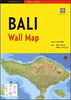
Bali, Java, In My Dreams

From ancient temples to the muddy streets of Jakarta, from the volcano to the mini-cab, Christine Jordis leads an intoxicating, sensual tour of Indonesia. Relying on atmosphere and sensation over fact and statistic, Christine Jordis has written a deeply personal, vividly impressionistic account of several journeys to the Indonesian islands of Bali and Java. Dazzled, wide-eyed, but always astute, Jordis describes famous monuments, native dances, encounters with locals. She conjures up the various literary and artistic figures who sought refuge and inspiration in Indonesia - Arthur Rimbaud, Herman Melville, Joseph Conrad - and brings ancient legends to life. She chronicles fascinating sociological observations and historical curiosities, but it is Jordis' sensual, emotional
responses to her surroundings that most distinguish Bali, Java, in my Dreams from the average East-meets-West travelogue. From the heart of the lush tropical forests, Jordis guides her readers through the technicolor paradise that makes Paris seem grey in comparison. Ultimately, it is these very colours that infuse her life - and her readers' lives - with new meaning.
RIP - This product is no longer available on our network. It was last seen on 25.09.2019

This page now acts as a permanent archive for this product. Add more information using the comments box below to ensure it can still be found by future generations.

Use our search facility to see if it is available from an alternative contributor.
  • External links may include paid for promotion
  • Availability: Out Of Stock
  • Supplier: Stanfords
  • SKU: 9781860469954
Availability: In Stock
£12.00

Product Description

From ancient temples to the muddy streets of Jakarta, from the volcano to the mini-cab, Christine Jordis leads an intoxicating, sensual tour of Indonesia. Relying on atmosphere & sensation over fact & statistic, Christine Jordis has written a deeply personal, vividly impressionistic account of several journeys to the Indonesian islands of Bali & Java. Dazzled, wide-eyed, but always astute, Jordis describes famous monuments, native dances, encounters with locals. She conjures up the various literary & artistic figures who sought refuge & inspiration in Indonesia
- Arthur Rimbaud, Herman Melville, Joseph Conrad
- & brings ancient legends to life. She chronicles fascinating sociological observations & historical curiosities, but it is Jordis' sensual, emotional responses to her surroundings that most distinguish Bali, Java, in my Dreams from the average East-meets-West travelogue. From the heart of the lush tropical forests, Jordis guides her readers through the technicolor paradise that makes Paris seem grey in comparison. Ultimately, it is these very colours that infuse her life
- & her readers' lives
- with new meaning.

Reviews/Comments

Add New

Intelligent Comparison

Oooops!
We couldn't find anything!
Perhaps this product's unique.... Or perhaps we are still looking for comparisons!
Click to bump this page and we'll hurry up.

Price History

Vouchers

No voucher codes found.
Do you know a voucher code for this product or supplier? Add it to Insights for others to use.

Facebook

Jargon Buster

Grey - A colour often associated with old age (going grey)
Heart - An organ that pumps blood around the body. Usually related to love.
Tropical - Coming fro the work "tropics" a hot and humid area of the world.
Wide - Something with a large width.
Personal - Something that belongs more to an individual due to it affecting them more by relating to them.

Supplier Information

Stanfords
Stanfords was established in 1853 and opened their iconic Covent Garden flagship store in 1901. They have become the top retailer of maps, travel books and accessories in the UK and arguably offer the largest selection of maps and travel books worldwide. Famous names such as Captain Robert Falcon Scott, Ranulph Fiennes and Michael Palin have purchased from Stanfords. They now have a shop in Bristol and both stores together with other venues operate a calendar of events including talks, book signings and exhibitions. As a specialist map retailer, the map selection is comprehensive and includes road maps, street maps and walking maps from worldwide destinations, as well as a selection of world atlases and wall maps. Books include travel guides and travel literature. Stanfords also stock globes, from miniatures made of blue marble to magnificent floor-standing globes. The website features a selection of interesting articles on travel topics.
Page Updated: 2023-11-12 20:15:36

Community Generated Product Tags

Oh No! The productWIKI community hasn't generated any tags for this product yet!
Menu