More From Contributor
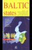
£9.95
Baltic Sea States from Freytag & Berndt: a large, double-sided map of the area surrounding the Baltic Sea, with an index & street plans of major cities. Very subtle relief shading & spot heights, plus names of mountain ranges, lake districts, forests & other natural features indicate the topography. Road network shows motorway facilities, border crossings, gradients, etc. The map also shows the rail network. National parks & places of interest are highlighted. A grid showing latitude & longitude is at intervals of 30 ...
Archived Product
£4.99
Baltic States at 1:770, 000 is an indexed map with additional street plans & enlargements of popular regions on the reverse. The publisher has chosen to concentrate on creating a map which will primarily be of use for a tourist navigating between main points of interest as opposed to stressing more detailed cartography. Motorways, national, main & minor roads are extremely clearly marked, as are airports, rail lines, ferry routes & lighthouses. National & regional boundaries are demarcated. Whilst many towns are shown on the main map, little else is highlighted for the visitor beyond a small selection of places of interest & the national parks. More concentration is given to providing useful tourist information on the individual street plans. Basic cartography is provided by some spot heights. Also included on the map are small charts for Tallinn, Riga & Vilnius which give average temperatures, levels of rainfall & hours of sunlight for each month, as well as calendars of events throughout the year, a table indicating distances between major towns in the region & the national flags of & very basic language tips for Latvia, Estonia & Lithuania. On the reverse of the map are street plans of Tallinn old town, Greater Tallinn, Riga, Vilnius old town, Kaunas, Klaipeda & Liepaja, as well as a local area road map for the greater Riga area. ...
Archived Product
£5.99
The Michelin National road map of the the Baltic States at 1:500, 000 scale is ideal for route planning & touring. The map gives comprehensive coverage of national road networks showing all major motorways, dual carriageways, national & regional main roads & some single-lane roads, as well as unsurfaced roads & those currently under construction. The map is divided by grid showing latitude & logitude. Distances between major locations are marked along roads, with total distance & several intermediate distances shown. A quick-reference chart of distances & driving times between major locations is also included. The map also

Includes::
a grid-referenced index of principal place names. Clear, easy-to read cartography shows roads in reds, yellows & white with black outlines. Woodland & forest is marked with green shading. Built-up urban areas are clearly marked in yellow. Airports & ferries are also marked. National & administrative divisions are marked, as are principal customs posts. City plan plans & regional enlargements:- Tallinn at 1:10, 000 scale.- Riga at 1:10, 000 scale.- Vinius at 1:10, 000 scale.

...
Archived Product
£9.95
The Baltic States; Estonia, Latvia & Lithuania at 1:800, 000 from Mair Dumont, with special features to aid navigation, street plans of the city centres in the three capital cities, & an extensive index listing localities with postcodes. Coverage included the Kaliningrad Oblast of Russia & extends to St. Petersburg, Minsk, Gdansk, Helsinki & Stockholm. Maps in the Mair Dumont ...
Archived Product
£9.50
Baltic States on an indexed, waterproof & tear-resistant road map of Estonia, Latvia & Lithuania, plus the Kaliningrad region of Russia, with topographic & tourist information. The map, published by Reise Know-How as part of their highly acclaimed World Mapping Project, is double-sided to provide the best balance between a good scale & a convenient size sheet. Road & rail networks are easy to see on a clear base which presents topography by altitude colouring with contours, spot heights, mountain passes & names of mountain ranges, & marshes. Road network

Includes::
local roads & tracks & gives driving distances on main & secondary roads. Ferry connections are also marked. Internal administrative boundaries are shown with names of the provinces. National parks & protected areas are marked & symbols highlight various places of interest, including campsites, UNESCO world heritage sites, archaeological remains, castles & churches, museums, viewpoints, beaches, etc. The map has a grid with latitude & longitude at intervals of 30

...
Archived Product
£9.99
Different types of roads are clearly marked & named. Petrol stations, hotels & campsites, airports, sea ports & checkpoints. Railways are shown. International borders & internal administrative boundaries are marked. Driving distances are marked on main roads. Multilingual Legend

Includes::
Engrish & Russian. No index.

...
Archived Product
£17.99
Road Atlas of the Baltic States: Estonia, Latvia & Lithuania, plus the Kaliningrad province of Russia in a handy size, 14x 24cm, paperback format, with a separate index for each country & street plans of over 50 towns. Detailed presentation of the region’s road network

Includes::
gravel roads & tracks, with locations of petrol stations, border crossings, & intermediate distances on main & secondary roads. Railway connections & ferry routes are marked. Local administrative divisions are shown with names of regions. Colouring & graphics show forested areas & swaps. National parks & other protected areas as well as picturesque locations are highlighted, & symbols mark other places of interest. Within the Kaliningrad region old pre-WWII German names are given for many locations. The maps have latitude & longitude lines at 15’ & 30’ respectively. Map legend

Includes::
English. Over 50 street plans, annotated with accommodation, places of interest & facilities including petrol stations, show through routes & main streets in towns within the whole region. For Tallinn, Riga, Vilnius & Kaunas more detailed street plans are provided for the city centre.


...
Archived Product
£14.99
Baltic States & the Kaliningradskaya Oblast showing present day & old German names for main towns in Estonia & Latvia, with more double names in Lithuania &, of course, in the Kaliningrad region of Russia. The map shows the regions road & rail networks, with border crossings to Russia, Belarus & Pol&. Locations of particular interest are highlighted. No geographical coordinates are provided. Map legend

Includes::
English. * Please note: many place names are in very small print, but the map comes with a magnifier lens attached to its cover.* An index attached to the map cover has list of both current & old names for locations in Estonia, Latvia & Lithuania. Kaliningrad Oblast is not included. Since coverage extends to St. Petersburg a small plan shows its historic centre.

...
Archived Product
£10.99
Double-sided, road map showing intermediate driving distances on many routes. Road detail

Includes::
secondary

...
Archived Product
£8.99
Baltic States in New Holland’s Globetrotter Travel Guide series, comprising a range of practical & accessible guides to a number of cities, regions & countries worldwide. Globetrotter guides incorporate essential information in an easy-to-carry & easy-to-reference format. They provide visitors with an introduction highlighting the country’s ‘must see’ areas, allowing readers to make the most of their time away. Presented in a paperback PVC format, each guide in the series provides vital tips for visitors &

Includes::
information on the best places to stay, eat & shop, star-rated top attractions, detailed regional profiles & recommendations of the best tours & excursions. Individual titles also have a separate, pull-out overview map in the rear pocket of the guide that serves as a companion to the book itself. An introductory section profiles the destination with details of the l&, a brief history, government & economy & the people. Every chapter is summarised in the ‘ At-a-Glance’ sections at the end of each chapter. There is also a Travel Tips section at the back of each guide providing practical guidance & information on tourist information services, entry requirements, customs, health requirements, getting there, what to pack, money matters, accommodation, transport, business hours, time difference, electricity, health precautions, useful phrases, personal safety, emergencies, etiquette & tipping.

...
Archived Product

Baltic States

Baltic States: Estonia, Latvia and Lithuania at 1:1, 200, 000 on an overview road map from the Tallinn based Regio, highlighting locations of petrol stations run by Statoil, with on the reverse enlargement of the three capitals.On one side is a road map of the three countries at 1:1, 200, 000 designed to show the network of principal and secondary roads. Border crossings are marked but no driving distances are indicated on any routes, also a separate distance table is provided. Locations of petrol stations run by Statoil are prominently highlighted. Latitude and longitude lines are drawn at intervals of 1
RIP - This product is no longer available on our network. It was last seen on 25.09.2019

This page now acts as a permanent archive for this product. Add more information using the comments box below to ensure it can still be found by future generations.

Use our search facility to see if it is available from an alternative contributor.
  • Availability: Out Of Stock
  • Supplier: Stanfords
  • SKU: 9789949465101
Availability: In Stock
£8.95

Product Description

Baltic States: Estonia, Latvia & Lithuania at 1:1, 200, 000 on an overview road map from the Tallinn based Regio, highlighting locations of petrol stations run by Statoil, with on the reverse enlargement of the three capitals. On one side is a road map of the three countries at 1:1, 200, 000 designed to show the network of principal & secondary roads. Border crossings are marked but no driving distances are indicated on any routes, also a separate distance table is provided. Locations of petrol stations run by Statoil are prominently highlighted. Latitude & longitude lines are drawn at intervals of 1

Reviews/Comments

Add New

Price History

Vouchers

No voucher codes found.
Do you know a voucher code for this product or supplier? Add it to Insights for others to use.

Facebook

Jargon Buster

Network - A link and communication between things. Often computers or people.
Road - a manmade lane or a path that is used to speed up travel.

Supplier Information

Stanfords
Stanfords was established in 1853 and opened their iconic Covent Garden flagship store in 1901. They have become the top retailer of maps, travel books and accessories in the UK and arguably offer the largest selection of maps and travel books worldwide. Famous names such as Captain Robert Falcon Scott, Ranulph Fiennes and Michael Palin have purchased from Stanfords. They now have a shop in Bristol and both stores together with other venues operate a calendar of events including talks, book signings and exhibitions. As a specialist map retailer, the map selection is comprehensive and includes road maps, street maps and walking maps from worldwide destinations, as well as a selection of world atlases and wall maps. Books include travel guides and travel literature. Stanfords also stock globes, from miniatures made of blue marble to magnificent floor-standing globes. The website features a selection of interesting articles on travel topics.
Page Updated: 2023-11-12 20:15:36

Community Generated Product Tags

Oh No! The productWIKI community hasn't generated any tags for this product yet!
Menu