More From Contributor

£9.50
Baltic States on an indexed, waterproof & tear-resistant road map of Estonia, Latvia & Lithuania, plus the Kaliningrad region of Russia, with topographic & tourist information. The map, published by Reise Know-How as part of their highly acclaimed World Mapping Project, is double-sided to provide the best balance between a good scale & a convenient size sheet. Road & rail networks are easy to see on a clear base which presents topography by altitude colouring with contours, spot heights, mountain passes & names of mountain ranges, & marshes. Road network

Includes::
local roads & tracks & gives driving distances on main & secondary roads. Ferry connections are also marked. Internal administrative boundaries are shown with names of the provinces. National parks & protected areas are marked & symbols highlight various places of interest, including campsites, UNESCO world heritage sites, archaeological remains, castles & churches, museums, viewpoints, beaches, etc. The map has a grid with latitude & longitude at intervals of 30

...
Archived Product
£8.95
Baltic States: Estonia, Latvia & Lithuania at 1:1, 200, 000 on an overview road map from the Tallinn based Regio, highlighting locations of petrol stations run by Statoil, with on the reverse enlargement of the three capitals. On one side is a road map of the three countries at 1:1, 200, 000 designed to show the network of principal & secondary roads. Border crossings are marked but no driving distances are indicated on any routes, also a separate distance table is provided. Locations of petrol stations run by Statoil are prominently highlighted. Latitude & longitude lines are drawn at intervals of 1 ...
Archived Product
£9.99
Different types of roads are clearly marked & named. Petrol stations, hotels & campsites, airports, sea ports & checkpoints. Railways are shown. International borders & internal administrative boundaries are marked. Driving distances are marked on main roads. Multilingual Legend

Includes::
Engrish & Russian. No index.

...
Archived Product
£17.99
Road Atlas of the Baltic States: Estonia, Latvia & Lithuania, plus the Kaliningrad province of Russia in a handy size, 14x 24cm, paperback format, with a separate index for each country & street plans of over 50 towns. Detailed presentation of the region’s road network

Includes::
gravel roads & tracks, with locations of petrol stations, border crossings, & intermediate distances on main & secondary roads. Railway connections & ferry routes are marked. Local administrative divisions are shown with names of regions. Colouring & graphics show forested areas & swaps. National parks & other protected areas as well as picturesque locations are highlighted, & symbols mark other places of interest. Within the Kaliningrad region old pre-WWII German names are given for many locations. The maps have latitude & longitude lines at 15’ & 30’ respectively. Map legend

Includes::
English. Over 50 street plans, annotated with accommodation, places of interest & facilities including petrol stations, show through routes & main streets in towns within the whole region. For Tallinn, Riga, Vilnius & Kaunas more detailed street plans are provided for the city centre.


...
Archived Product
£14.99
Baltic States & the Kaliningradskaya Oblast showing present day & old German names for main towns in Estonia & Latvia, with more double names in Lithuania &, of course, in the Kaliningrad region of Russia. The map shows the regions road & rail networks, with border crossings to Russia, Belarus & Pol&. Locations of particular interest are highlighted. No geographical coordinates are provided. Map legend

Includes::
English. * Please note: many place names are in very small print, but the map comes with a magnifier lens attached to its cover.* An index attached to the map cover has list of both current & old names for locations in Estonia, Latvia & Lithuania. Kaliningrad Oblast is not included. Since coverage extends to St. Petersburg a small plan shows its historic centre.

...
Archived Product
£8.99
Baltic States in New Holland’s Globetrotter Travel Guide series, comprising a range of practical & accessible guides to a number of cities, regions & countries worldwide. Globetrotter guides incorporate essential information in an easy-to-carry & easy-to-reference format. They provide visitors with an introduction highlighting the country’s ‘must see’ areas, allowing readers to make the most of their time away. Presented in a paperback PVC format, each guide in the series provides vital tips for visitors &

Includes::
information on the best places to stay, eat & shop, star-rated top attractions, detailed regional profiles & recommendations of the best tours & excursions. Individual titles also have a separate, pull-out overview map in the rear pocket of the guide that serves as a companion to the book itself. An introductory section profiles the destination with details of the l&, a brief history, government & economy & the people. Every chapter is summarised in the ‘ At-a-Glance’ sections at the end of each chapter. There is also a Travel Tips section at the back of each guide providing practical guidance & information on tourist information services, entry requirements, customs, health requirements, getting there, what to pack, money matters, accommodation, transport, business hours, time difference, electricity, health precautions, useful phrases, personal safety, emergencies, etiquette & tipping.

...
Archived Product
£9.99
Baltic States: Estonia, Latvia & Lithuania on an indexed, double-sided map at 1: 500, 000 from ITMB. Coverage of the northern side extends just beyond Riga; on the reverse is the rest of Latvia & Lithuania. The map shows the region’s road network with driving distances on main & selected local routes. Railway lines are included & ferry connections are marked. Topography is indicated by altitude colouring & graphics for national parks, & symbols show locations of various places of interest. ...
Archived Product
£5.99
The Michelin National road map of the the Baltic States at 1:500, 000 scale is ideal for route planning & touring. The map gives comprehensive coverage of national road networks showing all major motorways, dual carriageways, national & regional main roads & some single-lane roads, as well as unsurfaced roads & those currently under construction. The map is divided by grid showing latitude & logitude. Distances between major locations are marked along roads, with total distance & several intermediate distances shown. A quick-reference chart of distances & driving times between major locations is also included. The map also

Includes::
a grid-referenced index of principal place names. Clear, easy-to read cartography shows roads in reds, yellows & white with black outlines. Woodland & forest is marked with green shading. Built-up urban areas are clearly marked in yellow. Airports & ferries are also marked. National & administrative divisions are marked, as are principal customs posts. City plan plans & regional enlargements:- Tallinn at 1:10, 000 scale.- Riga at 1:10, 000 scale.- Vinius at 1:10, 000 scale.

...
Archived Product
£3.99
The Lonely Planet Baltic States Phrasebook is not only an extensive list of useful phrases, but also an ideal tool to start getting to grips with a language & beginning two-way communication. Containing excellent sections on language basics such as numbers, question phrases, dates, phrase construction, grammar & pronunciation, as well as containing concise but well-rounded two-way dictionaries, Lonely Planet phrasebooks enable you to quickly & confidently construct your own phrases in addition to those given. The given phrases cover all the essential travel & tourism categories such as transport, communications, business meetings & accommodation, as well as in-depth categories such as health, food & social interaction. The phrasebooks are designed to enable more than just simple question-answer communication, allowing the start of two-way conversations
- putting you comfortably on your way to learning the language & understanding its speakers. True to Lonely Planet
...
Archived Product
£26.99
Road atlas from the Tallinn-based Regio presenting the three Baltic States: Estonia, Latvia & Lithuania at 1:430, 000, highlighting in each country 10 best sights, plus enlargements for the environs & city centre maps of the three capitals, a route planning section, an extensive table of driving distances, etc. The atlas is folded to 15x 29cm but opens to double that size, 30x 29cm for each page. The main section has mapping at 1:430, 000 with detailed classification of the road network including local tracks, driving distances on main routes, & locations of petrol stations, border crossings & tourist information centres. Railway lines are shown with stations & local airports are marked. Landscape is indicated by colouring for woodlands & graphics for marshlands, plus boundaries of national parks & other protected areas. In each country 10 most interesting locations are prominently highlighted. The maps have latitude & longitude lines at 15’ & 30’ respectively. The atlas has an extensive index & also

Includes::
overview mapping for route planning at 1:1, 400, 000 indicating coverage by the pages in the main section, enlargements showing in greater detail the environs of Tallinn, Riga & Vilnius, city centre maps of the three capitals, a comprehensive distance table with 76 locations, contact details for tourist offices, plus a political map of the Baltic states with the neighbouring regions. Map legend & the text include English.

...
Archived Product

Baltic States F&B

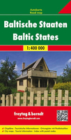
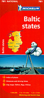
Double-sided, road map showing intermediate driving distances on many routes. Road detail includes secondary roads, and toll roads and scenic routes are highlighted. Other details: ferries & railways, symbols for airports, ports, major filling stations & service stations, telecommunications towers, monuments, castles, border crossings, campsites. Nature reserves are highlighted in green. Names are printed in Cyrillic text for the Russian territory on the map.Map legend includes English. Index booklet attached to map cover includes central stret plans for Tallin, Riga & Vilnius.
RIP - This product is no longer available on our network. It was last seen on 25.09.2019

This page now acts as a permanent archive for this product. Add more information using the comments box below to ensure it can still be found by future generations.

Use our search facility to see if it is available from an alternative contributor.
  • Availability: Out Of Stock
  • Supplier: Stanfords
  • SKU: 9783707905670
Availability: In Stock
£10.99

Product Description

Double-sided, road map showing intermediate driving distances on many routes. Road detail

Includes::
secondary roads, & toll roads & scenic routes are highlighted. Other

Details:
ferries & railways, symbols for airports, ports, major filling stations & service stations, telecommunications towers, monuments, castles, border crossings, campsites. Nature reserves are highlighted in green. Names are printed in Cyrillic text for the Russian territory on the map. Map legend

Includes::
English. Index booklet attached to map cover

Includes::
central stret plans for Tallin, Riga & Vilnius.

Reviews/Comments

Add New

Price History

Vouchers

No voucher codes found.
Do you know a voucher code for this product or supplier? Add it to Insights for others to use.

Facebook

Jargon Buster

Railways - A set of tracks that have been laid for the purpose of trains to travel up and down them
Road - a manmade lane or a path that is used to speed up travel.

Supplier Information

Stanfords
Stanfords was established in 1853 and opened their iconic Covent Garden flagship store in 1901. They have become the top retailer of maps, travel books and accessories in the UK and arguably offer the largest selection of maps and travel books worldwide. Famous names such as Captain Robert Falcon Scott, Ranulph Fiennes and Michael Palin have purchased from Stanfords. They now have a shop in Bristol and both stores together with other venues operate a calendar of events including talks, book signings and exhibitions. As a specialist map retailer, the map selection is comprehensive and includes road maps, street maps and walking maps from worldwide destinations, as well as a selection of world atlases and wall maps. Books include travel guides and travel literature. Stanfords also stock globes, from miniatures made of blue marble to magnificent floor-standing globes. The website features a selection of interesting articles on travel topics.
Page Updated: 2023-11-12 20:15:36

Community Generated Product Tags

Oh No! The productWIKI community hasn't generated any tags for this product yet!
Menu