More From Contributor

£4.99
A great number of monuments dating from the twelfth to the twentieth centuries can be seen in cathedrals & churches throughout Engl&, & they make up a valuable part of the country`s cultural heritage. Not only are they important as works of art, but they also throw light on many aspects of English history & life. Brian Kemp introduces the subject of English church monuments, detailing everything from matters of conservation & the making of monuments to historical developments, the changing forms & attitudes of effigies, & the symbolism of death & immortality. This title

Includes::
numerous illustrations & a list of places where interesting examples can be found.

...
Archived Product
£3.50
Church Stretton in 1901 in a fascinating series of reproductions of old Ordnance Survey plans in the Alan Godfrey Editions, ideal for anyone interested in the history of their neighbourhood or family. The map is double-sided.; the main map covers the southern half of the town, stretching from St Laurence`s church southward to the Brockhurst Castle site. Features include Stretton House, railway with station, Hydropathic Hotel, Market Hall, Ragleth Wood, Sandford Avenue (laid out but not yet built on.) On the reverse is part of the adjacent map 56.05 extending coverage northward to include Burway House, Ashbrook, Workhouse, part of Carding Mill Valley, Burway Hill, etc. About the Alan Godfrey Editions of the 25” OS Series: Selected towns in Great Britain & Ireland are covered by maps showing the extent of urban development in the last decades of the 19th & early 20th century. The plans have been taken from the Ordnance Survey mapping & reprinted at about 15 inches to one mile (1:4, 340). On the reverse most maps have historical notes & many also include extracts from contemporary directories. Most maps cover about one mile (1.6kms) north/south, one & a half miles (2.4kms) across; adjoining sheets can be combined to provide wider coverage.FOR MORE INFORMATION & A COMPLETE LIST OF ALL AVAILABLE TITLES PLEASE CLICK ON THE SERIES LINK. ...
Archived Product
£9.99
Map No. 137, Church Stretton & Ludlow / Llwydlo 1832-1836, in the Cassini Historical Series of old Ordnance Survey mapping of England & Wales at 1:50, 000 in a format designed to offer a convenient comparison with the present day coverage from the OS, & most locations in three different editions. Old historical maps have been combined so that the sheet lines correspond to the current Landranger series & reproduced with the scale changed from one inch to one mile to 1:50, 000. Most locations are covered by three separate maps, showing how the area has changed over the decades, with selected major cities also presented in a fourth edition. * Old Series: the first detailed survey mapping dating for most areas from the first half of the 19th century, in black & white & with relief shown by hachuring.* Revised New Series from 1880s/1900s, with some colouring & a mixture of hachuring & contour lines.* Popular Edition from the inter-war years, with contour lines & colouring to indicate woodlands, parks, etc.* New Popular Edition from the late 1940s, reproduced in the Cassini series for the major cities. Each map

Includes::
notes on the development of Ordnance Survey & the various series produced by them. For those interested in maps & cartography in general, the Cassini series also provides a fascinating insight into how Ordnance Survey cartographic style has developed over a period of over 100 years. Coverage in this title

Includes::
present day Bishop’s Castle, Knighton / Tref-y-Clawdd, Presteigne / Llanandras, Montgomery / Trefaldwyn, Chirburym Pennerley, Medicott, Norbury, Leebotwood, Hughley, Sarn, Pentre, Whittingslow, Holdgate, Churchtown, Lydbury North, Wistanstow, Munslow, Newcastle, Clunton, Craven Arms, Culmington, Clee St. Margaret, Dutlas, Clun, Clungunford, Onibury, Stanton Lacy, Lloyney, Pentre Hodre, Cleehill, Lloyney, Bucknell, Leintwardine, Caynham, Burrington, Wigmore, Brinfield, Tenbury Wells, Ashton, Kimbolton, Eyton, Mortimer’s Cross, Shobdon, New Radnor, Whitton Llangunilo & Lloyney, with The Long Mynd & the Wenlock Edge.* PLEASE NOTE: Stanfords can also print on request mapping from all four series *centring the map on a location of your choice.* For more information please click on the link below.


...
Archived Product
£14.99
Map No. 137, Church Stretton & Ludlow / Llwydlo 1832-1921 (3-map set), in the Cassini Historical Series of old Ordnance Survey mapping of England & Wales at 1:50, 000 in a format designed to offer a convenient comparison with the present day coverage from the OS, & most locations in three different editions. Old historical maps have been combined so that the sheet lines correspond to the current Landranger series & reproduced with the scale changed from one inch to one mile to 1:50, 000. Most locations are covered by three separate maps, showing how the area has changed over the decades, with selected major cities also presented in a fourth edition. Old Series: the first detailed survey mapping dating for most areas from the first half of the 19th century, in black & white & with relief shown by hachuring. Revised New Series from 1880s/1900s, with some colouring & a mixture of hachuring & contour lines. Popular Edition from the inter-war years, with contour lines & colouring to indicate woodlands, parks, etc. New Popular Edition from the late 1940s, reproduced in the Cassini series for the major cities. Each map

Includes::
notes on the development of Ordnance Survey & the various series produced by them. For those interested in maps & cartography in general, the Cassini series also provides a fascinating insight into how Ordnance Survey cartographic style has developed over a period of over 100 years. Coverage in this title

Includes::
present day Bishop


...
Archived Product
£9.99
Map No. 137, Church Stretton & Ludlow / Llwydlo 1901-1903, in the Cassini Historical Series of old Ordnance Survey mapping of England & Wales at 1:50, 000 in a format designed to offer a convenient comparison with the present day coverage from the OS, & most locations in three different editions. Old historical maps have been combined so that the sheet lines correspond to the current Landranger series & reproduced with the scale changed from one inch to one mile to 1:50, 000. Most locations are covered by three separate maps, showing how the area has changed over the decades, with selected major cities also presented in a fourth edition. * Old Series: the first detailed survey mapping dating for most areas from the first half of the 19th century, in black & white & with relief shown by hachuring.* Revised New Series from 1880s/1900s, with some colouring & a mixture of hachuring & contour lines.* Popular Edition from the inter-war years, with contour lines & colouring to indicate woodlands, parks, etc.* New Popular Edition from the late 1940s, reproduced in the Cassini series for the major cities. Each map

Includes::
notes on the development of Ordnance Survey & the various series produced by them. For those interested in maps & cartography in general, the Cassini series also provides a fascinating insight into how Ordnance Survey cartographic style has developed over a period of over 100 years. Coverage in this title

Includes::
present day Bishop’s Castle, Knighton / Tref-y-Clawdd, Presteigne / Llanandras, Montgomery / Trefaldwyn, Chirburym Pennerley, Medicott, Norbury, Leebotwood, Hughley, Sarn, Pentre, Whittingslow, Holdgate, Churchtown, Lydbury North, Wistanstow, Munslow, Newcastle, Clunton, Craven Arms, Culmington, Clee St. Margaret, Dutlas, Clun, Clungunford, Onibury, Stanton Lacy, Lloyney, Pentre Hodre, Cleehill, Lloyney, Bucknell, Leintwardine, Caynham, Burrington, Wigmore, Brinfield, Tenbury Wells, Ashton, Kimbolton, Eyton, Mortimer’s Cross, Shobdon, New Radnor, Whitton Llangunilo & Lloyney, with The Long Mynd & the Wenlock Edge.* PLEASE NOTE: Stanfords can also print on request mapping from all four series *centring the map on a location of your choice.* For more information please click on the link below.


...
Archived Product
£3.50
Church Stretton & Wenlock Edge in 1906 in a series of reproductions of Ordnance Survey’s famous ” Inch to the Mile” maps published in the Alan Godfrey Editions to provide a historical record of England & Wales in the second half of 19th & early 20th century. In this title coverage stretches from Ratlinghope & the Longmynd eastward to Morville Hall, Aston Eyre & Upton Cressett; & from All Stretton southward to Clungunford & Onibury. A long stretch of Wenlock Edge runs diagonally across much of the map, with Brown Clee Hill & Caer Caradoc Hill other much loved landmarks. Other locations covered by the map include Abdon, Acton Scott, All Stretton, Aston Botterell, Burwarton, Cardington, Chetton, Church Stretton, Clee St Margaret, Cleobury North, Cold Weston, Craven Arms, Culmington, Diddlebury, Ditton Priors, Easthope, Farlow, Halford, Heath, Holdgate, Hope Bowdler, Hopesay, Hopton Cangeford, Little Stretton, Loughton, Monkhopton, Munslow, Myndtown, Neenton, Rushbury, Sibdon Carwood, Silvington, Stanton Lacy, Stanton Long, Stoke St Milborough, Stokesay, Tugford, Wentnor & Wheathill. On the reverse is a detailed map of Wistanstow. About the Alan Godfrey Editions of the OS Inch to the Mile Maps: the maps provide an invaluable overview of a wider area, typically 18 x 12 miles (29 x 19 kms approx.), & offer historical mapping for small towns & villages not covered by the more detailed series for which the Godfrey Editions are better known. On the reverse all the maps have historical notes & most titles also include a more detailed, large scale map of a small town or a village in the area. To see other titles in this series please click on the series link. ...
Archived Product
£8.99
Church Stretton, Ludlow, Wenlock Edge, Long Mynd & the area westwards to Montgomery, Knighton & Presteigne including a section of the Offa’s Dyke Path National Trail on a paper version of map No. 137 from the Ordnance Survey’s Landranger series at 1:50, 000, with contoured & GPS compatible topographic mapping plus tourist information.MOBILE DOWNLOADS: As well as the physical edition of the map, each Landranger title now

Includes::
a code for downloading after purchase its digital version onto your smartphone or tablet for viewing on the OS smartphone app.OS LANDRANGER SERIES: to see the list of all the titles in the OS Landranger series, both paper & waterproof versions, please click on the series link. Maps in the Landranger series provide plenty of recreational & tourist information, indicating the traditional public right of way paths (except in Scotland where different laws apply), including bridleways & byways restricted or open to motorized traffic. National Trails & selected other long-distance paths are marked, as well as on-road & traffic-free cycle routes with their National/ Regional Cycle Network numbers. National Trust/ National Trust for Scotland & Forestry Commission land is clearly marked, indicating open or restricted access. A range of symbols highlights camping & caravanning sites, youth hostels, tourist information offices & visitors’ centres, parking & picnicking places, World Heritage sites, sport & recreational facilities, etc. The maps provide detailed presentation of topography with contours at 10m intervals, numerous spot heights & additional colouring and/or graphics for different types of woodlands, orchards or parkl&, rock features including scree & cliffs, water features inland & along the sea shore with marshl&, dunes, s&, mud, shingle & the high water mark. All the standard information expected of survey mapping at this scale is included: finely graded road network, railway lines with stations, cuttings, embankments, etc; individual isolated buildings; archaeological & historical sites, etc. For GPS users the British National Grid is shown at 1km intervals, with latitude & longitude given by margin ticks at 1` & cross hairs on the map at 5`. Each map covers an area of 40 x 40km, (approx. 25 x 25 miles).

...
Archived Product
£14.99
Church Stretton, Ludlow, Wenlock Edge, Long Mynd & the area westwards to Montgomery, Knighton & Presteigne including a section of the Offa’s Dyke Path National Trail on a waterproof & tear-resistant OS Active version of map No. 137 from the Ordnance Survey’s Landranger series at 1:50, 000, with contoured & GPS compatible topographic mapping plus tourist information.MOBILE DOWNLOADS: As well as the physical edition of the map, each Landranger title now

Includes::
a code for downloading after purchase its digital version onto your smartphone or tablet for viewing on the OS smartphone app.OS LANDRANGER SERIES: to see the list of all the titles in the OS Landranger series, both paper & waterproof versions, please click on the series link. Maps in the Landranger series provide plenty of recreational & tourist information, indicating the traditional public right of way paths (except in Scotland where different laws apply), including bridleways & byways restricted or open to motorized traffic. National Trails & selected other long-distance paths are marked, as well as on-road & traffic-free cycle routes with their National/ Regional Cycle Network numbers. National Trust/ National Trust for Scotland & Forestry Commission land is clearly marked, indicating open or restricted access. A range of symbols highlights camping & caravanning sites, youth hostels, tourist information offices & visitors’ centres, parking & picnicking places, World Heritage sites, sport & recreational facilities, etc. The maps provide detailed presentation of topography with contours at 10m intervals, numerous spot heights & additional colouring and/or graphics for different types of woodlands, orchards or parkl&, rock features including scree & cliffs, water features inland & along the sea shore with marshl&, dunes, s&, mud, shingle & the high water mark. All the standard information expected of survey mapping at this scale is included: finely graded road network, railway lines with stations, cuttings, embankments, etc; individual isolated buildings; archaeological & historical sites, etc. For GPS users the British National Grid is shown at 1km intervals, with latitude & longitude given by margin ticks at 1` & cross hairs on the map at 5`. Each map covers an area of 40 x 40km, (approx. 25 x 25 miles).

...
Archived Product
£19.99
This guide represents 340 churches & monasteries in Macedonia, texts about their history, over 900 photographs & their location on the maps. The guide also contains information about Christianity in Macedonia, the heads & metropolitans of the Macedonian Orthodox Church as well as its history, symbols & concepts. This is a must-have guide: you will feel the soul of the old monasteries & churches during the centuries; you will see their beauty & experience their peace & tranquillity. As never before, a collection of churches & monasteries in Macedonia with abundant photographs & information. ...
Archived Product
£35.00
Rome
- imperial city, fountain-head of the Christian world & site of some of the world`s most amazing ecclesiastical architecture.
...
Archived Product

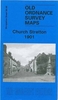
Church Stretton And Ludlow / Llwydlo 1920-1921

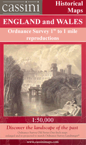
Map No. 137, Church Stretton and Ludlow / Llwydlo 1920-1921, in the Cassini Historical Series of old Ordnance Survey mapping of England and Wales at 1:50, 000 in a format designed to offer a convenient comparison with the present day coverage from the OS, and most locations in three different editions. Old historical maps have been combined so that the sheet lines correspond to the current Landranger series and reproduced with the scale changed from one inch to one mile to 1:50, 000. Most locations are covered by three separate maps, showing how the area has changed over the decades, with selected major cities also presented in a fourth edition. * Old Series: the first detailed survey mapping dating for most areas from the first half of the 19th century, in black and white and with
relief shown by hachuring.* Revised New Series from 1880s/1900s, with some colouring and a mixture of hachuring and contour lines.* Popular Edition from the inter-war years, with contour lines and colouring to indicate woodlands, parks, etc.* New Popular Edition from the late 1940s, reproduced in the Cassini series for the major cities.Each map includes notes on the development of Ordnance Survey and the various series produced by them. For those interested in maps and cartography in general, the Cassini series also provides a fascinating insight into how Ordnance Survey cartographic style has developed over a period of over 100 years.Coverage in this title includes present day Bishop’s Castle, Knighton / Tref-y-Clawdd, Presteigne / Llanandras, Montgomery / Trefaldwyn,
Chirburym Pennerley, Medicott, Norbury, Leebotwood, Hughley, Sarn, Pentre, Whittingslow, Holdgate, Churchtown, Lydbury North, Wistanstow, Munslow, Newcastle, Clunton, Craven Arms, Culmington, Clee St. Margaret, Dutlas, Clun, Clungunford, Onibury, Stanton Lacy, Lloyney, Pentre Hodre, Cleehill, Lloyney, Bucknell, Leintwardine, Caynham, Burrington, Wigmore, Brinfield, Tenbury Wells, Ashton, Kimbolton, Eyton, Mortimer’s Cross, Shobdon, New Radnor, Whitton Llangunilo and Lloyney, with The Long Mynd and the Wenlock Edge.* PLEASE NOTE: Stanfords can also print on request mapping from all four series *centring the map on a location of your choice.* For more information please click on the link below.
RIP - This product is no longer available on our network. It was last seen on 25.09.2019

This page now acts as a permanent archive for this product. Add more information using the comments box below to ensure it can still be found by future generations.

Use our search facility to see if it is available from an alternative contributor.
  • External links may include paid for promotion
  • Availability: Out Of Stock
  • Supplier: Stanfords
  • SKU: 9781847361844
Availability: In Stock
£9.99

Product Description

Map No. 137, Church Stretton & Ludlow / Llwydlo 1920-1921, in the Cassini Historical Series of old Ordnance Survey mapping of England & Wales at 1:50, 000 in a format designed to offer a convenient comparison with the present day coverage from the OS, & most locations in three different editions. Old historical maps have been combined so that the sheet lines correspond to the current Landranger series & reproduced with the scale changed from one inch to one mile to 1:50, 000. Most locations are covered by three separate maps, showing how the area has changed over the decades, with selected major cities also presented in a fourth edition. * Old Series: the first detailed survey mapping dating for most areas from the first half of the 19th century, in black & white & with relief shown by hachuring.* Revised New Series from 1880s/1900s, with some colouring & a mixture of hachuring & contour lines.* Popular Edition from the inter-war years, with contour lines & colouring to indicate woodlands, parks, etc.* New Popular Edition from the late 1940s, reproduced in the Cassini series for the major cities. Each map

Includes::
notes on the development of Ordnance Survey & the various series produced by them. For those interested in maps & cartography in general, the Cassini series also provides a fascinating insight into how Ordnance Survey cartographic style has developed over a period of over 100 years. Coverage in this title

Includes::
present day Bishop’s Castle, Knighton / Tref-y-Clawdd, Presteigne / Llanandras, Montgomery / Trefaldwyn, Chirburym Pennerley, Medicott, Norbury, Leebotwood, Hughley, Sarn, Pentre, Whittingslow, Holdgate, Churchtown, Lydbury North, Wistanstow, Munslow, Newcastle, Clunton, Craven Arms, Culmington, Clee St. Margaret, Dutlas, Clun, Clungunford, Onibury, Stanton Lacy, Lloyney, Pentre Hodre, Cleehill, Lloyney, Bucknell, Leintwardine, Caynham, Burrington, Wigmore, Brinfield, Tenbury Wells, Ashton, Kimbolton, Eyton, Mortimer’s Cross, Shobdon, New Radnor, Whitton Llangunilo & Lloyney, with The Long Mynd & the Wenlock Edge.* PLEASE NOTE: Stanfords can also print on request mapping from all four series *centring the map on a location of your choice.* For more information please click on the link below.

Reviews/Comments

Add New

Price History

Vouchers

No voucher codes found.
Do you know a voucher code for this product or supplier? Add it to Insights for others to use.

Facebook

Jargon Buster

Black - A colour which does not emit any colour of the spectrum. Black absorbs all frequencies of the spectrum.
Inch - Equivalent to approximately 2.5cm
White - A colour combining all colours
England - A country within the United Kingdom.
edge - Enhanced data rates for GSM evolution also known as enhanced GPRS. A mobile phone technology with improved data transmission rates.
edge - The point at which two surfaces meet
Day - The time it takes a planet or other space objects to complete one rotation.
Popular - Something that is admired and liked by many people.
Print - A mechanical process of putting text onto paper. It can also relate to a pattern on an item.
Convenient - Something that suits and fits well to other activities.

Supplier Information

Stanfords
Stanfords was established in 1853 and opened their iconic Covent Garden flagship store in 1901. They have become the top retailer of maps, travel books and accessories in the UK and arguably offer the largest selection of maps and travel books worldwide. Famous names such as Captain Robert Falcon Scott, Ranulph Fiennes and Michael Palin have purchased from Stanfords. They now have a shop in Bristol and both stores together with other venues operate a calendar of events including talks, book signings and exhibitions. As a specialist map retailer, the map selection is comprehensive and includes road maps, street maps and walking maps from worldwide destinations, as well as a selection of world atlases and wall maps. Books include travel guides and travel literature. Stanfords also stock globes, from miniatures made of blue marble to magnificent floor-standing globes. The website features a selection of interesting articles on travel topics.
Page Updated: 2023-11-12 20:15:36

Community Generated Product Tags

Oh No! The productWIKI community hasn't generated any tags for this product yet!
Menu