
 United Kingdom
 France
 Germany
 Netherlands
 Sweden
 USA
USA
 Italy
Italy
 Spain
Spain
More From Contributor
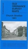


Church Stretton And Wenlock Edge 1906
Church Stretton and Wenlock Edge in 1906 in a series of reproductions of Ordnance Survey’s famous ”Inch to the Mile” maps published in the Alan Godfrey Editions to provide a historical record of England and Wales in the second half of 19th and early 20th century.In this title coverage stretches from Ratlinghope and the Longmynd eastward to Morville Hall, Aston Eyre and Upton Cressett; and from All Stretton southward to Clungunford and Onibury. A long stretch of Wenlock Edge runs diagonally across much of the map, with Brown Clee Hill and Caer Caradoc Hill other much loved landmarks. Other locations covered by the map include Abdon, Acton Scott, All Stretton, Aston Botterell, Burwarton, Cardington, Chetton, Church Stretton, Clee St Margaret, Cleobury North, Cold Weston,
Craven Arms, Culmington, Diddlebury, Ditton Priors, Easthope, Farlow, Halford, Heath, Holdgate, Hope Bowdler, Hopesay, Hopton Cangeford, Little Stretton, Loughton, Monkhopton, Munslow, Myndtown, Neenton, Rushbury, Sibdon Carwood, Silvington, Stanton Lacy, Stanton Long, Stoke St Milborough, Stokesay, Tugford, Wentnor and Wheathill. On the reverse is a detailed map of Wistanstow.About the Alan Godfrey Editions of the OS Inch to the Mile Maps: the maps provide an invaluable overview of a wider area, typically 18 x 12 miles (29 x 19 kms approx.), and offer historical mapping for small towns and villages not covered by the more detailed series for which the Godfrey Editions are better known. On the reverse all the maps have historical notes and most titles also
include a more detailed, large scale map of a small town or a village in the area.To see other titles in this series please click on the series link.
Product Description
Reviews/Comments
Add New
Vouchers
No voucher codes found.
Do you know a voucher code for this product or supplier? Add it to Insights for others to use.
Do you know a voucher code for this product or supplier? Add it to Insights for others to use.
 Denmark