More From Contributor

£5.99
The Essential Film Companion for ALBUS DUMBLEDORE! Albus Dumbledore founded the Order of the Phoenix, guided Harry Potter through his hunt for Horcruxes, & was known as the only wizard the Dark Lord, Voldemort, ever feared. This treasured collection of photographs, "es & memories from all eight HARRY POTTER films celebrates the moments that made Professor Albus Dumbledore an extraordinary wizard & one of the greatest headmasters ever to teach at Hogwarts School of Witchcraft & Wizardry. ...
Archived Product
£5.99
The Essential Film Companion for HARRY POTTER! On his eleventh birthday, Harry Potter received the best gift he could possibly imagine: learning he is a wizard who`s been invited to attend Hogwarts School of Witchcraft & Wizardry! Relive Harry`s thrilling adventure through all eight HARRY POTTER films: from his first trip to Diagon Alley to his epic battles with the Dark Lord, Voldemort. Packed with memorable"es & photos, this book has everything you need to know about the Boy Who Lived. ...
Archived Product
£5.99
The Essential Film Companion for HERMIONE GRANGER! Hermione Granger hardly ever breaks the rules
- unless, of course, she needs
...
Archived Product
£5.99
The Essential Film Companion for RON WEASLEY! Relive the magical moments when Ron Weasley proved just as courageous & loyal as his famous best friend, Harry Potter
- whether he was facing the Slytherin Quidditch team or a forest of scary giant spiders! This collection of photographs "es from all eight HARRY POTTER films takes a closer look at Ron`s life, including his time at Hogwarts, family & friends & dangerous battles against the Dark Lord, Voldemort.
...
Archived Product
£9.50
Topographical survey of Belgium at 1:20, 000 from Nationaal Geografisch Instituut / Institut Géographique National, the country’s national survey organization. Each 20K map covers one quarter of the corresponding 1:50, 000 map (with adjustments in the border & coastal areas). The maps provide all the information expected of topographic mapping at this scale & in addition have an unusually large amount of vegetation and/or land use information (different types of woodlands, gardens, orchards, heath, etc). The maps have a 1-km UTM grid, with margin ticks for latitude & longitude at intervals of 1`. Map legend & a glossary of terms used on the maps include English. Stanfords keeps as regular stock 20K maps for the World War I battlefields around the Ypres, Messines & Passchendaele, & for the area of the Battle of Waterloo. The 1:20, 000 survey covers the whole of Belgium & maps for other regions can be supplied as special orders. To see the list of titles in this series please click on the series link.PLEASE NOTE: the Long-Distance Footpaths Map of Belgium at 1:300, 000 which shows the division of Belgium into the 50K survey sheets can also be used to see in more detail coverage by the 20K maps. ...
Archived Product
£7.99
STEP INTO THE DREAMLIKE CITY OF MARRAKECH Where passionate music, magic potions & the drama of Africa are cooled by the intuitive genius of Arabic culture. Miranda Innes & her partner were lured into buying a beautiful long-neglected riad in the heart of this pink-walled city. Only after they`d begun their restoration work did they find that nothing in this place of smoke & mirrors was quite what it seemed. In Cinnamon City Miranda Innes takes you beyond the tourist track, behind the bolted doors & deep inside the romance that is Marrakech. With lyrical & evocative descriptions of the swirling colours, flavours & aromas, this glorious book will open your eyes to this most exotic of North African cities. ...
Archived Product
£10.50
Map No. 644, Cinque Terre, from Kompass printed on sturdy waterproof & tear-resistant plastic paper in a series of walking maps of selected areas of Italy at 1:50, 000, with hiking routes on a topographic base, various types of accommodation, recreational facilities, places of interest, etc. This title is printed on sturdy waterproof & tear-resistant plastic &

Includes::
basic street plans of Levanto, Monterosso al Mare, Vernazza, Corniglia, Manarola, Riomaggiore & Portovenere highlighting the towns

...
Archived Product
£12.99
If you enjoyed Sunflower's best-selling guide to Sorrento & the Amalfi Coast, you're sure to love the Cinque Terre & Riviera di Levante
-
...
Archived Product
£13.99
Cinque Terre
- Golfo del Tigullio area of the Italian Riviera from genoa to la Spezia including Sestri Levante & Rapallo in a series
...
Archived Product
£12.99
1:25, 000 scale hiking map to Cinque Terre including Bonassola, Vernazza, Porto Venere & Lerici. Published in association with the CAI, the Italian Alpine Club, who are responsible for the trails. Trails are marked on the map. The key information & more detailed information on the rear of the sheet are in Italian, German & English. Printed on waterproof, tear-proof paper. ...
Archived Product

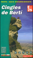
Cingles De Berti Editorial Alpina

Cingles de Berti area at 1:25, 000 in an extensive and very popular series of walking maps from Editorial Alpina. Contours are at 10m intervals, enhanced by relief shading and vegetation colouring. The map has UTM grid and 1’ margin ticks. In addition to footpaths, the overprint shows various types of accommodation (hotels, campsites, etc.), information centres, places of interest, climbing centres, mountain bike routes, locations of petrol stations on local roads, etc. Map legend includes English. The booklet with descriptions of the area and the various routes is in Catalan only.Maps in the Editorial Alpina hiking series cover the Pyrenees, Catalonia and other selected hiking areas in Spain, including Picos de Europa, Sierra Nevada and parts of Andalucía, Majorca, etc.
Scales vary from 1:50, 000 to 1:10, 000, with the majority of the titles at 1:25, 000. The maps have contours, usually at 20m or 10m intervals, with additional hill shading and spot heights. An overprint highlights hiking trails, long-distance footpaths, campsites, mountain huts, refuges, etc. Many maps also show climbing sites, potholing caves, mountain bike routes, equestrian and ski centres. All the latest editions have a UTM grid, plus margin ticks for latitude and longitude at intervals of 1’. Map legend in most titles includes English. Each title has a separate booklet with general information on the area, descriptions of selected hiking routes, a list of accommodation with addresses, etc. In several titles the booklet now includes English.For the complete list of
all the titles in this series please click on the series link.
RIP - This product is no longer available on our network. It was last seen on 25.09.2019

This page now acts as a permanent archive for this product. Add more information using the comments box below to ensure it can still be found by future generations.

Use our search facility to see if it is available from an alternative contributor.
  • External links may include paid for promotion
  • Availability: Out Of Stock
  • Supplier: Stanfords
  • SKU: 9788480904988
Availability: In Stock
£13.99

Product Description

Cingles de Berti area at 1:25, 000 in an extensive & very popular series of walking maps from Editorial Alpina. Contours are at 10m intervals, enhanced by relief shading & vegetation colouring. The map has UTM grid & 1’ margin ticks. In addition to footpaths, the overprint shows various types of accommodation (hotels, campsites, etc.), information centres, places of interest, climbing centres, mountain bike routes, locations of petrol stations on local roads, etc. Map legend

Includes::
English. The booklet with descriptions of the area & the various routes is in Catalan only. Maps in the Editorial Alpina hiking series cover the Pyrenees, Catalonia & other selected hiking areas in Spain, including Picos de Europa, Sierra Nevada & parts of Andalucía, Majorca, etc. Scales vary from 1:50, 000 to 1:10, 000, with the majority of the titles at 1:25, 000. The maps have contours, usually at 20m or 10m intervals, with additional hill shading & spot heights. An overprint highlights hiking trails, long-distance footpaths, campsites, mountain huts, refuges, etc. Many maps also show climbing sites, potholing caves, mountain bike routes, equestrian & ski centres. All the latest editions have a UTM grid, plus margin ticks for latitude & longitude at intervals of 1’. Map legend in most titles

Includes::
English. Each title has a separate booklet with general information on the area, descriptions of selected hiking routes, a list of accommodation with addresses, etc. In several titles the booklet now

Includes::
English. For the complete list of all the titles in this series please click on the series link.

Reviews/Comments

Add New

Intelligent Comparison

Oooops!
We couldn't find anything!
Perhaps this product's unique.... Or perhaps we are still looking for comparisons!
Click to bump this page and we'll hurry up.

Price History

Vouchers

No voucher codes found.
Do you know a voucher code for this product or supplier? Add it to Insights for others to use.

Facebook

Jargon Buster

Hiking - An outdoor activity envolving walking in nature
Spain - A country within the EU.
Accommodation - A room in which someone can live in, for example in a hotel
Popular - Something that is admired and liked by many people.

Supplier Information

Stanfords
Stanfords was established in 1853 and opened their iconic Covent Garden flagship store in 1901. They have become the top retailer of maps, travel books and accessories in the UK and arguably offer the largest selection of maps and travel books worldwide. Famous names such as Captain Robert Falcon Scott, Ranulph Fiennes and Michael Palin have purchased from Stanfords. They now have a shop in Bristol and both stores together with other venues operate a calendar of events including talks, book signings and exhibitions. As a specialist map retailer, the map selection is comprehensive and includes road maps, street maps and walking maps from worldwide destinations, as well as a selection of world atlases and wall maps. Books include travel guides and travel literature. Stanfords also stock globes, from miniatures made of blue marble to magnificent floor-standing globes. The website features a selection of interesting articles on travel topics.
Page Updated: 2023-11-12 20:15:36

Community Generated Product Tags

Oh No! The productWIKI community hasn't generated any tags for this product yet!
Menu