More From Contributor
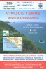
£5.99
The Essential Film Companion for RON WEASLEY! Relive the magical moments when Ron Weasley proved just as courageous & loyal as his famous best friend, Harry Potter
- whether he was facing the Slytherin Quidditch team or a forest of scary giant spiders! This collection of photographs "es from all eight HARRY POTTER films takes a closer look at Ron`s life, including his time at Hogwarts, family & friends & dangerous battles against the Dark Lord, Voldemort.
...
Archived Product
£9.50
Topographical survey of Belgium at 1:20, 000 from Nationaal Geografisch Instituut / Institut Géographique National, the country’s national survey organization. Each 20K map covers one quarter of the corresponding 1:50, 000 map (with adjustments in the border & coastal areas). The maps provide all the information expected of topographic mapping at this scale & in addition have an unusually large amount of vegetation and/or land use information (different types of woodlands, gardens, orchards, heath, etc). The maps have a 1-km UTM grid, with margin ticks for latitude & longitude at intervals of 1`. Map legend & a glossary of terms used on the maps include English. Stanfords keeps as regular stock 20K maps for the World War I battlefields around the Ypres, Messines & Passchendaele, & for the area of the Battle of Waterloo. The 1:20, 000 survey covers the whole of Belgium & maps for other regions can be supplied as special orders. To see the list of titles in this series please click on the series link.PLEASE NOTE: the Long-Distance Footpaths Map of Belgium at 1:300, 000 which shows the division of Belgium into the 50K survey sheets can also be used to see in more detail coverage by the 20K maps. ...
Archived Product
£13.99
Cingles de Berti area at 1:25, 000 in an extensive & very popular series of walking maps from Editorial Alpina. Contours are at 10m intervals, enhanced by relief shading & vegetation colouring. The map has UTM grid & 1’ margin ticks. In addition to footpaths, the overprint shows various types of accommodation (hotels, campsites, etc.), information centres, places of interest, climbing centres, mountain bike routes, locations of petrol stations on local roads, etc. Map legend

Includes::
English. The booklet with descriptions of the area & the various routes is in Catalan only. Maps in the Editorial Alpina hiking series cover the Pyrenees, Catalonia & other selected hiking areas in Spain, including Picos de Europa, Sierra Nevada & parts of Andalucía, Majorca, etc. Scales vary from 1:50, 000 to 1:10, 000, with the majority of the titles at 1:25, 000. The maps have contours, usually at 20m or 10m intervals, with additional hill shading & spot heights. An overprint highlights hiking trails, long-distance footpaths, campsites, mountain huts, refuges, etc. Many maps also show climbing sites, potholing caves, mountain bike routes, equestrian & ski centres. All the latest editions have a UTM grid, plus margin ticks for latitude & longitude at intervals of 1’. Map legend in most titles

Includes::
English. Each title has a separate booklet with general information on the area, descriptions of selected hiking routes, a list of accommodation with addresses, etc. In several titles the booklet now

Includes::
English. For the complete list of all the titles in this series please click on the series link.


...
Archived Product
£7.99
STEP INTO THE DREAMLIKE CITY OF MARRAKECH Where passionate music, magic potions & the drama of Africa are cooled by the intuitive genius of Arabic culture. Miranda Innes & her partner were lured into buying a beautiful long-neglected riad in the heart of this pink-walled city. Only after they`d begun their restoration work did they find that nothing in this place of smoke & mirrors was quite what it seemed. In Cinnamon City Miranda Innes takes you beyond the tourist track, behind the bolted doors & deep inside the romance that is Marrakech. With lyrical & evocative descriptions of the swirling colours, flavours & aromas, this glorious book will open your eyes to this most exotic of North African cities. ...
Archived Product
£10.50
Map No. 644, Cinque Terre, from Kompass printed on sturdy waterproof & tear-resistant plastic paper in a series of walking maps of selected areas of Italy at 1:50, 000, with hiking routes on a topographic base, various types of accommodation, recreational facilities, places of interest, etc. This title is printed on sturdy waterproof & tear-resistant plastic &

Includes::
basic street plans of Levanto, Monterosso al Mare, Vernazza, Corniglia, Manarola, Riomaggiore & Portovenere highlighting the towns

...
Archived Product
£13.99
Cinque Terre
- Golfo del Tigullio area of the Italian Riviera from genoa to la Spezia including Sestri Levante & Rapallo in a series
...
Archived Product
£12.99
1:25, 000 scale hiking map to Cinque Terre including Bonassola, Vernazza, Porto Venere & Lerici. Published in association with the CAI, the Italian Alpine Club, who are responsible for the trails. Trails are marked on the map. The key information & more detailed information on the rear of the sheet are in Italian, German & English. Printed on waterproof, tear-proof paper. ...
Archived Product
£9.99
Cinque Terre on a GPS compatible hiking map from Freytag & Berndt, with long-distance routes & local waymarked paths, cycling routes, campsites, places of interest, etc. The maps

Includes::
the Portofino peninsula, as shown on the area coverage image. The base map has contours at 50m intervals, supplemented by relief shading. National parks & protected areas are clearly marked. An overprint highlights local hiking routes, indicating their numbers & waymarking. Also shown are local sections of long-distance routes & special circuits: Alta Via del Monti Liguri, Alta Via del Golfo, Alta Via delle Cinque Terre, Sentiero Verdeazurro & Trekking Lunigiana. The map also shows local bridleways & mountain bike routes. A wide range of symbols indicate various facilities & places of interest, including campsites, sport & recreational sites, museums & interesting churches, etc. Railway stations are clearly marked, as are coastal ferry connections. The map has a 2-km UTM grid. Map legend

Includes::
English. A separate multilingual booklet has 11 pages of text in English with a general introduction to the area, plus descriptions of main interesting locations & a selection of hiking recommendations.


...
Archived Product
£12.99
Cinque Terre National Park along the Ligurian coast at 1:25, 000 on a contoured & GPS compatible map from Edizioni Multigraphic presenting local hiking trails with their new official waymarking numbers. Coverage extends from Deiva Marina in the west to Seno di Fosola bay, so does not include the south-easternmost tip of the Park around Portovenere or La Spezia. Contours are at 20m intervals, with relief shading & spot heights. Hiking trails are annotated with their official waymarking – please see the note below – at the map also indicate picturesque locations, visitors’ centres, museums, etc. The map has a 1km UTM grid, plus latitude & longitude margin ticks at 5’ intervals. Map legend & notes about the area include English.PLEASE NOTE: the map, published in summer 2016, has a list of hiking trails with a note “ Hiking trails here are represented by the new numbering plan according to the standard of Regione Liguria. The full list of trails with the walking times in ascent & descent is reported below. Old trail numbers, if available, are reported in brackets. The update of signage to the new numbering plan is in progress. Signals with the old trail numbers might still be present in the field.” To see the list of titles in this Ed. Multigraphic series please click on the series link. ...
Archived Product
£12.99
If you enjoyed Sunflower`s best-selling guide to Sorrento & the Amalfi Coast, you`re sure to love the Cinque Terre & Riviera di Levante
-
...
Archived Product

Cinque Terre

If you enjoyed Sunflower's best-selling guide to Sorrento and the Amalfi Coast, you're sure to love the Cinque Terre and Riviera di Levante - the steeply terraced vineyards, ancient mule trails and colourful villages. This was the birthplace of modern tourism in the early 1800s, but over the last 30 years it has become a much-loved hiking destination. The colourful houses of the five villages, nestled against steep terraced slopes above the blue sea and still connected by old cobbled mule trails, take the visitor back to the days when the Italian coast was still unspoilt by modern civilisation. That's why this small area has been designated as an Italian national park and a UNESCO world heritage site. Further inland, the sparsely inhabited Apennines present a totally different
landscape - a remote area of high pastures, mixed forests and barren ridges. This area has plenty of hiking trails too, but it does not satisfy the expectations of visitors seeking the charm of the Mediterranean. That's why foreign visitors tend to ignore this hinterland and why nearly all the walks in this book keep to the coast.This is a walking guide: while Landscapes guides normally feature car tours, the Riviera di Levante does not lend itself to touring by car. The towns and villages are so tightly packed that parking is a major problem especially in the Cinque Terre. And since most of the trails are linear, the walks require access by public transport in any case. Visitors out for a stroll can use Sunflower's detailed maps to find the best spots for picnicking in a gorgeous
setting. The Landscapes series (50 destinations), dubbed 'the blue Bibles' by the Sunday Times, has won Sunflower the Which? accolade: Recommended Provider of Guidebooks. Unique free on-line update service with specific route change information.
RIP - This product is no longer available on our network. It was last seen on 25.09.2019

This page now acts as a permanent archive for this product. Add more information using the comments box below to ensure it can still be found by future generations.

Use our search facility to see if it is available from an alternative contributor.
  • External links may include paid for promotion
  • Availability: Out Of Stock
  • Supplier: Stanfords
  • SKU: 9781856914529
Availability: In Stock
£12.99

Product Description

If you enjoyed Sunflower's best-selling guide to Sorrento & the Amalfi Coast, you're sure to love the Cinque Terre & Riviera di Levante
- the steeply terraced vineyards, ancient mule trails & colourful villages. This was the birthplace of modern tourism in the early 1800s, but over the last 30 years it has become a much-loved hiking destination. The colourful houses of the five villages, nestled against steep terraced slopes above the blue sea & still connected by old cobbled mule trails, take the visitor back to the days when the Italian coast was still unspoilt by modern civilisation. That's why this small area has been designated as an Italian national park & a UNESCO world heritage site. Further inl&, the sparsely inhabited Apennines present a totally different landscape
- a remote area of high pastures, mixed forests & barren ridges. This area has plenty of hiking trails too, but it does not satisfy the expectations of visitors seeking the charm of the Mediterranean. That's why foreign visitors tend to ignore this hinterland & why nearly all the walks in this book keep to the coast. This is a walking guide: while Landscapes guides normally feature car tours, the Riviera di Levante does not lend itself to touring by car. The towns & villages are so tightly packed that parking is a major problem especially in the Cinque Terre. & since most of the trails are linear, the walks require access by public transport in any case. Visitors out for a stroll can use Sunflower's detailed maps to find the best spots for picnicking in a gorgeous setting. The Landscapes series (50 destinations), dubbed 'the blue Bibles' by the Sunday Times, has won Sunflower the Which? accolade: Recommended Provider of Guidebooks. Unique free on-line update service with specific route change information.

Reviews/Comments

Add New

Intelligent Comparison

Oooops!
We couldn't find anything!
Perhaps this product's unique.... Or perhaps we are still looking for comparisons!
Click to bump this page and we'll hurry up.

Price History

Vouchers

No voucher codes found.
Do you know a voucher code for this product or supplier? Add it to Insights for others to use.

Facebook

Jargon Buster

Hiking - An outdoor activity envolving walking in nature
Blue - A primary colour
Italian - A word used ot descibe something from Italy
World - A physical grouping, commonly used to describe earth and everything associated with ti
Car - A machine used for transport which runs on roads
Love - Someone who shows deep affection for someone else.
Small - something that takes up less space than normal.
Feature - An attribute that makes something stand out.
Transport - Something that carries people or goods.

Supplier Information

Stanfords
Stanfords was established in 1853 and opened their iconic Covent Garden flagship store in 1901. They have become the top retailer of maps, travel books and accessories in the UK and arguably offer the largest selection of maps and travel books worldwide. Famous names such as Captain Robert Falcon Scott, Ranulph Fiennes and Michael Palin have purchased from Stanfords. They now have a shop in Bristol and both stores together with other venues operate a calendar of events including talks, book signings and exhibitions. As a specialist map retailer, the map selection is comprehensive and includes road maps, street maps and walking maps from worldwide destinations, as well as a selection of world atlases and wall maps. Books include travel guides and travel literature. Stanfords also stock globes, from miniatures made of blue marble to magnificent floor-standing globes. The website features a selection of interesting articles on travel topics.
Page Updated: 2023-11-12 20:15:36

Community Generated Product Tags

Oh No! The productWIKI community hasn't generated any tags for this product yet!
Menu