More From Contributor

£8.99
The islands of Colonsay & Oronsay on a detailed topographic & GPS compatible map No. 354, paper version, from the Ordnance Survey’s 1:25, 000 Explorer series. MOBILE DOWNLOADS: this title & all the other OS Explorer maps include a code for downloading after purchase the digital version onto your smartphone or tablet for viewing on the OS smartphone app.OS EXPLORER SERIES: to see the list of all the titles in the OS Explorer series, both paper & waterproof versions, please click on the series link. The Explorer series, Ordnance Survey’s most detailed maps recommended for anyone enjoying outdoor activities, provides topographic coverage of Great Britain at 1:25, 000 on GPS compatible maps with hiking trails, cycling routes & extensive tourist information. Each printed map is available either on paper or as a waterproof & tear-resistant OS Active Map, as indicated in its title. Britain’s National Parks & other areas of particular tourist interest are presented on often double-sided OL (Outdoor Leisure) maps, whilst most standard format Explorers cover an area of 30 x 20km (approx. 19 x 12 miles). All three versions (paper, waterproof & digital) are the same & provide plenty of recreational & tourist information, indicating the traditional public right of way paths (except in Scotland where different laws apply), including bridleways & byways. National Trails & other long-distance paths are marked, as well as permissive footpaths or bridleways & on-road or traffic-free cycle routes with, where appropriate, their National/ Regional Cycle Network numbers. Boundaries of access land are clearly marked. A wide range of symbols provides additional tourist information, highlighting camping & caravanning sites, information offices & visitors’ centres, parking & picnicking places, country pubs, sport & recreational facilities including cycle hire locations & mountain biking trails, historic buildings & museums, etc. Exceptionally clear presentation of the landscape is provided by contours at 5m or in the uplands at 10m intervals, with additional spot heights plus colouring and/or graphics for different types of woodlands, orchards, heath, marshl&, scree or boulders, & other topographic features. For GPS users the maps have British National Grid lines at 1km intervals, with latitude & longitude given by margin ticks at 1`. Clearly laid out map legend

Includes::
French & German translations for the tourist information symbols.

...
Archived Product
£10.99
Our lives become busier with each passing day, & as technology escalates, so does our access to work, obligations, & stress. Constant stimulation & expectation have left us burnt out & distanced from the present moment. ” Now” has become something that happens online, not in the space & time that we physically occupy. Color Me Calm is a guided coloring book designed for harried adults. Art therapist Lacy Mucklow & artist Angela Porter offer up 100 coloring templates all designed to help you get coloring & get relaxed. Organised into seven therapeutically-themed chapters including Mandalas, Water Scenes, Wooded Scenes, Geometric Patterns, Flora & Fauna, Natural Patterns, & Spirituality
- the book examines the benefits of putting pencil to paper & offers adults an opportunity to channel their anxiety into satisfying, creative accomplishment.
...
Archived Product
£8.50
Colorado in a series of US state maps from the National Geographic with cartography from Mapquest, including city maps for the Denver area, downtown Denver, Colorado Springs, Pueblo & Fort Collins, enlargements of the Rocky Mountain & Mesa Verde National Parks, plus a scenic drive route along the San Juan Skyway. The map is printed on lightweight, waterproof & tear-resistant plastic paper. Maps in the NGS State Series clearly show each state ...
Archived Product
£11.99
Colorado in the Countries & Regions series from Lonely Planet, market-leading comprehensive guides aimed at independent travellers & serving a large range of international destinations. Frank & informal in style, the guides explore an extensive range of sights, activities, accommodation, restaurants & nightlife & are designed for practical use while travelling on the road. Written & researched by a team of experts, each book is independent in its recommendations & suggestions, often offering individual takes on individual destinations. Widely recognised for their reliability, each Lonely Planet country & region guide has the same layout. Introductory sections profile the destination with individual chapters on particular highlights, getting started, (including when to go) itineraries, history, culture, arts, food & drink & the environment. Each guide is organised geographically by region, with individual sections detailing an extensive range of sights, places of interest, attractions, restaurants, nightlife, accommodation & any local activities. The guides have detailed explanations of historical context where relevant. There is also practical guidance on ...
Archived Product
£15.99
DUE OUT MAY 2014
- Lonely Planet: The world's leading travel guide publisher Lonely Planet Colorado is your passport to all the
...
Archived Product
£24.99
The new National Geographic Benchmark Recreation Atlases are an ideal recreation resource complete with accurate, detailed topographic maps. They contain a wealth of robust travel information, including campground locations, state park maps, sports & activity destinations, museums, hunting & fishing information, historic sites & even climate details. Every feature is clearly labelled, field-checked & verified, & everything is organised for convenience & intuitive ease-of-use. The books feature a double laminated cover to prevent wear & tear. ...
Archived Product
£9.99
Colorado on a laminated & waterproof Easy-to-Fold map from Rand Mc Nally, the country’s leading publisher of road maps & street plans. For clarity of road information Rand Mc Nally state maps present the road network on a plain background, with no or little topographic detail. Driving distances are indicated on all principal highways & on many local routes. National or state parks & other protected areas, Indian Reservations & restricted entry military zones are highlighted & symbols indicate campsites, rest areas, various places of interest, etc. Each map shows local administrative boundaries with names of the counties, is indexed & gives geographical coordinates as margin ticks usually at 1° intervals. Rand Mc Nally state maps are available in two formats: double-sided Easy-to-Read maps with numerous enlargements for cities and/or most visited areas, & laminated Easy-to-Fold maps in a more handy format but with smaller print. TO SEE THE LIST OF RAND Mc NALLY STATE MAPS PLEASE CLICK ON THE SERIES LINK. ...
Archived Product
£6.99
Colorado Easy-to-Read map from Rand Mc Nally, US leading publisher of road maps & street plans, in their extensive series of state maps. Additional panels provide enlargements for Denver & Vicinity with a street plan of downtown Denver; plus Boulder, Colorado Springs, Fort Collins, Greeley, Pueblo, Mesa Verde National Park, & Rocky Mountain National Park. For clarity of road information Rand Mc Nally state maps present the road network on a plain background, with no or little topographic detail. Driving distances are indicated on all principal highways & on many local routes. National or state parks & other protected areas, Indian Reservations & restricted entry military zones are highlighted & symbols indicate campsites, rest areas, various places of interest, etc. Each map shows local administrative boundaries with names of the counties, is indexed & gives geographical coordinates as margin ticks usually at 1° intervals. Rand Mc Nally state maps are available in two formats: double-sided Easy-to-Read maps with numerous enlargements for cities and/or most visited areas, & laminated Easy-to-Fold maps in a more handy format but with smaller print. TO SEE THE LIST OF RAND Mc NALLY STATE MAPS PLEASE CLICK ON THE SERIES LINK. ...
Archived Product
£7.99
Quick to read, light to carry with expert advice in all price ranges, Frommer's Easy Guide to Colorado 2014 is the complete up-to-date reference for travelers who want to maximize their stay in the smartest, most efficient way. With Frommer's trademark candid & accessible expertise, this invaluable guide offers reviews in a wide array of choices available including lodging, sightseeing, shopping, dining & entertainment. It

Includes::
insider tips on how to tackle this vast nation, based on time constraints & interests, complete with practical advice & suggested itineraries. With user-friendly features it offers tips on excellent values, special moments, traveling with kids & overrated experiences &

Includes::
thematic tours for every interest, schedule & taste.


...
Archived Product
£8.99
With its extraordinary Rocky Mountains (America`s best skiing) alongside expansive plains & desert of numerous national parks, landmarks & monuments, the fast-growing state of Colorado is a tourism leader, receiving large numbers of vacationers throughout the year (whose number will now be affected by the hard-to-predict effect of its recent legalization of recreational cannabis). In this Easy Guide resident author discusses every major travel option, every popular destination within the state. The Guides in the Easy Guide Series by Frommer’s capture the unique spirit of the place offering expert advice in all price ranges for a variety of establishments & attractions. Arranged in a clear layout, put together in a light & compact format (256 pages ), these guides are easy to read & light to carry. The guides introduce a city and/or a region with ‘ Best of’, ‘ In Context’ & ‘ Suggested Itineraries’ chapters, offering information on the local history, culture, geography as well as selecting recommended road trips in & around the location. This section is followed by individual chapters dedicated to the different cities or regions covered by the guide, with advice on where to stay, where to eat, strolls, exploring, shopping, entertainment etc. The guides conclude with a final section on planning your trip. Frommer’s is an American publisher specialising in guidebooks emphasising the culture, lifestyle & history of the destination & stressing the insights travels offer. In their effort to contribute to making travel more accessible they are a cost-conscious company & offer, not only reasonable priced guides, but they also always include sensible priced lodgings & establishments in their guides. They are openly & highly critical when it comes to judging value for your money, & if something or somewhere is not worth your money & time, you will read it. ...
Archived Product

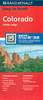
Colorado Backcountry Discovery Route Butler Motorcycle Maps

The Colorado Backcountry Discovery Route is a scenic ride across the state of Colorado, beginning in Four Corners and finishing at the Wyoming Border. The route has been created specifically for dual-sport and adventure motorcyclists who are interested in exploring Colorado’s majestic high-mountain ranges and historic mining country. This 675-mile south-to-north route utilizes many remote and high-elevation dirt roads and leads riders through a number of iconic locations including Telluride, San Juan Mountains, Continental Divide, Collegiate Range, Northern Rocky Mountains and historic Leadville, along the Colorado River.
RIP - This product is no longer available on our network. It was last seen on 25.09.2019

This page now acts as a permanent archive for this product. Add more information using the comments box below to ensure it can still be found by future generations.

Use our search facility to see if it is available from an alternative contributor.
  • External links may include paid for promotion
  • Availability: Out Of Stock
  • Supplier: Stanfords
  • SKU: 9780983270133
Availability: In Stock
£16.99

Product Description

The Colorado Backcountry Discovery Route is a scenic ride across the state of Colorado, beginning in Four Corners & finishing at the Wyoming Border. The route has been created specifically for dual-sport & adventure motorcyclists who are interested in exploring Colorado’s majestic high-mountain ranges & historic mining country. This 675-mile south-to-north route utilizes many remote & high-elevation dirt roads & leads riders through a number of iconic locations including Telluride, San Juan Mountains, Continental Divide, Collegiate Range, Northern Rocky Mountains & historic Leadville, along the Colorado River.

Reviews/Comments

Add New

Intelligent Comparison

Oooops!
We couldn't find anything!
Perhaps this product's unique.... Or perhaps we are still looking for comparisons!
Click to bump this page and we'll hurry up.

Price History

Vouchers

No voucher codes found.
Do you know a voucher code for this product or supplier? Add it to Insights for others to use.

Facebook

Jargon Buster

Adventure - an undertaking of an exciting challenge or experience.

Supplier Information

Stanfords
Stanfords was established in 1853 and opened their iconic Covent Garden flagship store in 1901. They have become the top retailer of maps, travel books and accessories in the UK and arguably offer the largest selection of maps and travel books worldwide. Famous names such as Captain Robert Falcon Scott, Ranulph Fiennes and Michael Palin have purchased from Stanfords. They now have a shop in Bristol and both stores together with other venues operate a calendar of events including talks, book signings and exhibitions. As a specialist map retailer, the map selection is comprehensive and includes road maps, street maps and walking maps from worldwide destinations, as well as a selection of world atlases and wall maps. Books include travel guides and travel literature. Stanfords also stock globes, from miniatures made of blue marble to magnificent floor-standing globes. The website features a selection of interesting articles on travel topics.
Page Updated: 2023-11-12 20:15:36

Community Generated Product Tags

Oh No! The productWIKI community hasn't generated any tags for this product yet!
Menu