More From Contributor

£15.99
DUE OUT MAY 2014
- Lonely Planet: The world's leading travel guide publisher Lonely Planet Colorado is your passport to all the
...
Archived Product
£16.99
The Colorado Backcountry Discovery Route is a scenic ride across the state of Colorado, beginning in Four Corners & finishing at the Wyoming Border. The route has been created specifically for dual-sport & adventure motorcyclists who are interested in exploring Colorado’s majestic high-mountain ranges & historic mining country. This 675-mile south-to-north route utilizes many remote & high-elevation dirt roads & leads riders through a number of iconic locations including Telluride, San Juan Mountains, Continental Divide, Collegiate Range, Northern Rocky Mountains & historic Leadville, along the Colorado River. ...
Archived Product
£24.99
The new National Geographic Benchmark Recreation Atlases are an ideal recreation resource complete with accurate, detailed topographic maps. They contain a wealth of robust travel information, including campground locations, state park maps, sports & activity destinations, museums, hunting & fishing information, historic sites & even climate details. Every feature is clearly labelled, field-checked & verified, & everything is organised for convenience & intuitive ease-of-use. The books feature a double laminated cover to prevent wear & tear. ...
Archived Product
£9.99
Colorado on a laminated & waterproof Easy-to-Fold map from Rand Mc Nally, the country’s leading publisher of road maps & street plans. For clarity of road information Rand Mc Nally state maps present the road network on a plain background, with no or little topographic detail. Driving distances are indicated on all principal highways & on many local routes. National or state parks & other protected areas, Indian Reservations & restricted entry military zones are highlighted & symbols indicate campsites, rest areas, various places of interest, etc. Each map shows local administrative boundaries with names of the counties, is indexed & gives geographical coordinates as margin ticks usually at 1° intervals. Rand Mc Nally state maps are available in two formats: double-sided Easy-to-Read maps with numerous enlargements for cities and/or most visited areas, & laminated Easy-to-Fold maps in a more handy format but with smaller print. TO SEE THE LIST OF RAND Mc NALLY STATE MAPS PLEASE CLICK ON THE SERIES LINK. ...
Archived Product
£6.99
Colorado Easy-to-Read map from Rand Mc Nally, US leading publisher of road maps & street plans, in their extensive series of state maps. Additional panels provide enlargements for Denver & Vicinity with a street plan of downtown Denver; plus Boulder, Colorado Springs, Fort Collins, Greeley, Pueblo, Mesa Verde National Park, & Rocky Mountain National Park. For clarity of road information Rand Mc Nally state maps present the road network on a plain background, with no or little topographic detail. Driving distances are indicated on all principal highways & on many local routes. National or state parks & other protected areas, Indian Reservations & restricted entry military zones are highlighted & symbols indicate campsites, rest areas, various places of interest, etc. Each map shows local administrative boundaries with names of the counties, is indexed & gives geographical coordinates as margin ticks usually at 1° intervals. Rand Mc Nally state maps are available in two formats: double-sided Easy-to-Read maps with numerous enlargements for cities and/or most visited areas, & laminated Easy-to-Fold maps in a more handy format but with smaller print. TO SEE THE LIST OF RAND Mc NALLY STATE MAPS PLEASE CLICK ON THE SERIES LINK. ...
Archived Product
£8.99
With its extraordinary Rocky Mountains (America`s best skiing) alongside expansive plains & desert of numerous national parks, landmarks & monuments, the fast-growing state of Colorado is a tourism leader, receiving large numbers of vacationers throughout the year (whose number will now be affected by the hard-to-predict effect of its recent legalization of recreational cannabis). In this Easy Guide resident author discusses every major travel option, every popular destination within the state. The Guides in the Easy Guide Series by Frommer’s capture the unique spirit of the place offering expert advice in all price ranges for a variety of establishments & attractions. Arranged in a clear layout, put together in a light & compact format (256 pages ), these guides are easy to read & light to carry. The guides introduce a city and/or a region with ‘ Best of’, ‘ In Context’ & ‘ Suggested Itineraries’ chapters, offering information on the local history, culture, geography as well as selecting recommended road trips in & around the location. This section is followed by individual chapters dedicated to the different cities or regions covered by the guide, with advice on where to stay, where to eat, strolls, exploring, shopping, entertainment etc. The guides conclude with a final section on planning your trip. Frommer’s is an American publisher specialising in guidebooks emphasising the culture, lifestyle & history of the destination & stressing the insights travels offer. In their effort to contribute to making travel more accessible they are a cost-conscious company & offer, not only reasonable priced guides, but they also always include sensible priced lodgings & establishments in their guides. They are openly & highly critical when it comes to judging value for your money, & if something or somewhere is not worth your money & time, you will read it. ...
Archived Product
£9.95
Colorado Front Range Cities in a series of City Map Books from Rand Mc Nally providing in a handy 10.5 x 24 cm paperback format a collection of street plans for neighbouring towns & cities within a region. Areas covered by the plans are shown on a regional map & all the plans covered by one overall street index. The plans show the network of streets & roads, indicating where appropriate, routes with limited access, tolls, service & rest areas, one-way traffic, etc. Railway & local transit stations are marked & a range of symbols indicate various services & places of interest. This title provides coverage of Brighton, Boulder, Broomfield, Fort Collins, Greeley, Lafayette, Longmont, Lovel&, Louisville & Windsor. ...
Archived Product
£16.99
Colorado is one of the top motorcycle destinations in the country for good reason. stunning paved mountain passes, desolate ...
Archived Product
£9.99
Map No. 208, Colorado National Monument, CO, in an extensive series of GPS compatible, contoured hiking maps of USA’s national & state parks or forests & other popular recreational areas. Cartography based on the national topographic survey, with additional tourist information. The maps, with most titles now printed on light, waterproof & tear-resistant plastic paper, highlight walking trails along with campsites & other accommodation, picnic sites, areas for various recreational pursuits such as horse riding or skiing, drinking water sources, & many other facilities of interest to the outdoor enthusiast. Cartography is based on information from the USGS (United States Geological Survey
- the country’s national survey organization), revised by the National Geographic Maps in cooperation with the National Park Service, USDA Forest Service, etc. Topography is excellently presented by contours (interval varies according to scale), enhanced by relief shading & colouring/graphics for wood cover, glaciers, etc. All heights are given in feet. The maps have a UTM grid plus latitude & longitude margin ticks & GPS waypoints for selected important locations. Each map is double-sided to give either maximum coverage of the chosen area or additional enlargements of its important sections. Accompanying notes provide useful information on relevant regulations, safety precautions, contact addresses, etc.* *IMPORTANT
- PLEASE NOTE: the series is very extensive, ranging in scale from 1:400, 000 for the vast national parks of Alaska to 1:25, 000 for local map in several states. We recommend, therefore, viewing the series by state rather than the whole list.*

...
Archived Product
£8.99
While GPS is handy for navigating unfamiliar cities, there is nothing better than a printed map for simplicity, perspective & fun on road trips. National Geographic`s State Guide Maps are the perfect combination of detailed map & travel guide. Each map contains scenic drives, parks & recreation maps, as well as insets of cities & useful information on local attractions & events. The maps are printed on durable, waterproof, tear-resistant material that is lightweight & easily folded to fit in your pocket. ...
Archived Product

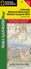
Colorado Frommer's Easyguide 2014

Quick to read, light to carry with expert advice in all price ranges, Frommer's EasyGuide to Colorado 2014 is the complete up-to-date reference for travelers who want to maximize their stay in the smartest, most efficient way. With Frommer's trademark candid and accessible expertise, this invaluable guide offers reviews in a wide array of choices available including lodging, sightseeing, shopping, dining and entertainment. It includes insider tips on how to tackle this vast nation, based on time constraints and interests, complete with practical advice and suggested itineraries. With user-friendly features it offers tips on excellent values, special moments, traveling with kids and overrated experiences and includes thematic tours for every interest, schedule and taste.
RIP - This product is no longer available on our network. It was last seen on 25.09.2019

This page now acts as a permanent archive for this product. Add more information using the comments box below to ensure it can still be found by future generations.

Use our search facility to see if it is available from an alternative contributor.
  • External links may include paid for promotion
  • Availability: Out Of Stock
  • Supplier: Stanfords
  • SKU: 9781628870060
Availability: In Stock
£7.99

Product Description

Quick to read, light to carry with expert advice in all price ranges, Frommer's Easy Guide to Colorado 2014 is the complete up-to-date reference for travelers who want to maximize their stay in the smartest, most efficient way. With Frommer's trademark candid & accessible expertise, this invaluable guide offers reviews in a wide array of choices available including lodging, sightseeing, shopping, dining & entertainment. It

Includes::
insider tips on how to tackle this vast nation, based on time constraints & interests, complete with practical advice & suggested itineraries. With user-friendly features it offers tips on excellent values, special moments, traveling with kids & overrated experiences &

Includes::
thematic tours for every interest, schedule & taste.

Reviews/Comments

Add New

Intelligent Comparison

Oooops!
We couldn't find anything!
Perhaps this product's unique.... Or perhaps we are still looking for comparisons!
Click to bump this page and we'll hurry up.

Price History

Vouchers

No voucher codes found.
Do you know a voucher code for this product or supplier? Add it to Insights for others to use.

Facebook

Jargon Buster

Date - A day on a calendar
Date - A social activity whith a current or potential partner
Entertainment - Something that provides amusement
Quick - Something that is fast
Wide - Something with a large width.
Practical - Weather a task is easy to carry out and realistically succeed.
Invaluable - Something that cannot be replaces as it is indispensable.
Reference - To prove evidence with a back up source.
Kids - A young child.

Supplier Information

Stanfords
Stanfords was established in 1853 and opened their iconic Covent Garden flagship store in 1901. They have become the top retailer of maps, travel books and accessories in the UK and arguably offer the largest selection of maps and travel books worldwide. Famous names such as Captain Robert Falcon Scott, Ranulph Fiennes and Michael Palin have purchased from Stanfords. They now have a shop in Bristol and both stores together with other venues operate a calendar of events including talks, book signings and exhibitions. As a specialist map retailer, the map selection is comprehensive and includes road maps, street maps and walking maps from worldwide destinations, as well as a selection of world atlases and wall maps. Books include travel guides and travel literature. Stanfords also stock globes, from miniatures made of blue marble to magnificent floor-standing globes. The website features a selection of interesting articles on travel topics.
Page Updated: 2023-11-12 20:15:36

Community Generated Product Tags

Oh No! The productWIKI community hasn't generated any tags for this product yet!
Menu