
 United Kingdom
 France
 Germany
 Netherlands
 Sweden
 USA
USA
 Italy
Italy
 Spain
Spain
More From Contributor


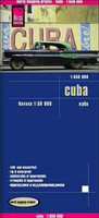
Cuba Reise Know-How
Cuba at 1:650, 000 on an indexed road map from Reise Know-How, with a street plan of Havana, printed on light, waterproof and tear-resistant paper and published as part of their highly acclaimed “World Mapping Project”. The map is double-sided to provide the best balance between a good scale and a convenient size sheet, and presents the island with a good overlap between the sides.Road and rail networks are clearly visible on the background of light altitude colouring to indicate the island’s topography. The map also shows swamps and mangroves and coral reefs, and has plenty of names of various mountain ranges, peaks, etc. Road network includes local tracks, shows locations of petrol stations and gives driving distances on main and secondary routes. Symbols highlight various
places of interest including campsites, beaches, diving and fishing sites, national parks and nature reserves, etc. Also marked are internal administrative boundaries with names of the provinces. The map is indexed and has latitude and longitude lines at intervals of 1°. Map legend includes English.A large panel shows Havana, indicating principal traffic arteries and important buildings, with another inset covering the city’s international airport.
places of interest including campsites, beaches, diving and fishing sites, national parks and nature reserves, etc. Also marked are internal administrative boundaries with names of the provinces. The map is indexed and has latitude and longitude lines at intervals of 1°. Map legend includes English.A large panel shows Havana, indicating principal traffic arteries and important buildings, with another inset covering the city’s international airport.

Product Description
Reviews/Comments
Add New
Vouchers
No voucher codes found.
Do you know a voucher code for this product or supplier? Add it to Insights for others to use.
Do you know a voucher code for this product or supplier? Add it to Insights for others to use.
 Denmark