More From Contributor

£9.99
Cuba on a waterproof & tear-resistant, double-sided map at 1:650, 000 from terra Quest, with street plans of central Havana & the Varadero peninsula. The map is presented in a special format handy for conveniently viewing just small sections of it at one time. The map divides Cuba east/west, with a small overlap between the sides. Road network

Includes::
local roads & selected tracks, with driving distances marked on main & most secondary routes. Railway lines are included & local airports are marked. Symbols highlight various facilities & places of interest including campsites, UNESCO World Heritage sites, beaches & diving sites, etc. Topography is indicated by contours with names of mountain ranges, etc, & colouring for woodlands. Latitude & longitude lines are drawn at 10’ intervals & the map has no index. A large panel presents central Havana, from the Old Town to the Palacio de la Revolución, at 1:17, 000 highlighting hotels, important buildings, etc. Another panel shows the Varadero peninsula at 1:15, 000 with names of numerous hotels. The map is laminated in a format similar to the old cloth-dissected maps so that sections of it can be easily folded back without damage, & can be annotated with write-on/wipe-off marker pens.

...
Archived Product
£12.99
Cuba in the National Geographic Traveler guide series, produced by America’s leading travel publishers, exploring a range of cities, regions & countries worldwide & using the expertise & tradition of National Geographic to provide a comprehensive survey of each destination. Each of the guides in the series draws upon National Geographic’s rich history of travel experience & is researched by authors familiar with the area. Whilst the content is influenced by an American editorial style, individual titles are still accessible to a non-American audience, with a combination of practical guidance & detailed information included in each guide. The series also relies upon the extensive image libraries of National Geographic to present a rich visual image of each destination. Individual National Geographic Traveler titles are organised uniformly, allowing readers to access information quickly & easily. Introductory sections provide information on Charting your Trip, with details of getting there & around & a History & Culture chapter profiling history, food & drink, land & landscape, flora & fauna & arts & literature. Chapter are arranged geographically by region, with notable cities & areas principally describing the main sites & attractions, with further information on directions, history & practicalities. There are also a number of individual features & insider tips throughout each guide covering subjects such as walking tours, local culture, driving tours, recommended local experiences & in-depth thematic short histories of the culture & histories of individual regions. A Travelwise section at the back of each guide provides essential practical information on when to go, what to take, further reading, getting there & around, local etiquette, media, holidays, money matters, religion, smoking, time differences, opening times, travellers with disabilities & accommodation. Restaurants & hotels are listed with brief descriptions & information on prices, location, contact details & facilities for the relevant regional chapters in the guide. ...
Archived Product
£18.99
Cuba Viva is a highly personal attempt by one of Cuba`s new generation of photographers to capture the soul of his homel&, in snapshots of family & friends, unknown passers-by, suggesting the smells & tastes of the isl&, its flesh-and blood heroes, its dreams, songs & poetry, & the pride of its people in the achievements of their ongoing revolution. ...
Archived Product
£13.50
Wall map of Cuba from Gizi with excellent topographic information, a street plan of Old Havana, enlargements for the Varadero Peninsula, Valle de Viñales & the environs of the capital, plus a distance table & an extensive index. Vivid altitude colouring with graphics for mangrove & swamps, plus plenty of names of geographical

Features:
peaks, mountain ranges, national parks & protected areas, etc., show the terrain. In coastal waters coral reefs are marked & sea depths are given. Road network gives distances on main & secondary routes &

Includes::
dirt tracks. Railways & local airfields are marked, as well as provincial administrative boundaries. Symbols highlight various places of interest including world heritage sites, locations with tourist accommodation, campsites, beaches, diving & fishing sites, marinas, etc. The map has latitude & longitude lines at intervals of 1º & an extensive index of localities. Map legend included English. Enlargements cover the Varadero Peninsula (1:50, 000) with names of numerous hotels & places of interest & Valle de Viñales (1:75, 000) with hiking trails. Also included is a street plan of Old Havana, annotated with places of interest, a map of greater Havana showing main access roads, districts & places of interest outside the city centre, plus a distance table.


...
Archived Product
£9.99
Western Cuba, with coverage extending from the island’s western tip to Camangüey, on an indexed, double-sided map at 1:600, 000 from ITMB, with an enlargement for the Greater Havana region & street plans of central Havana, Cienfuegos & Trinidad, plus the Varadero peninsula & resort. The map is double -sided with an overlap between the sides. Topography is indicated by altitude colouring with spot heights & highlighting for national parks & other protected areas. Also shown are coastal reefs. Road network

Includes::
selected local tracks, gives distances on main & some local routes, & shows locations of petrol stations. Railway lines & ferry connections are included & local airports are marked. A range of symbols indicate various facilities & places of interest, including campsites, UNESCO World Heritage sites, etc. The map has latitude at longitude lines at 30’ intervals. Each side has a separate index. An enlargement shows the Greater Havana region in greater detail at 1:150, 000. Street plans, annotated with selected named hotels, important sights, etc, cover Havana, Cienfuegos & Trinidad, plus the Varadero peninsula & resort.

...
Archived Product
£40.00
At a time when more travelers are discovering or rediscovering Cuba, this book is an in-depth exploration of 101 of the most authentic ...
Archived Product
£30.00
“ Cuba: A Cruising Guide” dispels the navigational fog that has long surrounded the isl&. The information in this book is condensed from Cuban, American & British charts, supplemented with archival materials from the British Admiralty & the DMA, & checked, tested & corrected with the latest in satellite-based chartmaking technology. This 1999 revised edition contains a large number of revisions, an updated introductory section &

Includes::
the addition of a section of colour plates. There are almost 200 sketch charts, showing details of well over 200 anchorages, with entry waypoints for each & every one. The charts are supplemented by excellent horizon sketches by artist Teresa Frisbie-Calder. There has never been a cruising guide with sketch charts of this calibre, or with this amount of detail- this guide sets a new standard. For anyone contemplating or planning a cruise in Cuban waters, it as an indispensable resource.

...
Archived Product
£18.00
Cuba is a rare & fascinating place. In a world where revolutionary socialism seems an almost quaint reminder of the Cold War, the island remains one of the few nations on the planet guided by a Communist party, still committed to fighting imperialism, opposed to the injustices of globalization & wedded to the dream of one day building a classless society, albeit in a distant future. But Cuba is more than a struggling socialist country: it is a nation with a complex & turbulent history & a rich & varied culture. This book is neither simply a timeline narrative of Cuban history nor a traditional history of Cuban culture. Instead, it invites the reader to enter Cuban history from the perspective of the island`s uniquely creative cultural forms. As it does so, it traces that restless island as it ebbs & flows with the power, beauty & longings of its culture & history. All those who have visited this captivating place, or been inspired by its history & culture, should read this fascinating account. ...
Archived Product
£14.95
Map No. J-26A in the TPC series: military topographic survey mapping covering the world's land masses & significant islands at 1:500, 000. The maps are useful as general topographical coverage where nothing else is available, although they are designed primarily as flying charts for military aircraft. TPC stands for Tactical Pilotage Chart. Relief is portrayed by a combination of contours (basic interval 500ft, intermediate contours shown where appropriate), elevation tinting & relief shading, plus spot heights. Towns, villages, major roads, railways & airports are shown but please note that many of the smaller settlements are not named & the road information is not necessarily up to date, as compilation & revision dates vary. Some air navigation information also appears on the map, such as radio beacons & restricted flying zones. Each TPC chart has both UTM & latitude/longitude grids overprinted on it, with additional margin ticks. IMPORTANT
- PLEASE NOTE: The series is gradually being withdrawn from sale to the general public & some sheets may no longer be available when ordered by us. Due to the nature of the map projection assembling these sheets to make a larger map is not recommended. in addition, colours used for relief are not constant throughout the series. In some areas of central Africa & South America the maps have blank spaces, reflecting localized deficiencies or inconsistencies in the survey data.
...
Archived Product
£29.95
A unique compilation of authentic home-cooking recipes from Cuba, reflecting the island`s remarkable culinary diversity. Cuban ...
Archived Product

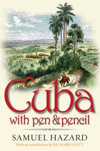
Cuba With Pen And Pencil

In 1866, worn out by fighting in the American Civil War, the writer Samuel Hazard arrived in Cuba to begin work on a guidebook to the island. Over a period of several months, as his health recovered, he travelled throughout what was then still a Spanish colony, observing and recording daily life. The result is one of the most complete and evocative portrayals of colonial Cuban life, written in the decade when the first concerted struggle for independence was already under way. Hazard`s sympathies were clearly with the pro-independence ”patriots”, but his main aim was to produce a complete overview of the island`s sights and customs, aimed at visitors. He is informative on hotels, restaurants, and transport and sightseeing, but is also intrigued by the people he meets and the
idiosyncrasies of Cuban social life. Illustrated with hundreds of the author`s own sketches, ”Cuba with Pen and Pencil” takes the reader through the historic fortresses and mansions of Havana, the tropical city of Santiago de Cuba and the plantations and mountains of the island`s countryside.With a keen and often quirky eye for detail, Hazard explores the sugar industry - still largely powered by slave labour - and Cuba`s other economic activities. He describes the island`s flora and fauna, its varied topography, and its varied social life, ranging from upper-class balls to slave compounds. First published in 1871 and now reissued with an introduction by acclaimed historian Richard Gott, ”Cuba with Pen and Pencil” is a unique portrait of an island and a society on the eve of
fundamental and historic change.
RIP - This product is no longer available on our network. It was last seen on 25.09.2019

This page now acts as a permanent archive for this product. Add more information using the comments box below to ensure it can still be found by future generations.

Use our search facility to see if it is available from an alternative contributor.
  • Availability: Out Of Stock
  • Supplier: Stanfords
  • SKU: 9781904955207
Availability: In Stock
£12.99

Product Description

In 1866, worn out by fighting in the American Civil War, the writer Samuel Hazard arrived in Cuba to begin work on a guidebook to the isl&. Over a period of several months, as his health recovered, he travelled throughout what was then still a Spanish colony, observing & recording daily life. The result is one of the most complete & evocative portrayals of colonial Cuban life, written in the decade when the first concerted struggle for independence was already under way. Hazard`s sympathies were clearly with the pro-independence ”patriots”, but his main aim was to produce a complete overview of the island`s sights & customs, aimed at visitors. He is informative on hotels, restaurants, & transport & sightseeing, but is also intrigued by the people he meets & the idiosyncrasies of Cuban social life. Illustrated with hundreds of the author`s own sketches, ” Cuba with Pen & Pencil” takes the reader through the historic fortresses & mansions of Havana, the tropical city of Santiago de Cuba & the plantations & mountains of the island`s countryside. With a keen & often quirky eye for detail, Hazard explores the sugar industry
- still largely powered by slave labour
- & Cuba`s other economic activities. He describes the island`s flora & fauna, its varied topography, & its varied social life, ranging from upper-class balls to slave compounds. First published in 1871 & now reissued with an introduction by acclaimed historian Richard Gott, ” Cuba with Pen & Pencil” is a unique portrait of an island & a society on the eve of fundamental & historic change.

Reviews/Comments

Add New

Intelligent Comparison

Oooops!
We couldn't find anything!
Perhaps this product's unique.... Or perhaps we are still looking for comparisons!
Click to bump this page and we'll hurry up.

Price History

Vouchers

No voucher codes found.
Do you know a voucher code for this product or supplier? Add it to Insights for others to use.

Facebook

Jargon Buster

Eye - An organ which detects light
Spanish - The main language spoken in Spain and Latin America.
Sugar - A sweet substance, white in colour.
Tropical - Coming fro the work "tropics" a hot and humid area of the world.
Transport - Something that carries people or goods.

Supplier Information

Stanfords
Stanfords was established in 1853 and opened their iconic Covent Garden flagship store in 1901. They have become the top retailer of maps, travel books and accessories in the UK and arguably offer the largest selection of maps and travel books worldwide. Famous names such as Captain Robert Falcon Scott, Ranulph Fiennes and Michael Palin have purchased from Stanfords. They now have a shop in Bristol and both stores together with other venues operate a calendar of events including talks, book signings and exhibitions. As a specialist map retailer, the map selection is comprehensive and includes road maps, street maps and walking maps from worldwide destinations, as well as a selection of world atlases and wall maps. Books include travel guides and travel literature. Stanfords also stock globes, from miniatures made of blue marble to magnificent floor-standing globes. The website features a selection of interesting articles on travel topics.
Page Updated: 2023-11-12 20:15:36

Community Generated Product Tags

Oh No! The productWIKI community hasn't generated any tags for this product yet!
Menu