More From Contributor

£30.99
Map No. E-3 in the ONC series: military topographic survey mapping covering the world`s land masses & significant islands at 1:1, 000, 000. The maps are useful as general topographical coverage where nothing else is available, although they are designed primarily as flying charts for military aircraft. ONC stands for Operational Navigation Chart. Relief is portrayed by a combination of contours (basic interval 1000ft, intermediate contours shown where appropriate), elevation tinting & relief shading, plus spot heights. Towns, villages, major roads, railways & airports are shown but please note that many of the smaller settlements are not named & the road information is not necessarily up to date, as compilation & revision dates vary. Some air navigation information also appears on the map, such as radio beacons & restricted flying zones. Each ONC chart has both UTM & latitude/longitude grids overprinted on it, with additional margin ticks. *IMPORTANT
- PLEASE NOTE:** * The series is gradually being withdrawn from sale to the general public & some sheets may no longer be available when ordered by us.** Due to the nature of the map projection assembling these sheets to make a larger map is not recommended. in addition, colours used for relief are not constant throughout the series.* In some areas of central Africa & South America the maps have blank spaces, reflecting localized deficiencies or inconsistencies in the survey data.
...
Archived Product
£15.99
When the movie E.T. the Extra-Terrestrial was released in 1982, it enchanted millions of kids & surpassed Star Wars to become the highest-grossing film of all time. Now he s back & rendered in the fun, colourful, retro illustration styles of illustrator Kim Smith. This storybook follows all the basic beats of the film: After E.T. is stranded on Earth, he takes refuge with Elliott, a lonely young boy in need of a friend. As Elliott & his siblings help E.T. phone home & make it back to his spaceship against all odds, they learn important lessons about courage, friendship, & the power of the imagination. It s the perfect read-along story for children & their parents. ...
Archived Product
£6.99
When the movie E.T. the Extra-Terrestrial was released in 1982, it enchanted millions of kids & surpassed Star Wars to become the highest-grossing film of all time. Now he s back & rendered in the fun, colourful, retro illustration styles of illustrator Kim Smith. This storybook follows all the basic beats of the film: After E.T. is stranded on Earth, he takes refuge with Elliott, a lonely young boy in need of a friend. As Elliott & his siblings help E.T. phone home & make it back to his spaceship against all odds, they learn important lessons about courage, friendship, & the power of the imagination. It s the perfect read-along story for children & their parents. ...
Archived Product
£18.95
On this 2016 edition the latest depth surveys have been applied. New Marine Reserves are shown where appropriate as are new submarine cables. Completed harbour development is now shown on the Porto das Velas plan as are the current works in progress. There has been general updating throughout. Plans included: Vila das Lajes (1:20 000) Horta (1:12 500) Lajes (Pico) (1:10 000) Porto das Velas (1:7500) Vila da Praia (1:10 000) Praia da Vitoria (1:20 000) Angra do Heroismo (1:12 500) Ponta Delgada (1:10 000) Vila Franco do Campo (1:15 000) Vila do Porto (1:10 000) ...
Archived Product
£18.95
The Canary islands in Imray’s series of charts of North Atlantic Islands, which are comprehensive & easy-to-use sailing charts published on rip-proof, waterproof paper- ideal to be used on small tables or in cockpits. They show detailed coastline & depth information, & are constantly corrected to reflect latest information. Designed primarily for yachtsmen, they are comprehensive without being unnecessarily cluttered. Each chart contains insets showing local harbours annotated with symbols indicating what facilities can be found there (marinas, mooring & berth facilities, fuel, water, chandlers, etc.). Charts are fully updated to the latest printing date, & often include further corrections on a separate sheet. Subsequent corrections can be found on the Imray website. On these charts, depths are shown in metres. Positions referring to WGS84 Datum, such as most GPS readings, can be plotted directly onto these charts. Base cartography uses contours, several levels of colour shading, & spot measurements to indicate depth relative to Lowest Astronomical Tide, including distinct colour highlighting for tidally-covered l&. A large number of hatchings & markings are used to indicate coast types, salt flats, marshl&, reefs, etc. Compliant IALA ‘ System Region A’ buoys are clearly marked, & indications of other navigational aides such as light floats are given where possible. Lighthouses are clearly marked with arcs of visibility. A complex & comprehensive system of symbols is used to indicate all types of submerged obstructions, including wrecks, rocks, pipelines & cables, with depths where known. Flood tides, eddies races, ebb tide streams & other current information is given. A wide range of symbols indicate onshore features, anchorages, harbour details & other points of note. Danger areas, restricted areas & traffic zones are all shown. ...
Archived Product
£18.95
Plans included: St George`s Harbour Dockyard Marina Hamilton Harbour Bermuda Approaches (on reverse) 2012 EDITION
- Fully updated
...
Archived Product
£6.99
Each Peach Pear Plum
- the classic picture book by Janet & Allan Ahlberg. Each Peach Pear Plum is a timeless picture book classic
...
Archived Product
£9.99
Map No. 121, Eagle
- Avon, CO, in an extensive series of GPS compatible, contoured hiking maps of USA’s national & state parks
...
Archived Product
£14.99
” The Eagle Cookbook” was first published in 2001
- as ” Rough Edges & Strong Flavours -” & was reissued in 2009, featuring wonderful
...
Archived Product
£9.99
Map No. 149, Holy Cross
- Eagles Nest Wilderness, CO, in an extensive series of GPS compatible, contoured hiking maps of USA’s
...
Archived Product

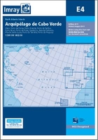
E4 Arquipelago De Cabo Verde

Imray’s series of charts of North Atlantic Islands are comprehensive and easy-to-use sailing charts published on rip-proof, waterproof paper- ideal for use on small tables or in cockpits. They show detailed coastline and depth information, and are constantly corrected to reflect latest information. Designed primarily for yachtsmen, they are comprehensive without being unnecessarily cluttered.This chart includes plans/insets of the following locations:- Pto da Furna- Pto Grande- Pto de Sal-Rei- Pto Novo- Pto da Praia- Cavaleiros- Baia da Palmeira- Ilha de Sta Luzia- Pto do Tarrafal (I. de Sao Nicolau)- Pto de Preguica.Each chart contains insets showing local harbours annotated with symbols indicating what facilities can be found there (marinas, mooring and berth facilities, fuel,
water, chandlers, etc.). Charts are fully updated to the latest printing date, and often include further corrections on a separate sheet. Subsequent corrections can be found on the Imray website.On these charts, depths are shown in metres. Positions referring to WGS84 Datum, such as most GPS readings, can be plotted directly onto these charts.Base cartography uses contours, several levels of colour shading, and spot measurements to indicate depth relative to Lowest Astronomical Tide, including distinct colour highlighting for tidally-covered land. A large number of hatchings & markings are used to indicate coast types, salt flats, marshland, reefs, etc.Compliant IALA ‘System Region A’ buoys are clearly marked, and indications of other navigational aides such as light
floats are given where possible. Lighthouses are clearly marked with arcs of visibility. A complex and comprehensive system of symbols is used to indicate all types of submerged obstructions, including wrecks, rocks, pipelines and cables, with depths where known. Flood tides, eddies races, ebb tide streams and other current information is given. A wide range of symbols indicate onshore features, anchorages, harbour details and other points of note. Danger areas, restricted areas and traffic zones are all shown.
RIP - This product is no longer available on our network. It was last seen on 25.09.2019

This page now acts as a permanent archive for this product. Add more information using the comments box below to ensure it can still be found by future generations.

Use our search facility to see if it is available from an alternative contributor.
  • Availability: Out Of Stock
  • Supplier: Stanfords
  • SKU: 9781846236549
Availability: In Stock
£18.95

Product Description

Imray’s series of charts of North Atlantic Islands are comprehensive & easy-to-use sailing charts published on rip-proof, waterproof paper- ideal to be used on small tables or in cockpits. They show detailed coastline & depth information, & are constantly corrected to reflect latest information. Designed primarily for yachtsmen, they are comprehensive without being unnecessarily cluttered. This chart

Includes::
plans/insets of the following locations:- Pto da Furna- Pto Grande- Pto de Sal-Rei- Pto Novo- Pto da Praia- Cavaleiros- Baia da Palmeira- Ilha de Sta Luzia- Pto do Tarrafal (I. de Sao Nicolau)- Pto de Preguica. Each chart contains insets showing local harbours annotated with symbols indicating what facilities can be found there (marinas, mooring & berth facilities, fuel, water, chandlers, etc.). Charts are fully updated to the latest printing date, & often include further corrections on a separate sheet. Subsequent corrections can be found on the Imray website. On these charts, depths are shown in metres. Positions referring to WGS84 Datum, such as most GPS readings, can be plotted directly onto these charts. Base cartography uses contours, several levels of colour shading, & spot measurements to indicate depth relative to Lowest Astronomical Tide, including distinct colour highlighting for tidally-covered l&. A large number of hatchings & markings are used to indicate coast types, salt flats, marshl&, reefs, etc. Compliant IALA ‘ System Region A’ buoys are clearly marked, & indications of other navigational aides such as light floats are given where possible. Lighthouses are clearly marked with arcs of visibility. A complex & comprehensive system of symbols is used to indicate all types of submerged obstructions, including wrecks, rocks, pipelines & cables, with depths where known. Flood tides, eddies races, ebb tide streams & other current information is given. A wide range of symbols indicate onshore features, anchorages, harbour details & other points of note. Danger areas, restricted areas & traffic zones are all shown.

Reviews/Comments

Add New

Intelligent Comparison

Oooops!
We couldn't find anything!
Perhaps this product's unique.... Or perhaps we are still looking for comparisons!
Click to bump this page and we'll hurry up.

Price History

Vouchers

No voucher codes found.
Do you know a voucher code for this product or supplier? Add it to Insights for others to use.

Facebook

Jargon Buster

GPS - Global Positioning System - Global position using satellites
Paper - A thin sheet mainly used for writing. Available in a variety of colours. Made mainly from wood pulp.
Metres - A unit of measure, one metre equals 100 centimetres
Date - A day on a calendar
Date - A social activity whith a current or potential partner
fuel - A material used to generate energy.
water - A chemical substance. Chemical formula H2O.
Waterproof - Resistant to water, usualy specified by depth in metres
Colour - The categorised spectrum of light visable to humans
Large - something that takes up more space than normal.
Small - something that takes up less space than normal.
Wide - Something with a large width.
Distinct - Something that can be seen to be slightly different.
Ideal - Something that satisfies a perfect criteria.

Supplier Information

Stanfords
Stanfords was established in 1853 and opened their iconic Covent Garden flagship store in 1901. They have become the top retailer of maps, travel books and accessories in the UK and arguably offer the largest selection of maps and travel books worldwide. Famous names such as Captain Robert Falcon Scott, Ranulph Fiennes and Michael Palin have purchased from Stanfords. They now have a shop in Bristol and both stores together with other venues operate a calendar of events including talks, book signings and exhibitions. As a specialist map retailer, the map selection is comprehensive and includes road maps, street maps and walking maps from worldwide destinations, as well as a selection of world atlases and wall maps. Books include travel guides and travel literature. Stanfords also stock globes, from miniatures made of blue marble to magnificent floor-standing globes. The website features a selection of interesting articles on travel topics.
Page Updated: 2023-11-12 20:15:36

Community Generated Product Tags

Oh No! The productWIKI community hasn't generated any tags for this product yet!
Menu