More From Contributor
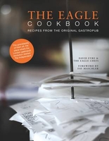
£18.95
The Canary islands in Imray’s series of charts of North Atlantic Islands, which are comprehensive & easy-to-use sailing charts published on rip-proof, waterproof paper- ideal to be used on small tables or in cockpits. They show detailed coastline & depth information, & are constantly corrected to reflect latest information. Designed primarily for yachtsmen, they are comprehensive without being unnecessarily cluttered. Each chart contains insets showing local harbours annotated with symbols indicating what facilities can be found there (marinas, mooring & berth facilities, fuel, water, chandlers, etc.). Charts are fully updated to the latest printing date, & often include further corrections on a separate sheet. Subsequent corrections can be found on the Imray website. On these charts, depths are shown in metres. Positions referring to WGS84 Datum, such as most GPS readings, can be plotted directly onto these charts. Base cartography uses contours, several levels of colour shading, & spot measurements to indicate depth relative to Lowest Astronomical Tide, including distinct colour highlighting for tidally-covered l&. A large number of hatchings & markings are used to indicate coast types, salt flats, marshl&, reefs, etc. Compliant IALA ‘ System Region A’ buoys are clearly marked, & indications of other navigational aides such as light floats are given where possible. Lighthouses are clearly marked with arcs of visibility. A complex & comprehensive system of symbols is used to indicate all types of submerged obstructions, including wrecks, rocks, pipelines & cables, with depths where known. Flood tides, eddies races, ebb tide streams & other current information is given. A wide range of symbols indicate onshore features, anchorages, harbour details & other points of note. Danger areas, restricted areas & traffic zones are all shown. ...
Archived Product
£18.95
Imray’s series of charts of North Atlantic Islands are comprehensive & easy-to-use sailing charts published on rip-proof, waterproof paper- ideal to be used on small tables or in cockpits. They show detailed coastline & depth information, & are constantly corrected to reflect latest information. Designed primarily for yachtsmen, they are comprehensive without being unnecessarily cluttered. This chart

Includes::
plans/insets of the following locations:- Pto da Furna- Pto Grande- Pto de Sal-Rei- Pto Novo- Pto da Praia- Cavaleiros- Baia da Palmeira- Ilha de Sta Luzia- Pto do Tarrafal (I. de Sao Nicolau)- Pto de Preguica. Each chart contains insets showing local harbours annotated with symbols indicating what facilities can be found there (marinas, mooring & berth facilities, fuel, water, chandlers, etc.). Charts are fully updated to the latest printing date, & often include further corrections on a separate sheet. Subsequent corrections can be found on the Imray website. On these charts, depths are shown in metres. Positions referring to WGS84 Datum, such as most GPS readings, can be plotted directly onto these charts. Base cartography uses contours, several levels of colour shading, & spot measurements to indicate depth relative to Lowest Astronomical Tide, including distinct colour highlighting for tidally-covered l&. A large number of hatchings & markings are used to indicate coast types, salt flats, marshl&, reefs, etc. Compliant IALA ‘ System Region A’ buoys are clearly marked, & indications of other navigational aides such as light floats are given where possible. Lighthouses are clearly marked with arcs of visibility. A complex & comprehensive system of symbols is used to indicate all types of submerged obstructions, including wrecks, rocks, pipelines & cables, with depths where known. Flood tides, eddies races, ebb tide streams & other current information is given. A wide range of symbols indicate onshore features, anchorages, harbour details & other points of note. Danger areas, restricted areas & traffic zones are all shown.

...
Archived Product
£18.95
Plans included: St George`s Harbour Dockyard Marina Hamilton Harbour Bermuda Approaches (on reverse) 2012 EDITION
- Fully updated
...
Archived Product
£6.99
Each Peach Pear Plum
- the classic picture book by Janet & Allan Ahlberg. Each Peach Pear Plum is a timeless picture book classic
...
Archived Product
£9.99
Map No. 121, Eagle
- Avon, CO, in an extensive series of GPS compatible, contoured hiking maps of USA’s national & state parks
...
Archived Product
£9.99
Map No. 149, Holy Cross
- Eagles Nest Wilderness, CO, in an extensive series of GPS compatible, contoured hiking maps of USA’s
...
Archived Product
£3.50
Ealing in 1894 in a fascinating series of reproductions of old Ordnance Survey plans in the Alan Godfrey Editions, ideal for anyone interested in the history of their neighbourhood or family. Two versions of this map show the area stretching from Eccleston Road eastward to Ealing Broadway & Windsor Road, & from Cleveland Road & Castle Bar southward to Grange Road & Churchfield Road. The map covers central & west Ealing. Features include Ealing Broadway station, Castle Hill & Ealing Dean station, Haven Green, Drayton Green, cemetery, Central London District School. Churches include St Stephen`s, St John`s Mattock Lane, Christ Church. Streets include The Avenue, Uxbridge Road, High Street, Eaton Rise, Argyle Road etc. The 1934 map has a 1933 list of private inhabitanmts in Ealing (the list continues on sheets 70 & 71). About the Alan Godfrey Editions of the 25” OS Series: Selected towns in Great Britain & Ireland are covered by maps showing the extent of urban development in the last decades of the 19th & early 20th century. The plans have been taken from the Ordnance Survey mapping & reprinted at about 15 inches to one mile (1:4, 340). On the reverse most maps have historical notes & many also include extracts from contemporary directories. Most maps cover about one mile (1.6kms) north/south, one & a half miles (2.4kms) across; adjoining sheets can be combined to provide wider coverage.FOR MORE INFORMATION & A COMPLETE LIST OF ALL AVAILABLE TITLES PLEASE CLICK ON THE SERIES LINK. ...
Archived Product
£3.50
Hackney in 1870 in a fascinating series of reproductions of old Ordnance Survey plans in the Alan Godfrey Editions, ideal for anyone interested in the history of their neighbourhood or family. Three versions of this map have been published to show how the area developed across the years, stretching from Mare Street eastward to White Post Lane, & from Tresham Avenue & Ashenden Road southward to Victoria Park Road. Features include much of Victoria Park, Hackney Cut Navigation, Hertford Union Canal, Hackney Common, Well Street, Wick Road, Hackney Wick, South Hackney, Homerton; Victoria Park, Homerton & Hackney stations; City of London Union Workhouse (later Institution), Hackney Workhouse, Eastern Fever Hospital, chemical works & factories at the east edge of map, St Thomas`s Square, St John of Jerusalem church, St John`s church, French Hospital, site of Rowe Chapel, Town Hall, Old Town Hall. The 1870 map is especially attractive, notably portraying South Hackney with its leafy gardens. About the Alan Godfrey Editions of the 25” OS Series: Selected towns in Great Britain & Ireland are covered by maps showing the extent of urban development in the last decades of the 19th & early 20th century. The plans have been taken from the Ordnance Survey mapping & reprinted at about 15 inches to one mile (1:4, 340). On the reverse most maps have historical notes & many also include extracts from contemporary directories. Most maps cover about one mile (1.6kms) north/south, one & a half miles (2.4kms) across; adjoining sheets can be combined to provide wider coverage.FOR MORE INFORMATION & A COMPLETE LIST OF ALL AVAILABLE TITLES PLEASE CLICK ON THE SERIES LINK. ...
Archived Product
£3.50
Ealing in 1934 in a fascinating series of reproductions of old Ordnance Survey plans in the Alan Godfrey Editions, ideal for anyone interested in the history of their neighbourhood or family. Two versions of this map show the area stretching from Eccleston Road eastward to Ealing Broadway & Windsor Road, & from Cleveland Road & Castle Bar southward to Grange Road & Churchfield Road. The map covers central & west Ealing. Features include Ealing Broadway station, Castle Hill & Ealing Dean station, Haven Green, Drayton Green, cemetery, Central London District School. Churches include St Stephen`s, St John`s Mattock Lane, Christ Church. Streets include The Avenue, Uxbridge Road, High Street, Eaton Rise, Argyle Road etc. The 1934 map has a 1933 list of private inhabitanmts in Ealing (the list continues on sheets 70 & 71). About the Alan Godfrey Editions of the 25” OS Series: Selected towns in Great Britain & Ireland are covered by maps showing the extent of urban development in the last decades of the 19th & early 20th century. The plans have been taken from the Ordnance Survey mapping & reprinted at about 15 inches to one mile (1:4, 340). On the reverse most maps have historical notes & many also include extracts from contemporary directories. Most maps cover about one mile (1.6kms) north/south, one & a half miles (2.4kms) across; adjoining sheets can be combined to provide wider coverage.FOR MORE INFORMATION & A COMPLETE LIST OF ALL AVAILABLE TITLES PLEASE CLICK ON THE SERIES LINK. ...
Archived Product
£12.99
Ealing, once known as the ` Queen of the Suburbs`, has had a long & varied history. Once a country town in Middlesex, the area became part of the City of London in 1965 & celebrates its fiftieth anniversary as a London borough in 2015. This is the first book to chart the history of Ealing from earliest times to the dawn of the twenty-first century. It draws on many sources, including contemporary diaries, newspapers, parish & borough archives. The reader will learn about the many changes in Ealing as it moved from being part of a manor belonging to the bishop of London to being an independent entity, going on to absorb neighbouring parishes & boroughs in the twentieth century. In Ealing: A Concise History, author Jonathan Oats discusses both the built environment of open spaces, churches, shops & pubs as well as the district`s residents, from little-known diarists, criminals & politicians to key local personalities who played their part in shaping its history. The impact of outside events, such as civil war, plague & the world wars are also explored in this fascinating insight into the history of the West London borough. ...
Archived Product

Eagle Cookbook

”The Eagle Cookbook” was first published in 2001 - as ”Rough Edges and Strong Flavours -” and was reissued in 2009, featuring wonderful ?new recipes from a number of award-winning ex-Eagle alumni such as Sam and Sam Clark of ”Moro” and Jonathan Jones from ”The Anchor and Hope” and completed by evocative photography that captured 24 hours in the life of this frantically busy and ever-popular gastropub. It remains one of the best collections of Mediterranean-inflected recipes in print. The book is divided into recipe sections for Soups, Salads, Meals on Toast, Eggs for Dinner, Pasta, Rice, Fish, Meat and Side Dishes: all of them full of the kind of wonderfully robust and vibrant flavours that the Eagle put their stamp on twenty years ago... long before any other
gastropub got there.
RIP - This product is no longer available on our network. It was last seen on 25.09.2019

This page now acts as a permanent archive for this product. Add more information using the comments box below to ensure it can still be found by future generations.

Use our search facility to see if it is available from an alternative contributor.
  • Availability: Out Of Stock
  • Supplier: Stanfords
  • SKU: 9781906650629
Availability: In Stock
£14.99

Product Description

” The Eagle Cookbook” was first published in 2001
- as ” Rough Edges & Strong Flavours -” & was reissued in 2009, featuring wonderful ?new recipes from a number of award-winning ex-Eagle alumni such as Sam & Sam Clark of ” Moro” & Jonathan Jones from ” The Anchor & Hope” & completed by evocative photography that captured 24 hours in the life of this frantically busy & ever-popular gastropub. It remains one of the best collections of Mediterranean-inflected recipes in print. The book is divided into recipe sections for Soups, Salads, Meals on Toast, Eggs for Dinner, Pasta, Rice, Fish, Meat & Side Dishes: all of them full of the kind of wonderfully robust & vibrant flavours that the Eagle put their stamp on twenty years ago... long before any other gastropub got there.

Reviews/Comments

Add New

Intelligent Comparison

Oooops!
We couldn't find anything!
Perhaps this product's unique.... Or perhaps we are still looking for comparisons!
Click to bump this page and we'll hurry up.

Price History

Vouchers

No voucher codes found.
Do you know a voucher code for this product or supplier? Add it to Insights for others to use.

Facebook

Jargon Buster

stamp - A distinctive mark or impression made upon an object, or the device used to make it.
strong - A descriptive word for an item that has physical strength
robust - An physical or metaphorical object which is well built or hard to destroy
Fish - A creature that lives in water. A fish uses gills to breath unlike mammals
Popular - Something that is admired and liked by many people.
Print - A mechanical process of putting text onto paper. It can also relate to a pattern on an item.
Wonderful - Another word for describing something that is extremely good, marvellous.

Supplier Information

Stanfords
Stanfords was established in 1853 and opened their iconic Covent Garden flagship store in 1901. They have become the top retailer of maps, travel books and accessories in the UK and arguably offer the largest selection of maps and travel books worldwide. Famous names such as Captain Robert Falcon Scott, Ranulph Fiennes and Michael Palin have purchased from Stanfords. They now have a shop in Bristol and both stores together with other venues operate a calendar of events including talks, book signings and exhibitions. As a specialist map retailer, the map selection is comprehensive and includes road maps, street maps and walking maps from worldwide destinations, as well as a selection of world atlases and wall maps. Books include travel guides and travel literature. Stanfords also stock globes, from miniatures made of blue marble to magnificent floor-standing globes. The website features a selection of interesting articles on travel topics.
Page Updated: 2023-11-12 20:15:36

Community Generated Product Tags

Oh No! The productWIKI community hasn't generated any tags for this product yet!
Menu