More From Contributor
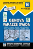
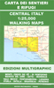
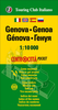
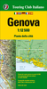
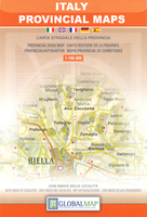
£4.99
Genoa & the Italian Riviera in the Pocket Guide series from Berlitz; a collection of handy, pocket-sized guides dedicated to an extensive range of cities, regions & countries worldwide. Written in narrative form, individual guides explore the history, main sights & attractions, food & drink, accommodation & local culture of the destination in detail. Each Berlitz pocket guide has a similar format, with colour-coded sections helping readers locate information quickly in addition to distinctive chapters exploring the city or region. An introduction outlines the destination for visitors & a section dedicated to 'A Brief History' actually explores the area in relative depth. A where to go chapter is organized by region & city & is written in prose form with references to individual sites highlighted in bold for clarity. There are also further suggestions on where & when to eat. Recommendations for leisure activities in the region, including sport, nightlife & shopping, are also provided & tailored accordingly for each destination. Handy travel tips are listed alphabetically in a dedicated section, providing practical guidance & helping visitors make the most of their stay. The main hotels, particularly for cities, are also listed in an accommodation section, offering a brief overview with approximate price bandings & relevant contact details. ...
Archived Product
£10.95
Genoa
- Varazze
- Ovada, map no. 16, in a series contoured hiking maps at 1:50, 000 with local trails, long-distance footpaths,

...
Archived Product
£13.99
The coast of the Italian Riviera & its hinterland around Genoa in a series contoured hiking maps at 1:50, 000 with local trails, long-distance footpaths, mountain accommodation, etc. from the Turin based Istituto Geografico Centrale. Maps in this series have contours at 50m intervals, enhanced by shading & graphic relief. An overprint highlights local footpaths & long-distance routes, including the GTA (Grande Traversata delle Alpi), Via Alpina, Tour Monte Rosa, & Alta Via del Monti Liguri
- the high level route along the Ligurian Alps. Difficult sections of the routes & the Via Ferrata passages are indicated. New editions now also include an overprint highlighting cycling routes, where indicated in the map’s individual description. The maps also show various types of alpine accommodation: refuges, shelters, hostels, campsites, etc. Cable car lines, chair lifts, & mountain railways are marked, as well as, for road users, entry restrictions on local tracks. Each map covers Approx. 50 x 40 km / 30 x 25 miles. The maps have no geographical coordinates. Map legend

Includes::
English. To see the other titles in this series please click on the series grid.


...
Archived Product
£12.99
Genoa
- Varazze, map no. 3/4, in a series of walking maps covering the Ligurian Alps & the coast, the crest of the Apennines
...
Archived Product
£6.99
This is the savvy city breakers' pocket guide to seeing & doing more in the sun-kissed maritime city of Genoa
- with a fun-seeking
...
Archived Product
£5.99
Central Genoa street plan on light, waterproof & tear-resistant pocket map with Touring Club Italiano’s excellent, clear cartography; indexed, with a diagram of the metro network, information about main sights, useful addresses, etc. The plan, printed on light, waterproof & tear resistant plastic paper, has clear, elegant cartography. Main traffic arteries are highlighted, but one way street are not indicated. Public buildings, including museums, churches, etc. are named. Unusually for street plans, in the hills outside the city centre the map has contours at 20m intervals to highlight the area’s hilly terrain. Street index is on the reverse. The plan is accompanied by a diagram of the metro network, a small map of the city’s environs, plus lists of main sights with opening hours, etc., & contact details of other useful institutions. Map legend & all information are in Italian & English. ...
Archived Product
£9.50
Genoa in a series of light, waterproof & tear-resistant street plans from Touring Club Italiano with the city’s historic centre shown at 1:6, 000, plus a road map of the environs. Clear, elegant cartography & subtle colouring make TCI plans particularly easy to read. The main plan at 1:12, 500 covers Genoa with its outer suburbs, extending along the coast from the airport & Sestri Ponente to Sturla in the east, & north beyond the A12 motorway. Main traffic arteries across the city are highlighted. Churches & other important historic or municipal buildings are prominently coloured & named. Unusually for street plans, outside the main built-up areas the map has contour lines at 25m intervals, highlighting the topography of the hills surrounding the city. Underground sections of the motorway network, such a great feature of this area, are clearly shown. Genoa’s historic centre is shown on an inset, enlarged to 1:6, 000. Pedestrianized streets & squares are clearly marked. Another inset shows the environs of the city at 1:90, 000. Map legend

Includes::
English. Street index in on the reverse of the map & has a list of useful addresses.

...
Archived Product
£5.95
Genoa in the Wallpaper* City Guide series, published by Phaidon & encompassing a collection of pocket-size guides dedicated to the best design elements in major cities. Compiled by experts at the Wallpaper* magazine, the guides are widely recognized for appealing to design-conscious travellers & are aimed at those interested in art, design & architecture. Each guide identifies the best bars, restaurants, hotels, places to shop, leisure activities & excursions with a unique emphasis on the finest examples of unusual architecture & design. Each Wallpaper* City Guide has the same layout, with separate tabs allowing readers & travellers to access individual sections easily. The tabs consist of Landmarks, Hotels, 24 Hours, Urban Life, Architour, Shopping, Sports & Escapes. High quality colour photographs appear alongside brief descriptions of each hotel, bar or attraction, highlighting distinctive & unusual styles of architecture & design. Extra pages are provided at the back of each guide, allowing readers to record their own notes & sketches. ...
Archived Product
£14.99
Genoa has an incredible story to tell. It rose from an obscurity imposed by its harsh geography to become a merchant-pirate superpower that helped create the medieval world. It fought bitter battles with its great rival Venice & imprisoned Marco Polo, as the feuding city states connected Europe to the glories of the East. It introduced the Black Death to Europe, led the fight against the Barbary Corsairs, bankrolled Imperial Spain, & gave the world Christopher Columbus & a host of fearless explorers. Genoa & Liguria provided the brains & the heroism behind the Risorgimento, & was the last place emigrants saw before building new lives across the Atlantic. It played host to writers & Grand Tourists, gave football to the Italians, & helped build modern Italy. Today, along with the glorious Riviera coast of Liguria, Genoa provides some of the finest places on earth to sip wine, eat pesto & enjoy spectacular views. This book brings the past alive & paints a portrait of a modern port city & region that is only now coming to terms with a past that is as bloody, fascinating & influential as any in Europe. ...
Archived Product
£18.99
Gentleman`s Umbrella with Vintage World Map by Rex International featuring a colourful up-to-date map of the world canopy, & a solid wood handle. The push of a button prompts the swift opening of this sturdy umbrella. Unique in style, this umbrella is the perfect way to brighten a rainy day & plan your next trip. Height 100cm, width when open 110cm ...
Archived Product

Genoa Province

Genoa Province in a series of handy size road maps from Litografia Artistica Cartografica (LAC) with more minor local roads and tracks than can be found on most regional maps. The series is gradually being changed to a new style of digitally derived cartography, so presentation of adjoining titles may vary.All the maps have hill shading to represent the general relief with spot heights for selected peaks, and show a few more local roads and rough tracks than the other road map series. Intermediate road distances are indicated. Regional, provincial and communal borders are marked, and railways, funiculars, airports, sea ferry links and campsites are shown. The legend is in Italian only. The new, digitally produced editions are indexed and have improved, more finely drawn
cartography: the hill-shading is less bold, motorway service areas are marked, natural parks are highlighted and an expanded range of symbols indicates various landmarks and sites, e.g. antiquities, churches, etc. Two styles of the new cartography are produced, differing only in the colour of the predominant background shading: grey or yellow/green. Some of the new editions include geographical coordinates for the map corners. The index of localities is on the reverse.This title is still produced in the traditional cartographic style.
RIP - This product is no longer available on our network. It was last seen on 25.09.2019

This page now acts as a permanent archive for this product. Add more information using the comments box below to ensure it can still be found by future generations.

Use our search facility to see if it is available from an alternative contributor.
  • Availability: Out Of Stock
  • Supplier: Stanfords
  • SKU: 9788879142045
Availability: In Stock
£7.95

Product Description

Genoa Province in a series of handy size road maps from Litografia Artistica Cartografica (LAC) with more minor local roads & tracks than can be found on most regional maps. The series is gradually being changed to a new style of digitally derived cartography, so presentation of adjoining titles may vary. All the maps have hill shading to represent the general relief with spot heights for selected peaks, & show a few more local roads & rough tracks than the other road map series. Intermediate road distances are indicated. Regional, provincial & communal borders are marked, & railways, funiculars, airports, sea ferry links & campsites are shown. The legend is in Italian only. The new, digitally produced editions are indexed & have enhanced, more finely drawn cartography: the hill-shading is less bold, motorway service areas are marked, natural parks are highlighted & an expanded range of symbols indicates various landmarks & sites, e.g. antiquities, churches, etc. Two styles of the new cartography are produced, differing only in the colour of the predominant background shading: grey or yellow/green. Some of the new editions include geographical coordinates for the map corners. The index of localities is on the reverse. This title is still produced in the traditional cartographic style.

Reviews/Comments

Add New

Price History

Vouchers

No voucher codes found.
Do you know a voucher code for this product or supplier? Add it to Insights for others to use.

Facebook

Jargon Buster

Grey - A colour often associated with old age (going grey)
Italian - A word used ot descibe something from Italy
Yellow - A primary colour. The sun is often described as yellow
Railways - A set of tracks that have been laid for the purpose of trains to travel up and down them
Colour - The categorised spectrum of light visable to humans
Size - is the measurement of how big an object is in space.
Natural - not manmade
Road - a manmade lane or a path that is used to speed up travel.
Traditional - Something that has become the same through a period of time and thus repeated.
Traditional - Something that has been around for a while and is repeated regularly.
Regional - An adjective to describe a set geographic area.
Borders - A line that sometimes can be built up separating off an area, e.g. countries "the welsh boarder"

Supplier Information

Stanfords
Stanfords was established in 1853 and opened their iconic Covent Garden flagship store in 1901. They have become the top retailer of maps, travel books and accessories in the UK and arguably offer the largest selection of maps and travel books worldwide. Famous names such as Captain Robert Falcon Scott, Ranulph Fiennes and Michael Palin have purchased from Stanfords. They now have a shop in Bristol and both stores together with other venues operate a calendar of events including talks, book signings and exhibitions. As a specialist map retailer, the map selection is comprehensive and includes road maps, street maps and walking maps from worldwide destinations, as well as a selection of world atlases and wall maps. Books include travel guides and travel literature. Stanfords also stock globes, from miniatures made of blue marble to magnificent floor-standing globes. The website features a selection of interesting articles on travel topics.
Page Updated: 2023-11-12 20:15:36

Community Generated Product Tags

Oh No! The productWIKI community hasn't generated any tags for this product yet!
Menu