
 United Kingdom
 France
 Germany
 Netherlands
 Sweden
 USA
USA
 Italy
Italy
 Spain
Spain
More From Contributor


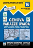

Genoa - Varazze - Ovada
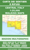
Genoa - Varazze - Ovada, map no. 16, in a series contoured hiking maps at 1:50, 000 with local trails, long-distance footpaths, mountain accommodation, etc. from the Turin based Istituto Geografico Centrale covering the Italian Alps and Piedmont, the lakes and northern Lombardy, and the Italian Riviera.The maps have contours at 50m intervals, enhanced by shading and graphic relief. An overprint highlights local footpaths and long-distance routes, including the GTA (Grande Traversata delle Alpi), Via Alpina, Tour Monte Rosa, and Alta Via del Monti Liguri - the high level route along the Ligurian Alps. Difficult sections of the routes and the Via Ferrata passages are indicated. New editions now also include an overprint highlighting cycling routes, where indicated in the map
Product Description
Reviews/Comments
Add New
Vouchers
No voucher codes found.
Do you know a voucher code for this product or supplier? Add it to Insights for others to use.
Do you know a voucher code for this product or supplier? Add it to Insights for others to use.
 Denmark