More From Contributor

£5.95
Folded version of the Geological Map of the British Islands at 1:1, 584, 000 (1” to 25 miles) from the British Geological Survey, showing the bedrock (formerly ‘solid’) geology of the whole of the UK, Irel&, the Channel Islands & part of the English Channel coastline of France. The disposition at surface (outcrops) of the major rock types & named rock units are shown, with a geological map key giving the scale of geochronological eras & chronostratigraphical systems. The currently available edition is a 2014 reprint of the map’s 5th edition originally published in 1969. The underlying base map shows important towns & cities, main roads, major rivers, significant topographical features, & pre-1965 counties. Please note: this map is also available as a wall map. ...
Archived Product
£16.50
A Geological Map of the World by the CGMW, designed to show the earth’s physiography while highlighting volcanoes & meteoric impact craters. This is sheet 1 of a pair of complementary geological maps, each annotated in English & French & accompanied by a booklet of extensive explanatory notes. Colour tinting represents land altimetry & ocean bathymetry, with the latter including isobaths at -200m, -500m then every 1000m. Ice cap altitude contours are at 1000m intervals. Relief-shading is also applied to accentuate significant relief features eg. mountain ranges. The world’s highest peaks, lowest depressions & the deepest ocean trench are highlighted & identified, & symbols denote active submarine volcanoes & onshore volcanoes
- active & recent (< 10, 000 yrs B.P.). Meteor impact craters are also shown, distinguishing between those greater or less than 10km in diameter. in addition, the location of the Tunguska airblast is indicated. The main map is Pacific-centred on a Mercator projection, with the two polar areas on stereographic projections (1:46, 0000, 000). Latitude & longitude lines are drawn at 10° intervals. NB. No location names are included on the map. The map legend is in English & French. The accompanying booklet (English only) explains content & sources for maps 1 & 2.1st edition. Published in 2009.
...
Archived Product
£36.95
A larger scale version of the Geological Map of the World
- Sheet 2, by the CGMW, with the same content of geology & structure
...
Archived Product
£36.95
A larger scale version of the Geological Map of the World
- Sheet 2, by the CGMW, with the same content of geology & structure
...
Archived Product
£12.99
Geological Structures is an easy-to-use, highly informative photographic field guide that introduces the great variety of geological structures to be found all around us. The authors` beautiful photography, extended captions & accessible text make interpreting & understanding geological structures simple, whether you`re an amateur enthusiast keen to learn or a more experienced geologist. The three main rock groups
- igneous, metamorphic & sedimentary
- & their related structures are each covered in detail, followed by sections focusing on folds & folding, faults & faulting, & unconformities. Structures & related landforms are illustrated in more than 200 detailed colour photographs & their helpful captions assist with identification in the field. Each geological account

Includes::
an indication of the structure`s formation & provides useful information on how to identify & understand its distinguishing features.


...
Archived Product
£17.99
Studying geology in the field will draw anyone curious about how our planet works into the field time & time again. Ireland is endowed with a spectacular variety of geology. The rocks that make up the island of Ireland offer a unique window into a 2-billion-year history, a history which

Includes::
almost all types of geological settings, including sedimentary basins, shallow tropical seas, high mountain ranges & active volcanoes. Seventeen field areas are described, showing how to venture into the field to explore the classic sites of Irish geology. Most excursions are on or near the coast & the variety of landscapes reflects the diversity of geology. Emphasis is placed on understanding processes that operated in the geological past to produce today`s rocks. Detailed `step-by-step` itineraries are provided & the material is presented in a manner accessible to the non-specialist.

...
Archived Product
£10.95
Geology of Svalbard from the Norsk Polarinstitutt: a slim but informative introduction to the diverse geology of Svalbard, which gives rise to its wide range of landscapes. The text, all in English & supported by colour photographs, diagrams & maps, deals with various topics e.g. the oldest rocks, sedimentary successions, fossils, plate tectonics, volcanic history, the ice age, landforms & fossil fuels. ...
Archived Product
£11.99
The Italians Have a Secret... There are said to be over 300 shapes of pasta, each of which has a history, a story to tell, & an affinity with particular foods. These shapes have evolved alongside the flavours of local ingredients, & the perfect combination can turn an ordinary gift into something sublime. The Geometry of Pasta pairs over 100 authentic recipes from critically acclaimed chef, Jacob Kenedy, with award-winning designer Caz Hildebrand's stunning black-&-white designs to reveal the science, history & philosophy behind spectacular pasta dishes from all over Italy. A striking fusion of design & food, The Geometry of Pasta tells you everything you need to know about cooking & eating pasta like an Italian. Praise for The Geometry of Pasta: Really delicious, authentic pasta recipes. (Jamie Oliver). The most delicious foodie publication of the year. (GQ). A maddeningly lovely book. (Stephen Bayley). ...
Archived Product
£19.99
Geomorphological map of the Byers Peninsula & Livingstone Island at 1:25, 000 from the British Antarctic Survey.PLEASE NOTE: to see the list of other detailed topographic & specialist maps from BAS please click on the series link. BAS maps of wider general interest are listed on our website in a separate series. ...
Archived Product
£11.50
Geoparque de las Sierras Subbeticas in Andalucía, roughly half Cordoba, on a very clear, contoured & GPS compatible map at 1:40, 000 from Editorial Piolet highlighting local walking trails including 10 recommended routes, long-distance hiking routes, Via Verde cycling trails, & various places of interest. Hiking maps in the Editorial Piolet series, unless indicated to the contrary in the individual description, have contours at 10m intervals, enhanced by relief shading and/or altitude colouring, & provide very detailed presentation of the terrain & local road network. An overprint highlights hiking routes, distinguishing between short local routes, longer PR paths & long-distance GR routes. Symbols mark campsites & mountain huts or refuges, various places of interest, climbing or other recreational areas, etc. Each title has a UTM grid. Map legend

Includes::
English. To see other titles in this series please click on the series link.

...
Archived Product

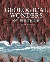
Geological Wonders Of Namibia

A beautiful depiction (with explanations) of geology in Namibia, from impact crater sites, meteorites, canyons and limestone caves to vast desert landscapes, moonscapes and bizarrely-shaped rocks, this picture-driven book will feature all the highlights of Namibian landscapes and landforms, with accessible brief explanations of the geology behind each of these.
RIP - This product is no longer available on our network. It was last seen on 25.09.2019

This page now acts as a permanent archive for this product. Add more information using the comments box below to ensure it can still be found by future generations.

Use our search facility to see if it is available from an alternative contributor.
  • External links may include paid for promotion
  • Availability: Out Of Stock
  • Supplier: Stanfords
  • SKU: 9781775842941
Availability: In Stock
£7.99

Product Description

A beautiful depiction (with explanations) of geology in Namibia, from impact crater sites, meteorites, canyons & limestone caves to vast desert landscapes, moonscapes & bizarrely-shaped rocks, this picture-driven book will feature all the highlights of Namibian landscapes & landforms, with accessible brief explanations of the geology behind each of these.

Reviews/Comments

Add New

Intelligent Comparison

Oooops!
We couldn't find anything!
Perhaps this product's unique.... Or perhaps we are still looking for comparisons!
Click to bump this page and we'll hurry up.

Price History

Vouchers

No voucher codes found.
Do you know a voucher code for this product or supplier? Add it to Insights for others to use.

Facebook

Jargon Buster

Feature - An attribute that makes something stand out.

Supplier Information

Stanfords
Stanfords was established in 1853 and opened their iconic Covent Garden flagship store in 1901. They have become the top retailer of maps, travel books and accessories in the UK and arguably offer the largest selection of maps and travel books worldwide. Famous names such as Captain Robert Falcon Scott, Ranulph Fiennes and Michael Palin have purchased from Stanfords. They now have a shop in Bristol and both stores together with other venues operate a calendar of events including talks, book signings and exhibitions. As a specialist map retailer, the map selection is comprehensive and includes road maps, street maps and walking maps from worldwide destinations, as well as a selection of world atlases and wall maps. Books include travel guides and travel literature. Stanfords also stock globes, from miniatures made of blue marble to magnificent floor-standing globes. The website features a selection of interesting articles on travel topics.
Page Updated: 2023-11-12 20:15:36

Community Generated Product Tags

Oh No! The productWIKI community hasn't generated any tags for this product yet!
Menu