
 United Kingdom
 France
 Germany
 Netherlands
 Sweden
 USA
USA
 Italy
Italy
 Spain
Spain
More From Contributor


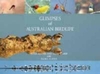


Glens Of Antrim Activity Map
Glens of Antrim Activity Map, including the Causeway Coast, at 1:25, 000 on a large, double-sided map published by the Ordnance Survey of Northern Ireland. Printed on water-resistant paper, the map is designed with outdoor enthusiasts in mind and shows hiking and cycling routes and tourist information for the area.Topographic base has contours at 10m intervals, with altitude colouring and graphics for rocks, scree, boulders, mud and shingle, different types of woodlands, etc. Road network indicates steep gradients and car parks, plus highlights scenic routes including the Causeway Coastal Route. The map also shows Sustrans National Cycle Network.Waymarked hiking paths are highlighted and a very wide range of symbols provides tourist information, indicating camping and caravan
sites, youth hostels, nature reserves, rock climbing and scuba diving sites, angling sites, museums, etc. The map has Irish national grid lines at 1km intervals.
sites, youth hostels, nature reserves, rock climbing and scuba diving sites, angling sites, museums, etc. The map has Irish national grid lines at 1km intervals.
Product Description
Reviews/Comments
Add New
Intelligent Comparison
Archived Product
Glens Of Antrim Activity Map Stanfords
£7.80
Vouchers
No voucher codes found.
Do you know a voucher code for this product or supplier? Add it to Insights for others to use.
Do you know a voucher code for this product or supplier? Add it to Insights for others to use.
 Denmark