More From Contributor

£11.19
Laminated waterproof edition of a detailed topographic map of Glenrothes North, Falkland & Lomond Hills from the Ordnance Survey Explorer series, covering Auchtermuchty & Cupar. Edition A1; Publication date March 2007 About this series: These highly detailed maps show all the administrative boundaries, settlements as small as isolated farms, the road network down to unfenced roads & country tracks, & field boundaries (hedges & drystone walls) which make navigation across the countryside much easier. Steep gradients on roads are indicated. Various landmarks, e.g. powerlines, archaeological sites, windmills, churches & lighthouses are shown & additional graphics indicate natural terrain features such as cliffs, scree, mud & vegetation variations. The contour interval is 5 metres in the lower parts of the country & 10 metres in the uplands, & spot heights are marked. Each map covers an area of 30 x 20km (i.e. approx. 19 x 12 miles), with some double-sided maps covering more, as indicated in the individual descriptions. The maps are fully GPS compatible, with the National Grid shown at 1km intervals & latitude & longitude indicated by margin ticks at 1'. The Explorer series has replaced the earlier, green-cover Pathfinder maps. The Explorer series is now complete & covers all of Engl&, Wales & Scotl&. Some sheets for popular areas like the National Parks are still branded as Outdoor Leisure (OL) maps, but are now included in this series as the cartography is the same as that in the Explorer Maps. The Explorer maps offer a substantial improvement on the Pathfinder series, with greater use of colour, larger area per map, & stronger emphasis on information for ramblers & tourists. This series is ideal for walking & other outdoor pursuits & each map shows a large amount of information for ramblers & tourists. Public rights of way are shown (except in Scotland), together with other routes with public access: National Trails & Recreational Paths, permitted paths & bridleways, & selected cycle routes. Open access land created under the Countryside & Rights of Way Act 2000 is marked. Tourist information

Includes::
caravan & camp sites, Park & Ride locations, recreation/leisure/sport centres, museums, historic buildings, English Heritage & National Trust sites, rural pubs, etc. The map legend is in English only, except for the tourist information content which is also in French & German.

...
Archived Product
£7.80
Glens of Antrim Activity Map, including the Causeway Coast, at 1:25, 000 on a large, double-sided map published by the Ordnance Survey of Northern Irel&. Printed on water-resistant paper, the map is designed with outdoor enthusiasts in mind & shows hiking & cycling routes & tourist information for the area. Topographic base has contours at 10m intervals, with altitude colouring & graphics for rocks, scree, boulders, mud & shingle, different types of woodlands, etc. Road network indicates steep gradients & car parks, plus highlights scenic routes including the Causeway Coastal Route. The map also shows Sustrans National Cycle Network. Waymarked hiking paths are highlighted & a very wide range of symbols provides tourist information, indicating camping & caravan sites, youth hostels, nature reserves, rock climbing & scuba diving sites, angling sites, museums, etc. The map has Irish national grid lines at 1km intervals. ...
Archived Product
£7.80
Glens of Antrim at 1:25, 000 on a large, double-sided Activity Map from the Ordnance Survey of Northern Ireland designed with outdoor enthusiasts in mind: waterproof & tear-resistant, topographic & GPS compatible, with hiking & cycling routes & tourist information for the area. Topographic base has contours at 10m intervals, with altitude colouring & graphics for rocks, scree, boulders, mud & shingle, different types of woodlands, etc. Road network indicates steep gradients & car parks, plus highlights scenic routes including the Causeway Coastal Route. The map also shows Sustrans National Cycle Network. Waymarked hiking paths are highlighted & a very wide range of symbols provides tourist information, indicating camping & caravan sites, youth hostels, nature reserves, rock climbing & scuba diving sites, angling sites, museums, etc. The map has Irish national grid lines at 1km intervals. To see the list of titles in this series please click on the series link. ...
Archived Product
£6.39
A detailed topographic map of Glen Shee & Braemar from the Ordnance Survey Explorer series, covering The Cairnwell & Glas Maol. Edition A1; Publication date May 2007 About this series: These highly detailed maps show all the administrative boundaries, settlements as small as isolated farms, the road network down to unfenced roads & country tracks, & field boundaries (hedges & drystone walls) which make navigation across the countryside much easier. Steep gradients on roads are indicated. Various landmarks, e.g. powerlines, archaeological sites, windmills, churches & lighthouses are shown & additional graphics indicate natural terrain features such as cliffs, scree, mud & vegetation variations. The contour interval is 5 metres in the lower parts of the country & 10 metres in the uplands, & spot heights are marked. Each map covers an area of 30 x 20km (i.e. approx. 19 x 12 miles), with some double-sided maps covering more, as indicated in the individual descriptions. The maps are fully GPS compatible, with the National Grid shown at 1km intervals & latitude & longitude indicated by margin ticks at 1'. The Explorer series has replaced the earlier, green-cover Pathfinder maps. The Explorer series is now complete & covers all of Engl&, Wales & Scotl&. Some sheets for popular areas like the National Parks are still branded as Outdoor Leisure (OL) maps, but are now included in this series as the cartography is the same as that in the Explorer Maps. The Explorer maps offer a substantial improvement on the Pathfinder series, with greater use of colour, larger area per map, & stronger emphasis on information for ramblers & tourists. This series is ideal for walking & other outdoor pursuits & each map shows a large amount of information for ramblers & tourists. Public rights of way are shown (except in Scotland), together with other routes with public access: National Trails & Recreational Paths, permitted paths & bridleways, & selected cycle routes. Open access land created under the Countryside & Rights of Way Act 2000 is marked. Tourist information

Includes::
caravan & camp sites, Park & Ride locations, recreation/leisure/sport centres, museums, historic buildings, English Heritage & National Trust sites, rural pubs, etc. The map legend is in English only, except for the tourist information content which is also in French & German.

...
Archived Product
£16.99
This beautifully photographed book captures the variety & brilliance of Australian birds in their natural habitat. Glimpses of Australian Birdlife by Sally Elmer & Peter Slater features stunning photos of small & large bush-birds & waterbirds, as well as a brief passage about how the photo was taken. The authors have spent many days travelling Australia to catch a glimpse of these birds, photographing them in flight, resting, hunting for prey & nesting. Short poems & haikus, by Peter Slater, accompany some of the images. A visual delight, Glimpses of Australian Birdlife would make a wonderful gift for nature lovers or those interested in nature. ...
Archived Product
£13.99
This is a complete, two-volume set of one of the greatest books on 19th century Japanese history & culture. Though Lafcadio Hearn went on to write a dozen more books on Japan, this collection of first impressions remains his most popular. Among the reasons is that here, more than anywhere else, the author most vividly captured a place that so affected him that he stayed for the rest of his life. The modern reader can still, through these pages, experience that first charm of Japan, intangible & volatile as a perfume. Glimpses of Unfamiliar Japan combines two volumes of a work that first appeared in 1894. In the pages of this book are the customs, the superstitions, the charming scenery, the revelations of Japanese character, & all the other elements that Lafcadio Hearn found so bewitching. Here, for example, are essays on such subjects as the Japanese garden, the household shrine, the festivals, & the bewildering Japanese smile; all aspects of Japanese life that have endured in spite of the changes that have taken place during the modernization of Japan. The Japanese character & the Japanese tradition are still fundamentally the same as Hearn found them to be, & for this reason his writing is still extremely revealing to modern readers. This edition also contains a new foreword by noted writer & examiner of Japanese culture Donnie Richie that puts Lafcadio Hearn & his classic works into perspective for readers just discovering Hearn`s writing for the first time. ...
Archived Product
£6.99
Gloria the rhino LOVES glitter. It`s her favourite colour (even though everyone knows glitter isn`t a real colour). Everywhere Gloria goes, she leaves a little bit of glittery happiness behind her. But BEWARE! Once glitter gets out of the pot, it goes EVERYWHERE! Uh-oh! This hilarious new book from Stella J Jones (The Very Grumpy Day) & Judi Abbot (Train!) is a sparkly celebration of glitter & the little ones who love it. With glorious glitter on every page, children won`t be able to resist reading this fabulous story again & again! ...
Archived Product
£23.99
Glittertinden area in Norway in a series of GPS compatible recreational maps at 1:25, 000 with cartography based on the country’s topographic survey & additional tourist information. The base map is an enlargement of the standard 1:50, 000 topographic survey series. Contours lines are drawn at 20m intervals. The overprint varies from title to title, but

Includes::
local footpaths, in some cases distinguishing between easy & more difficult trails, as well as mountain huts & campsites. Many titles also indicate cycle, ski or canoeing routes, other accommodation possibilities, sport & recreational facilities, including alpine skiing slopes, places of interest, etc. The maps have a UTM grid & margin ticks giving latitude & longitude. Map legend

Includes::
English. Several titles have on the reverse additional tourist information, although in most cases in Norwegian only. To see the list of Turkart maps at 1:25, 000 & links to Turkart series at 50K, 100K & Hiking Sets please click on the series link above.


...
Archived Product
£5.99
Brightly coloured luggage ID tags in a twin pack. Double your chances of quick recognition of your bags in the arrivals hall. Available in Glo green, Glo orange or Glo pink.- Vibrant colours identify cases & bags- Snap-lock casement conceals personal details- 2 tags per pack- Made from plastic ...
Archived Product
£19.99
In six lively chapters organized by continent, each illustrated with 30-40 photographs & artwork & a map, this new book will help you discover where the birds are whether in Mexico & southern Europe or in the distant, mythic Galapagos, Korea, & Antarctica. In depth, instructive, but engaging text of 100, 000 words is accompanied sidebars, lists of each area's most spectacular birds, & easy-access information about each place, the best time to visit, & what to expect. Spectacular photographs will make this a gorgeous gift book as well as practical reference. Each main chapter will begin with chapter-opener photo spread across one or two pages showing a typical habitat scene filled with birds of the continent addressed in the chapter. Each of the six main chapters will have 10 photos of exotic birding locations, such as the Pantanal region of Brazil, with its blue-violet Hyacinth Macaws; or photos of famous nature lodges that cater to birders, such as O' Reilly's Rainforest Guesthouse, near Brisbane, Australia. The most beautiful & sought-after birds of each region
- about 20 per chapter
- will be illustrated by some of the best bird photographers in the world. In addition, 8-10 maps will round out the coverage.

...
Archived Product

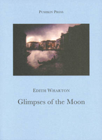
Glimpses Of The Moon

A young couple`s love is threatened by the destructive power of money Nick Lansing and Susy Branch are young, attractive, but impoverished New Yorkers. They are in love and decide to marry, but realise their chances of happiness are slim without the wealth and society that their more privileged friends take for granted. Nick and Susy agree to separate when either encounters a more eligible proposition. However, as they honeymoon in friends` lavish houses, from a villa on Lake Como to a Venetian palace, jealous passions and troubled consciences cause the idyll to crumble. Edith Wharton has perceptively described the choices faced by Nick and Susy; the same dilemma still facing those seduced by the pleasures of society. `Wharton`s unjustly neglected novel...a luscious, worldly,
sensuous read, surely the equal of its most obvious offspring - Tender is the Night.` BOYD TONKIN, Independent Edith Wharton was born in 1862 in New York, into a rich and socially prominent family. She began to write at an early age, although it was a habit viewed by her family as unsuitable for a woman of her social class. In 1885 she married Edward `Teddy` Wharton, a Boston banker.They lived a privileged life, but Wharton gradually grew dissatisfied with the roles of wife and society matron. The Whartons moved to Paris in 1907 and divorced in 1913. Edith continued to live in France, her beloved adoptive home, until her death in 1937.
RIP - This product is no longer available on our network. It was last seen on 25.09.2019

This page now acts as a permanent archive for this product. Add more information using the comments box below to ensure it can still be found by future generations.

Use our search facility to see if it is available from an alternative contributor.
  • Availability: Out Of Stock
  • Supplier: Stanfords
  • SKU: 9781901285567
Availability: In Stock
£12.00

Product Description

A young couple`s love is threatened by the destructive power of money Nick Lansing & Susy Branch are young, attractive, but impoverished New Yorkers. They are in love & decide to marry, but realise their chances of happiness are slim without the wealth & society that their more privileged friends take for granted. Nick & Susy agree to separate when either encounters a more eligible proposition. However, as they honeymoon in friends` lavish houses, from a villa on Lake Como to a Venetian palace, jealous passions & troubled consciences cause the idyll to crumble. Edith Wharton has perceptively described the choices faced by Nick & Susy; the same dilemma still facing those seduced by the pleasures of society. ` Wharton`s unjustly neglected novel...a luscious, worldly, sensuous read, surely the equal of its most obvious offspring
- Tender is the Night.` BOYD TONKIN, Independent Edith Wharton was born in 1862 in New York, into a rich & socially prominent family. She began to write at an early age, although it was a habit viewed by her family as unsuitable for a woman of her social class. In 1885 she married Edward ` Teddy` Wharton, a Boston banker. They lived a privileged life, but Wharton gradually grew dissatisfied with the roles of wife & society matron. The Whartons moved to Paris in 1907 & divorced in 1913. Edith continued to live in France, her beloved adoptive home, until her death in 1937.

Reviews/Comments

Add New

Intelligent Comparison

Oooops!
We couldn't find anything!
Perhaps this product's unique.... Or perhaps we are still looking for comparisons!
Click to bump this page and we'll hurry up.

Price History

Vouchers

No voucher codes found.
Do you know a voucher code for this product or supplier? Add it to Insights for others to use.

Facebook

Jargon Buster

New York - A United States State. Commonly known as the Big Apple
France - A state situated in Western Europe with several overseas territories.
Friends - A close associate or a popular US based sitcom about a group of friends
Love - Someone who shows deep affection for someone else.
Home - A place of permanent residence for families.
Unsuitable - Something that is not correct to use for a particular purpose.
Family - A group of people that live together made up from parents and children.

Supplier Information

Stanfords
Stanfords was established in 1853 and opened their iconic Covent Garden flagship store in 1901. They have become the top retailer of maps, travel books and accessories in the UK and arguably offer the largest selection of maps and travel books worldwide. Famous names such as Captain Robert Falcon Scott, Ranulph Fiennes and Michael Palin have purchased from Stanfords. They now have a shop in Bristol and both stores together with other venues operate a calendar of events including talks, book signings and exhibitions. As a specialist map retailer, the map selection is comprehensive and includes road maps, street maps and walking maps from worldwide destinations, as well as a selection of world atlases and wall maps. Books include travel guides and travel literature. Stanfords also stock globes, from miniatures made of blue marble to magnificent floor-standing globes. The website features a selection of interesting articles on travel topics.
Page Updated: 2023-11-12 20:15:36

Community Generated Product Tags

Oh No! The productWIKI community hasn't generated any tags for this product yet!
Menu