
 United Kingdom
 France
 Germany
 Netherlands
 Sweden
 USA
USA
 Italy
Italy
 Spain
Spain
More From Contributor

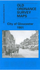


Gloucester North West 1901
Gloucester North West in 1901 in a fascinating series of reproductions of old Ordnance Survey plans in the Alan Godfrey Editions, ideal for anyone interested in the history of their neighbourhood or family. Gloucester is covered by four maps. This title covers the north-western area of Gloucester, including the Docks. The River Severn runs through the map, with the East Channel curving round towards the city. The map includes the prison (left blank as usual for security reasons), The Docks, Victoria Dock (in the south-eastern corner), Barge Arm, Llanthony Dock, Lower Westgate Street, Over Causeway, Archdeacon Meadow, The Island, Castle Meads, Sud Meadow, Oxlease, Port Ham, Town Ham, GWR Docks Branch, stretch of main GWR line with Over Junction, Over Bridge, part of Over
including Dog Inn, Over Farm. On the reverse are extracts from an 1894 directory, including private residents A to Ha.About the Alan Godfrey Editions of the 25” OS SeriesSelected towns in Great Britain and Ireland are covered by maps showing the extent of urban development in the last decades of the 19th and early 20th century. The plans have been taken from the Ordnance Survey mapping and reprinted at about 15 inches to one mile (1:4, 340). On the reverse most maps have historical notes and many also include extracts from contemporary directories. Most maps cover about one mile (1.6kms) north/south, one and a half miles (2.4kms) across; adjoining sheets can be combined to provide wider coverage.FOR MORE INFORMATION AND A COMPLETE LIST OF ALL AVAILABLE TITLES PLEASE CLICK ON THE
SERIES LINK.

Product Description
Reviews/Comments
Add New
Intelligent Comparison
Archived Product

Gloucester South East 1901 Stanfords
£3.50
Archived Product

Leicester North West 1902 Stanfords
£3.50
Archived Product
Worcester North-West 1902 Stanfords
£3.50
Archived Product

Leicester North East 1913 Stanfords
£3.50
Archived Product
Worcester North-East 1902 Stanfords
£3.50
Archived Product
Worcester South-West 1902 Stanfords
£3.50
Archived Product

Bury North West 1908 Stanfords
£3.50
Archived Product

Gloucester South West And Hempsted 1901 Stanfords
£3.50
Vouchers
No voucher codes found.
Do you know a voucher code for this product or supplier? Add it to Insights for others to use.
Do you know a voucher code for this product or supplier? Add it to Insights for others to use.
 Denmark