
 United Kingdom
 France
 Germany
 Netherlands
 Sweden
 USA
USA
 Italy
Italy
 Spain
Spain
More From Contributor


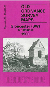
Gloucester South West And Hempsted 1901
Gloucester South West and Hempsted in 1901 in a fascinating series of reproductions of old Ordnance Survey plans in the Alan Godfrey Editions, ideal for anyone interested in the history of their neighbourhood or family. Gloucester is covered by four maps. In this title The Gloucester area includes the Bristol Road southward to Tuffley Avenue, with a mile-long stretch of the Gloucester & Berkeley Canal. Features include Monk Meadow Dock, Baker`s Quay, Llanthony Priory remains, St Luke`s church, match factory, Railway Carriage & Wagon Works, Atlas Engineering Works, tramway, timber yards, High Orchard Wharf, High Orchard, malthouses, Midland Railway New Docks Branch, Llanthony Abbey Farm. The Hempsted area includes Hempsted Court, Newark Farm, St Swithin`s church, Newark,
site of Roman Camp. On the reverse are extracts from an 1894 directory, including private residents Ha to Y.About the Alan Godfrey Editions of the 25” OS SeriesSelected towns in Great Britain and Ireland are covered by maps showing the extent of urban development in the last decades of the 19th and early 20th century. The plans have been taken from the Ordnance Survey mapping and reprinted at about 15 inches to one mile (1:4, 340). On the reverse most maps have historical notes and many also include extracts from contemporary directories. Most maps cover about one mile (1.6kms) north/south, one and a half miles (2.4kms) across; adjoining sheets can be combined to provide wider coverage.FOR MORE INFORMATION AND A COMPLETE LIST OF ALL AVAILABLE TITLES PLEASE CLICK ON THE SERIES LINK.
site of Roman Camp. On the reverse are extracts from an 1894 directory, including private residents Ha to Y.About the Alan Godfrey Editions of the 25” OS SeriesSelected towns in Great Britain and Ireland are covered by maps showing the extent of urban development in the last decades of the 19th and early 20th century. The plans have been taken from the Ordnance Survey mapping and reprinted at about 15 inches to one mile (1:4, 340). On the reverse most maps have historical notes and many also include extracts from contemporary directories. Most maps cover about one mile (1.6kms) north/south, one and a half miles (2.4kms) across; adjoining sheets can be combined to provide wider coverage.FOR MORE INFORMATION AND A COMPLETE LIST OF ALL AVAILABLE TITLES PLEASE CLICK ON THE SERIES LINK.

Product Description
Reviews/Comments
Add New
Intelligent Comparison
Archived Product

Gloucester South East 1901 Stanfords
£3.50
Archived Product

Gloucester North West 1901 Stanfords
£3.50
Archived Product
Bristol South West And Bedminster 1902 Stanfords
£3.50
Vouchers
No voucher codes found.
Do you know a voucher code for this product or supplier? Add it to Insights for others to use.
Do you know a voucher code for this product or supplier? Add it to Insights for others to use.
 Denmark