More From Contributor

£8.95
The A-Z Adventure Series of maps combines the best of OS & A-Z, creating the perfect companion for walkers, off-road cyclists, horse riders & anyone wishing to explore the great outdoors. Glyndwr`s Way is a 135 mile (217 km) National Trail in mid-Wales from Knighton to Welshpool via Machynlleth. Linking locations connected with Owain Glynd rs, the trail passes through the tranquil Radnorshire Hills & across open moorland & rolling farmland with views over Cadair Idris & Lake Vyrnwy. The route on the map is clearly highlighted in yellow with mileage markers to gauge distances when planning sections of the walk to enjoy. This official National Trail Map of Glyndwr`s Way features 43 pages of continuous Ordnance Survey 1:25000 mapping providing complete coverage of Glynd r`s Way. The atlas

Includes::
a route planner showing distances between places & the amenities available, featuring: Information Centres, Hotels/B& Bs, Youth Hostels, Campsites (seasonal opening), Public Houses, Shops, Restaurants, Cafes (seasonal opening) & Petrol Stations. Also featured is advice on safety & security when walking & a selection of QR codes linked to useful websites, including temporary route updates from the National Trails, regional information, map reading advice & weather reports. Unlike the original OS sheets, this A-Z Adventure Atlas

Includes::
a comprehensive index to towns, villages, hamlets & locations, natural features, nature reserves, car parks & youth hostels, making it easy to find the required location quickly.


...
Archived Product
£13.95
Glyndwr`s Way, a 217km / 135 mile long trail from Knighton in Powys to Welshpool presented at 1:40, 000 on a GPS compatible, light, waterproof & tear-resistant map from Harvey Map Services. The whole route is covered on eight overlapping panels. Map legend

Includes::
Welsh; most of the additional information is in English only. Maps in the Harvey’s series covering Great Britain’s national trails & other long-distance footpaths are printed on light, waterproof & tear-resistant synthetic paper & cover the routes at 1:40, 000 or 1:60, 000. Topography is shown by contours at 15m intervals, with additional spot heights plus colouring and/or graphics to provide a very detailed picture of the terrain (boulder fields, scree, crags, etc) & vegetation / land use (pastures, moorl&, woodlands, etc). In Scotland peaks & hills classified as Munros, Corbetts & Donalds are marked. The overprint for the long-distance trail shows sections on local or main roads (highlighting danger points), on tracks, & on footpaths, indicating intermittent or not visible paths. The maps also show other right of way paths, including permissive paths & bridleways. Symbols indicate various facilities & accommodation options (including campsites & youth hostels), pubs & refreshments, food shops, banks, information points, etc, both along the route itself & in the nearby locations. All maps are GPS compatible, with the British National Grid overprinted on each panel. The maps also include useful contact details & general advice. To see other titles in this series please click on the series link.

...
Archived Product
£9.95
Glyph is a visual exploration of marks & glyphs in the Latin alphabet
- some that we use every day, & some of which have been
...
Archived Product
£110.00
The GMDSS Manual provides, in a single comprehensive publication, an explanation of the principles upon which the GMDSS is based, the radiocommunication requirements & recommendations for its implementation, the operational performance standards & technical specifications to be met by GMDSS equipment, & the procedures for & method of operation of the various radio services which form the GMDSS & the Master Plan for the GMDSS. The 2017 edition is fully updated &
Includes::• A description of the development & the concepts of the GMDSS• A description of the components of the GMDSS, the carriage requirements & the operational procedures• Excerpts from the relevant SOLAS regulations for the GMDSS• Supporting resolutions & circulars relevant to the GMDSS• The IMO performance standards & related ITU-R Recommendations giving the technical detail of the radio equipment• The Joint IMO/IHO/WMO Manual on Maritime Safety Information (2015)• The NAVTEX Manual (2017)• The International Safety NET Manual (2017)• The current GMDSS Master Plan giving the details of the coastal infrastructure & services provided by member administrations• Extracts from the ITU-R Radio Regulations giving the radio regulatory background. The Manual is intended for use by ship personnel, shore operators, trainers, administrations, regulators & anyone else concerned with ship communication.
...
Archived Product
£70.00
Chapter IV of the International Convention for the safety of Life at Sea (SOLAS) & the regulations of the International Telecommunicaton Union (ITU) require that all GMDSS ships keep a radio log in a specified format & that certain items are recorded therein. This radio log book must be kept close to the radio installation & must be completed & retained onboard for inspection by any authorized person. The master of the ship is required to review the entries in this radio log on a daily basis & to countersign Section C of the log book to this effect. ...
Archived Product
£20.00
The Global Maritime Distress & Safety System (GMDSS)
- the maritime equivalent to the emergency services number
- provides a

...
Archived Product
£16.99
Topographic survey of Sweden at 1:50, 000, the Terrängkartan, from the Lantmäteriet, covering most of the country in 244 double-sided maps. Please note: the mountainous regions of central & northern Sweden are not covered by this series but presented in a separate “ Fjällkartan
- Mountain Map” series also listed on our website. Each 1:50, 000 topographic survey map covers an area of 37.5 x 40km. The maps have contours at 5 metre intervals, plus relief shading & graphics for rocky outcrops & boulders. Further graphics and/or colouring show different types of land use or vegetation (forests, arable l&, orchards, marshes, peat bogs, etc). An unusual feature of this survey is the colouring indicating buildings below or above two storeys high & “leisure/holiday homes”. The maps indicate privately maintained roads & include all other information expected of topographic survey at this scale. The maps have a 1-km UTM grid, plus latitude & longitude lines 5’ intervals. Map legend

Includes::
English. For coverage of the country’s most visited hiking areas in central & northern Sweden please see Lantmäteriet’s Mountain Map series, listed separately on our website.


...
Archived Product
£12.99
Barbara Cassani set up the no-frills airline GO for British Airways. She was a rare breed. A female airline chief executive who believed in doing things differently. Her European low-cost operation was launched in May 1998 with GBP25 million backing & within three years she took it into profit. Riding high, she led a management buy-out from BA, supported by the venture capitalist outfit 3i. They paid GBP110 million for the airline. Yet, less than a year later the venture capital group
- battered by a falling stock market
- had a chance to cash in their chips. GO was sold to arch-rival easy Jet for an astonishing GBP374 million. At at time when the airline industry is of great interest to the public as well as being in flux, this fast-paced read gives a fascinating insight into how to create a successful company with limited resources in such a short space of time. THE GO STORY is filled with real characters overcoming the odds to achieve great things & shows the remarkable vision & talent of the author, Barbara Cassani.

...
Archived Product
£30.00
This unique cushion by We Love Cushions, featuring a 12-color reproduction of a wood painting by Martin Wiscombe, the contemporary artist who rediscovered the lost world of the 1950s. It would definitely be a sophisticated addition to your sofa or arm chair. This cushion is made with a super soft faux & machine washable suede & comes complete with the cushion pad. The print had been created using archival inks to get the brightest, saturated finish possible, which will bring life & style to any room setting. Fully machine washable at 30c ...
Archived Product
£9.99
The 3 in 1 filter eliminates over 99.9% of all bacteria, viruses, chlorine, fluoride & heavy metals such as lead, from your water leaving you with safe, healthy water. Each filter that lasts Approx. 2 months (it filters 130 litres) &

Includes::
a unique timer to track the filter life. Available in six colours.

...
Archived Product

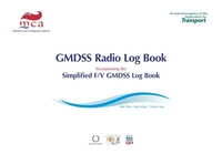
GMDSS Radio Log Book: Incorporating The Simplified F/V GMDSS Log Book

Includes fields for:Date & Time (UTC)Station toStation fromOperators actions/remarks, Log in/outFrequesncy, Channel or SatelliteAlso included are two chapters with instructions on how to keep this radio log and equipment tests and reserve energy checks.
RIP - This product is no longer available on our network. It was last seen on 25.09.2019

This page now acts as a permanent archive for this product. Add more information using the comments box below to ensure it can still be found by future generations.

Use our search facility to see if it is available from an alternative contributor.
  • External links may include paid for promotion
  • Availability: Out Of Stock
  • Supplier: Stanfords
  • SKU: 9780115530265
Availability: In Stock
£16.00

Product Description


Includes: fields for: Date & Time (UTC) Station to Station from Operators actions/remarks, Log in/out Frequesncy, Channel or Satellite Also included are two chapters with instructions on how to keep this radio log & equipment tests & reserve energy checks.

Reviews/Comments

Add New

Intelligent Comparison

Oooops!
We couldn't find anything!
Perhaps this product's unique.... Or perhaps we are still looking for comparisons!
Click to bump this page and we'll hurry up.

Price History

Vouchers

No voucher codes found.
Do you know a voucher code for this product or supplier? Add it to Insights for others to use.

Facebook

Jargon Buster

Radio - A device used for listening to audio transmissions
Date - A day on a calendar
Date - A social activity whith a current or potential partner
Equipment - A product or good that is tactile.
Instructions - An informative direction to take.

Supplier Information

Stanfords
Stanfords was established in 1853 and opened their iconic Covent Garden flagship store in 1901. They have become the top retailer of maps, travel books and accessories in the UK and arguably offer the largest selection of maps and travel books worldwide. Famous names such as Captain Robert Falcon Scott, Ranulph Fiennes and Michael Palin have purchased from Stanfords. They now have a shop in Bristol and both stores together with other venues operate a calendar of events including talks, book signings and exhibitions. As a specialist map retailer, the map selection is comprehensive and includes road maps, street maps and walking maps from worldwide destinations, as well as a selection of world atlases and wall maps. Books include travel guides and travel literature. Stanfords also stock globes, from miniatures made of blue marble to magnificent floor-standing globes. The website features a selection of interesting articles on travel topics.
Page Updated: 2023-11-12 20:15:36

Community Generated Product Tags

Oh No! The productWIKI community hasn't generated any tags for this product yet!
Menu