
 United Kingdom
 France
 Germany
 Netherlands
 Sweden
 USA
USA
 Italy
Italy
 Spain
Spain
More From Contributor


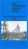
Gorleston 1904
Gorleston in 1904 in a fascinating series of reproductions of old Ordnance Survey plans in the Alan Godfrey Editions, ideal for anyone interested in the history of their neighbourhood or family. Selected towns in Great Britain and Ireland are covered by maps showing the extent of urban development in the last decades of the 19th and early 20th century.In this title: Yarmouth and Gorleston area is covered by four maps. The southern three include areas of Suffolk - the relevant Suffolk sheet numbers being 2.03, 2.07 and 2.11. GREAT YARMOUTH NORTH map covers the northern part of Yarmouth from St Nicholas church northward. Features include Vauxhall station, Runham Vauxhall, Workhouse, Old and New Cemeteries, Beach station, Breydon Viaduct, St Nicholas church, Old Recreation Ground,
Falcon Brewery, tramways, railway approaches, Infectious Diseases Hospital, Vauxhall Bridge, etc. On the reverse we include extracts from a directory re councillors and public establishments. GREAT YARMOUTH map covers the centre of Yarmouth, stretching from St Nicholas Road and Priory Plain southward to the Royal Naval Hospital, and from the coast inland to the Midland & Gt Northern railway (but note that the main station is north of this map). Features include the River Yare, East Suffolk line with station, Southtown, Cobholm Island, Market Place, King Street, St Georges Park, Britannia Pier, The Jetty, Wellington Pier, Winter Gardens, tramways, Town Hall, South Quay, railway lines along quay. A major feature is the extraordinary range of narrow yards, streets and
rows on what was the medieval centre; many of these disappeared during bombing in the 2nd World War. On the reverse directory extracts lists the private residents A-H. YARMOUTH SOUTH and GORLESTON NORTH map continues coverage southward to Gorleston Priory. Features here include the Royal Artillery Barracks, Nelson's Monument, South Beach, Fish Wharf, Southtown Common, Gorleston North station, Malthouse Quay, Otter's Farm, northern part of Gorleston High Street. Coverage extends west into countryside and Bradwell House and Gapton Hall. Yarmouth directory entries H-Z are included. GORLESTON map shows the centre of Gorleston, with coverage continuing south to Gorleston-on-Sea station. Features include St Andrew's church, South Pier, lighthouses at harbour entrance, Cliff Hotel,
Brush Quay, West Quay, Ballast Quay, High St, Pier Plain, Lowestoft Road, cemetery, Shrubland Farm, isolation hospital. A directory of Gorleston is included. About the Alan Godfrey Editions of the 25
Product Description
Reviews/Comments
Add New
Intelligent Comparison
Archived Product

Gorleston 1904 Stanfords
£3.50
Archived Product
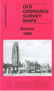
Boston 1904 Stanfords
£3.50
Archived Product

Garston 1905 Stanfords
£3.50
Archived Product
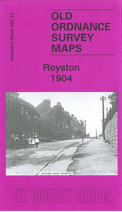
Royston 1904 Stanfords
£3.50
Archived Product
Garston 1905 Stanfords
£2.95
Archived Product
Woolton 1904 Stanfords
£2.95
Archived Product

Woolton 1904 Stanfords
£3.50
Archived Product

Folkestone 1906 Stanfords
£3.50
Vouchers
No voucher codes found.
Do you know a voucher code for this product or supplier? Add it to Insights for others to use.
Do you know a voucher code for this product or supplier? Add it to Insights for others to use.
 Denmark