
 United Kingdom
 France
 Germany
 Netherlands
 Sweden
 USA
USA
 Italy
Italy
 Spain
Spain
More From Contributor

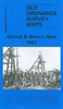


Gorton And Belle Vue 1905
Gorton and Belle Vue in 1905 in a fascinating series of reproductions of old Ordnance Survey plans in the Alan Godfrey Editions, ideal for anyone interested in the history of their neighbourhood or family. The map covers the area of south-east Manchester around Belle Vue, extending eastward to Gorton. Coverage stretches from Slade Lane eastward to Hyde Road station, and from Hector Street northward to Great Jackson Street. Features include Belle Vue Zoological Gardens, Nutsford Vale, St Cyprian`s church, Kirkmanshulme House, football ground, Imperial Brewery, tramways, Tarpaulin Works, sewage works, Catsknowl, Gorton Park, railway stretches with Belle Vue station, St Philip`s church, Unitarian church, Rider Brow, Spring Hill Farm, Sunny Brow Park, St James church,
Gorton Mills, Victoria Works, etc. On the reverse is a selection of street directory entries, including Belle Vue Street, Church Lane, Cross Street and Hyde Road. About the Alan Godfrey Editions of the 25” OS Series:Selected towns in Great Britain and Ireland are covered by maps showing the extent of urban development in the last decades of the 19th and early 20th century. The plans have been taken from the Ordnance Survey mapping and reprinted at about 15 inches to one mile (1:4, 340). On the reverse most maps have historical notes and many also include extracts from contemporary directories. Most maps cover about one mile (1.6kms) north/south, one and a half miles (2.4kms) across; adjoining sheets can be combined to provide wider coverage.FOR MORE INFORMATION AND A COMPLETE LIST
OF ALL AVAILABLE TITLES PLEASE CLICK ON THE SERIES LINK.

Product Description
Reviews/Comments
Add New
Vouchers
No voucher codes found.
Do you know a voucher code for this product or supplier? Add it to Insights for others to use.
Do you know a voucher code for this product or supplier? Add it to Insights for others to use.
 Denmark