More From Contributor

£6.99
There are musical goings-on at Ghastly-Gorm Hall & a spooky mystery for Ada Goth to solve in Goth Girl & the Sinister Symphony, the fourth book in the Costa Children`s Book Award winning Goth Girl series by Chris Riddell, Children`s Laureate 2015-2017. Lord Goth is throwing a music festival at Ghastly-Gorm Hall, with performances from the finest composers in the l&. Ada can`t wait, but it`s quite distracting when her grandmother is trying to find her father a fashionable new wife, there`s a faun living in her wardrobe & Maltravers is up to his old tricks. Ada must make sure everything goes to plan, & luckily help is at hand from a very interesting house guest... ...
Archived Product
£10.99
People are flocking to Ghastly-Gorm Hall from far & wide to compete in Lord Goth`s Literary Dog Show. The esteemed judges are in place & the contestants are all ready to win. Sir Walter Splott is preparing his Lanarkshire Lurcher, Plain Austen is preening her Hampshire Hound & Homily Dickinson & her Yankee Poodle are raring to go. But there`s something strange going on at Ghastly-Gorm
- mysterious footprints, howls in the night & some suspiciously chewed shoes. Can Ada, the Attic Club & their new friends the Vicarage sisters work out what`s going on before the next full moon? The third book in the Goth Girl series.
...
Archived Product
£11.99
Map No. 857, Gotha
- Erfurt
- Weimar
- Thüringer Becken
- Saale
- Unstrut
- Triasland (2-map set), including a


...
Archived Product
£16.99
Topographic survey of Sweden at 1:100, 000, the Vägkartan, from the Lantmäteriet, covering most of the country in 79 double-sided maps. Please note: the mountainous regions of central & northern Sweden are not covered by this series but presented in a separate “ Fjällkartan
- Mountain Map” series also listed on our website. Each 1:100, 000 topographic survey map covers an area of 75 x 80km. The maps have contours at 10 metre intervals, plus relief shading & colouring for different types of landscape: open l&, forests, alvar, marshes, etc. Boundaries of national parks & nature reserves, areas prohibited to cross-country vehicles, & restricted entry military zones are marked. The maps indicate privately maintained local roads, cycle paths with wind shelters, footpaths, etc, & include all other information expected of topographic survey at this scale. The maps have a 2-km UTM grid, plus latitude & longitude lines 10’ intervals. Map legend

Includes::
English. For coverage of the country’s most visited hiking areas in central & northern Sweden please see Lantmäteriet’s Mountain Map series, listed separately on our website.


...
Archived Product
£6.99
This is the savvy city breakers' pocket guide to seeing & doing more in the shopping capital of Scandinavia
- with a fun-seeking
...
Archived Product
£16.99
Sverigeserien is an outdoor map series consisting of 116 sheets with coverage of southern & central Sweden & the northern coastline. The map is suitable for outdoor activities such as hiking, excursions, trail running, hunting, fishing, riding, cycling, mountain biking, paddling, skating & much more. Every sheet covers an area of 45x 68km. These topographical maps in scale 1:50 000 contain all the information needed for outdoor activities: Terrain information, hiking trails, illuminated tracks, camping, shelters, golf courses, leisure baths, historical remains, roads in different categories, railway lines & much more. Easy to read topography with contour lines, vertical interval 5 m. Sverigeserien is a high-quality map series & is durable for frequent use! Updated content with map data from Lantmäteriet (National Land Survey of Sweden) & printed on Polyart which is water & tear resistant. This means that the map can be folded repeatedly without breaking & can withstand the challenging weather in Sweden during both winter & summer. Legend is in Swedish, English & German. ...
Archived Product
£17.99
One of the titles in the topographic survey of the Svalbard group still published only in a black & white version, without geographical names. These maps cover parts of the northern & north-eastern Spitzbergen, Nordaustlandet, Edgeøya & some of the small islands. The western coast, central & southern part of Spitzbergen, plus two small islands of Svenskøya & Kongsøyaare are now available in colour versions, with contours at 25-metre intervals, bold relief shading & spot heights. The maps settlements, roads & tracks, working & disused mines, airfields, lighthouses & radio beacons, etc. A grid gives UTM co-ordinates plus latitude in steps of 10` & longitude in 20’. ...
Archived Product
£10.50
Gotland at 1:100, 000 on a double-sided road map from Norstedts with street plans of the island’s four main towns & brief descriptions of 48 places of interest, including fauna & flora & examples of local architecture, all cross-reference to the map. The map show the island’s road network, including small local roads (incorrectly translated in the map legend as “private” roads), indicating waymarked cycle routes. Symbols highlight hotels & boarding houses, holiday camps, campsites & youth hostels, sport & recreational facilities, a wide range of places of interest including historical remains, geological sites of special interest, etc. The map has a 10km UTM grid. Street plans show Visby, Slite, Klintehamn & Hemse. The map

Includes::
brief descriptions of 48 main places of interest, ranging from museums & historical remains to best examples of local architecture, nature reserves, etc. Map legend & the descriptions include English. The publishers, Norstedts Kartförlaget, is the now privatized section of Sweden’s national survey organization, Lantmäteriet.

...
Archived Product
£19.99
The southern part of Sweden in a series of 30 double-sided cycling maps from Norstedts printed on light, waterproof & tear-resistant synthetic paper. Mainland is covered at 1:90, 000 with Gotland at 1:100, 000. The maps, prepared in association with Cykelfrämjandet
- Sweden’s largest national cycling organization, highlight all the national & other major cycle routes, plus a selection of local routes. The overprint indicates sections which are on gravel roads and/or not singposted. Also marked are selected hiking trails. A range of symbols indicate various facilities & places of interest, including campsites & youth hostels, wind shelters, cultural & historical sites, interesting nature & geological spots, etc. The maps provide a very detailed picture of the road network, including privately maintained roads open to the general public. Railway lines are shown with stations & ferry connections are marked. Topography is indicated by light relief shading with spot heights, plus colouring and/or graphics for forests & marshl&. The maps have a UTM grid, plus latitude & longitude lines at intervals of 10’. Map legend

Includes::
English. Each map also provides phone numbers & web addresses of local tourist offices.


...
Archived Product
£19.95
Gotland Island Cycling Map in a series of 30 double-sided maps from Norstedts of the southern part of Sweden, printed on light, waterproof & tear-resistant synthetic paper. Mainland is covered at 1:90, 000 with Gotland at 1:100, 000. The maps, prepared in association with Cykelfr ...
Archived Product

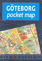
Gothenburg Pocket Atlas

Gothenburg/Göteborg in a handy size, indexed pocket atlas from Liber Kartor with diagrams of the public transport networks, a road map of the city’s environs, and ferry connections between the nearby islands.The plan shows the city with its network of tram routes (line numbers are not given) and ferry connections. Main public buildings are highlighted and named, and streets are shown with selected house numbers for easier identification of addresses. There is no map legend but all information is self-explanatory. Street index includes a list of useful phone numbers.Also provided are diagrams of tram lines plus regional bus and train networks, a road map of the city’s environs at 1:488, 000 and a map of ferry routes connecting the nearby islands.
RIP - This product is no longer available on our network. It was last seen on 25.09.2019

This page now acts as a permanent archive for this product. Add more information using the comments box below to ensure it can still be found by future generations.

Use our search facility to see if it is available from an alternative contributor.
  • External links may include paid for promotion
  • Availability: Out Of Stock
  • Supplier: Stanfords
  • SKU: 9789147801251
Availability: In Stock
£11.95

Product Description

Gothenburg/Göteborg in a handy size, indexed pocket atlas from Liber Kartor with diagrams of the public transport networks, a road map of the city’s environs, & ferry connections between the nearby islands. The plan shows the city with its network of tram routes (line numbers are not given) & ferry connections. Main public buildings are highlighted & named, & streets are shown with selected house numbers for easier identification of addresses. There is no map legend but all information is self-explanatory. Street index

Includes::
a list of useful phone numbers. Also provided are diagrams of tram lines plus regional bus & train networks, a road map of the city’s environs at 1:488, 000 & a map of ferry routes connecting the nearby islands.

Reviews/Comments

Add New

Intelligent Comparison

Oooops!
We couldn't find anything!
Perhaps this product's unique.... Or perhaps we are still looking for comparisons!
Click to bump this page and we'll hurry up.

Price History

Vouchers

No voucher codes found.
Do you know a voucher code for this product or supplier? Add it to Insights for others to use.

Facebook

Jargon Buster

phone - Short for telephone. A device that transmits sound allowing point to point communication over long distances
Size - is the measurement of how big an object is in space.
Network - A link and communication between things. Often computers or people.
Road - a manmade lane or a path that is used to speed up travel.
Tram - A large vehicle common in cities for public transport, also known as a cable car.
Pocket - A bag shaped insert in clothing used to carry items
Regional - An adjective to describe a set geographic area.
Transport - Something that carries people or goods.

Supplier Information

Stanfords
Stanfords was established in 1853 and opened their iconic Covent Garden flagship store in 1901. They have become the top retailer of maps, travel books and accessories in the UK and arguably offer the largest selection of maps and travel books worldwide. Famous names such as Captain Robert Falcon Scott, Ranulph Fiennes and Michael Palin have purchased from Stanfords. They now have a shop in Bristol and both stores together with other venues operate a calendar of events including talks, book signings and exhibitions. As a specialist map retailer, the map selection is comprehensive and includes road maps, street maps and walking maps from worldwide destinations, as well as a selection of world atlases and wall maps. Books include travel guides and travel literature. Stanfords also stock globes, from miniatures made of blue marble to magnificent floor-standing globes. The website features a selection of interesting articles on travel topics.
Page Updated: 2023-11-12 20:15:36

Community Generated Product Tags

Oh No! The productWIKI community hasn't generated any tags for this product yet!
Menu