More From Contributor

£6.99
The unavoidable downside to an evening spent enjoying your favourite cocktails is the dreaded hangover the following day. One would think that in this day & age, someone would have developed the technology to counteract nausea, lethargy & nagging headaches. Sadly not. Ben Reed
- bestselling author & seasoned bartender (and drinker)
- is here to help. ” Hangover Cures” explains why we get a hangover, the best way to avoid them &, if all else fails, recipes to help alleviate the pain. Try a Corpse Reviver or a Bloody Mary to take the edge off your hangover, or, for a healthier option, replace lost nutrients with a juice drink such as the restorative Liver Recovery. With cures from around the world, reviving recipes & expert advice, ” Hangover Cures” will help ease the suffering of the morning after the night before.

...
Archived Product
£8.99
The seventy-fifth anniversary edition, with a new introduction by Anthony Quinn. London, 1939, & in the grimy publands of Earls Court, George Harvey Bone is pursuing a helpless infatuation. Netta is cool, contemptuous & hopelessly desirable to George. George is adrift in a drunken hell, except in his `dead` moments, when something goes click in his head & he realises, without a doubt, that he must kill her. In the darkly comic Hangover Square Patrick Hamilton brilliantly evokes a seedy, fog-bound world of saloon bars, lodging houses & boozing philosophers, immortalising the slang & conversational tone of a whole generation & capturing the premonitions of doom that pervaded London life in the months before the war. ...
Archived Product
£17.99
The 1:50 000 topographic map gives a more general picture of the ground features than a basic map. It shows settlements, houses, roads, cultivated areas, waterways, cutting areas, mires, rock exposures, & relief. One map sheet covers an area of 30 x 40 km & one centimetre corresponds to 500 metres on the ground. The 1:50, 000 topographic map is also an ideal complement to nautical charts as it provides useful information about the land areas adjacent to waterways. For example, all Finnish sea areas are covered by 1:50 000 topographic map sheets. ...
Archived Product
£23.99
Karttakeskus’ Water touring maps are a completely new type of map series. The pre-folded maps made from waterproof & rip-proof material can fit into a small space on the boat, but when opened, they cover a wide area. In this way, the water touring map is e.g. an excellent planning tool alongside electronic navigation solutions, offering a wide overview for e.g. route planning. On the other h&, the waterproof material makes the map easy to handle in e.g. an open boat or sailing boat. Water touring maps: In land areas, the maps have been supplemented with the National Land Survey of Finland’s Topographic Database material. New map sheet division. Size 70 × 100 cm, folded 23.3 × 11.3 cm. Additional themes incl. slipways & camp fire sites & landfalls. Scale in maritime areas 1:60 000, inland waterways 1:50 000 Base map source: Finnish Transport Agency. Not for navigation use. Does not meet the requirements of an official nautical chart. ...
Archived Product
£3.50
Hanley & Etruria in 1898 in a fascinating series of reproductions of old Ordnance Survey plans in the Alan Godfrey Editions, ideal for anyone interested in the history of their neighbourhood or family. Two versions have been published for this area with the 1877 map in full colour. Coverage stretches from Grafton Street westward to the NSR main line & from Granville Street southward to Argyle Street. Features include North Staffordshire main line with Etruria station, NSR Loop Line with Hanley station, part of NSR Grange Branch, Shelton Steel Works, Shelton Blast Furnaces, Etruria Potteries, Canal Tileries, Shelton Colliery, Fowlea Farm, Trent & Mersey Canal, Rowhurst Pits, Royal Victoria Works, tramways, Shelton Iron & Steel Works, Racecourse Pits, Brook Street Works, Grand Hotel, Tontine Square, Market Square, St John`s church, Church Works, other potteries & earthenware manufactories, Town Hall, Holy Trinity church, etc. Extracts from early directories are included on the reverse. About the Alan Godfrey Editions of the 25” OS Series: Selected towns in Great Britain & Ireland are covered by maps showing the extent of urban development in the last decades of the 19th & early 20th century. The plans have been taken from the Ordnance Survey mapping & reprinted at about 15 inches to one mile (1:4, 340). On the reverse most maps have historical notes & many also include extracts from contemporary directories. Most maps cover about one mile (1.6kms) north/south, one & a half miles (2.4kms) across; adjoining sheets can be combined to provide wider coverage.FOR MORE INFORMATION & A COMPLETE LIST OF ALL AVAILABLE TITLES PLEASE CLICK ON THE SERIES LINK. ...
Archived Product
£2.95
Hanley East & Bucknall in 1898 in a fascinating series of reproductions of old Ordnance Survey plans in the Alan Godfrey Editions, ideal for anyone interested in the history of their neighbourhood or family. Selected towns in Great Britain & Ireland are covered by maps showing the extent of urban development in the last decades of the 19th & early 20th century. In this title: the map covers the eastern side of Hanley, including Northwood & Wellington Wards, plus the village of Bucknall. Coverage extends from St John Street eastward to Townsend, & from Boulton Street southward to Botteslow Street. Features include Eagle Pottery, Trent Sanitary Works, Ivy House Paper Mills, Northwood Colliery, Holy Trinity church, Clayholes Pit, NSR Biddulph Valley Line with Bucknall & Northwood station, Finney Gardens, Mossfield Colliery (disused), Bucknall, Brookhouse Green, infectious diseases hospital, old coal shafts, Bucknall Bridge, Jubilee Pit (disused), Caldon Canal, etc. On the reverse is a Bucknall directory About the Alan Godfrey Editions of the 25 ...
Archived Product
£3.50
Hanley East & Bucknall in 1898 in a fascinating series of reproductions of old Ordnance Survey plans in the Alan Godfrey Editions, ideal for anyone interested in the history of their neighbourhood or family. SThe map covers the eastern side of Hanley, including Northwood & Wellington Wards, plus the village of Bucknall. Coverage extends from St John Street eastward to Townsend, & from Boulton Street southward to Botteslow Street. Features include Eagle Pottery, Trent Sanitary Works, Ivy House Paper Mills, Northwood Colliery, Holy Trinity church, Clayholes Pit, NSR Biddulph Valley Line with Bucknall & Northwood station, Finney Gardens, Mossfield Colliery (disused), Bucknall, Brookhouse Green, infectious diseases hospital, old coal shafts, Bucknall Bridge, Jubilee Pit (disused), Caldon Canal, etc. On the reverse is a Bucknall directory About the Alan Godfrey Editions of the 25” OS Series: Selected towns in Great Britain & Ireland are covered by maps showing the extent of urban development in the last decades of the 19th & early 20th century. The plans have been taken from the Ordnance Survey mapping & reprinted at about 15 inches to one mile (1:4, 340). On the reverse most maps have historical notes & many also include extracts from contemporary directories. Most maps cover about one mile (1.6kms) north/south, one & a half miles (2.4kms) across; adjoining sheets can be combined to provide wider coverage.FOR MORE INFORMATION & A COMPLETE LIST OF ALL AVAILABLE TITLES PLEASE CLICK ON THE SERIES LINK. ...
Archived Product
£6.99
As Rome`s war with Carthage continues, two friends
- now on opposing sides
- confront each other in one of the most brutal

...
Archived Product
£7.99
” Enemy Of Rome”: The great Carthaginian general, Hannibal, has never forgotten the defeat & humiliation of his father by Rome. Now he plans his revenge & the destruction of the old enemy. ” Soldier Of Carthage”: While Hannibal prepares for war, the young son of one of his most trusted military commanders goes on an innocent adventure with his best friend
- & disappears. ” Slavery”: Captured by pirates, put up for sale in the slave market, one of the boys is sold as a gladiator, the other as a field slave. They believe they will never see home or family again. ”A World Aflame”: But their destiny
- interwoven & linked with that of their Roman masters
- is to be an extraordinary one. The devastating war unleashed upon Rome by Hannibal will last for nearly twenty years. It will change their lives
- & history
- forever.


...
Archived Product

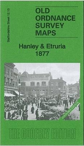
Hanley And Etruria 1877 (Colour Edition)

Hanley and Etruria in 1877 in a fascinating series of reproductions of old Ordnance Survey plans in the Alan Godfrey Editions, ideal for anyone interested in the history of their neighbourhood or family. Two versions have been published for this area with the 1877 map in full colour. Coverage stretches from Grafton Street westward to the NSR main line and from Granville Street southward to Argyle Street. Features include North Staffordshire main line with Etruria station, NSR Loop Line with Hanley station, part of NSR Grange Branch, Shelton Steel Works, Shelton Blast Furnaces, Etruria Potteries, Canal Tileries, Shelton Colliery, Fowlea Farm, Trent & Mersey Canal, Rowhurst Pits, Royal Victoria Works, tramways, Shelton Iron & Steel Works, Racecourse Pits, Brook Street Works,
Grand Hotel, Tontine Square, Market Square, St John`s church, Church Works, other potteries and earthenware manufactories, Town Hall, Holy Trinity church, etc. Extracts from early directories are included on the reverse. About the Alan Godfrey Editions of the 25” OS Series:Selected towns in Great Britain and Ireland are covered by maps showing the extent of urban development in the last decades of the 19th and early 20th century. The plans have been taken from the Ordnance Survey mapping and reprinted at about 15 inches to one mile (1:4, 340). On the reverse most maps have historical notes and many also include extracts from contemporary directories. Most maps cover about one mile (1.6kms) north/south, one and a half miles (2.4kms) across; adjoining sheets can be combined to
provide wider coverage.FOR MORE INFORMATION AND A COMPLETE LIST OF ALL AVAILABLE TITLES PLEASE CLICK ON THE SERIES LINK.
RIP - This product is no longer available on our network. It was last seen on 25.09.2019

This page now acts as a permanent archive for this product. Add more information using the comments box below to ensure it can still be found by future generations.

Use our search facility to see if it is available from an alternative contributor.
  • External links may include paid for promotion
  • Availability: Out Of Stock
  • Supplier: Stanfords
  • SKU: 9781847844484
Availability: In Stock
£4.50

Product Description

Hanley & Etruria in 1877 in a fascinating series of reproductions of old Ordnance Survey plans in the Alan Godfrey Editions, ideal for anyone interested in the history of their neighbourhood or family. Two versions have been published for this area with the 1877 map in full colour. Coverage stretches from Grafton Street westward to the NSR main line & from Granville Street southward to Argyle Street. Features include North Staffordshire main line with Etruria station, NSR Loop Line with Hanley station, part of NSR Grange Branch, Shelton Steel Works, Shelton Blast Furnaces, Etruria Potteries, Canal Tileries, Shelton Colliery, Fowlea Farm, Trent & Mersey Canal, Rowhurst Pits, Royal Victoria Works, tramways, Shelton Iron & Steel Works, Racecourse Pits, Brook Street Works, Grand Hotel, Tontine Square, Market Square, St John`s church, Church Works, other potteries & earthenware manufactories, Town Hall, Holy Trinity church, etc. Extracts from early directories are included on the reverse. About the Alan Godfrey Editions of the 25” OS Series: Selected towns in Great Britain & Ireland are covered by maps showing the extent of urban development in the last decades of the 19th & early 20th century. The plans have been taken from the Ordnance Survey mapping & reprinted at about 15 inches to one mile (1:4, 340). On the reverse most maps have historical notes & many also include extracts from contemporary directories. Most maps cover about one mile (1.6kms) north/south, one & a half miles (2.4kms) across; adjoining sheets can be combined to provide wider coverage.FOR MORE INFORMATION & A COMPLETE LIST OF ALL AVAILABLE TITLES PLEASE CLICK ON THE SERIES LINK.

Reviews/Comments

Add New

Price History

Vouchers

No voucher codes found.
Do you know a voucher code for this product or supplier? Add it to Insights for others to use.

Facebook

Jargon Buster

Contemporary - Modern era design
Steel - An alloy made predominately of Iron combined with <2% carbon
Contemporary - A design reference to indicate post war modern design
Hotel - An establishment which provides lodging for a fee
iron - An electrical deviced used for removing creases from fabrics
iron - A chemical element (FE). The most common element on earth
History - Anything that happens in the past. An acedemic subject.
Colour - The categorised spectrum of light visable to humans
Contemporary - An object that is living in the same time.
Hall - A room at the inside of an entrance of a house.
Ideal - Something that satisfies a perfect criteria.
Family - A group of people that live together made up from parents and children.

Supplier Information

Stanfords
Stanfords was established in 1853 and opened their iconic Covent Garden flagship store in 1901. They have become the top retailer of maps, travel books and accessories in the UK and arguably offer the largest selection of maps and travel books worldwide. Famous names such as Captain Robert Falcon Scott, Ranulph Fiennes and Michael Palin have purchased from Stanfords. They now have a shop in Bristol and both stores together with other venues operate a calendar of events including talks, book signings and exhibitions. As a specialist map retailer, the map selection is comprehensive and includes road maps, street maps and walking maps from worldwide destinations, as well as a selection of world atlases and wall maps. Books include travel guides and travel literature. Stanfords also stock globes, from miniatures made of blue marble to magnificent floor-standing globes. The website features a selection of interesting articles on travel topics.
Page Updated: 2023-11-12 20:15:36

Community Generated Product Tags

Oh No! The productWIKI community hasn't generated any tags for this product yet!
Menu