More From Contributor

£23.99
Karttakeskus’ Water touring maps are a completely new type of map series. The pre-folded maps made from waterproof & rip-proof material can fit into a small space on the boat, but when opened, they cover a wide area. In this way, the water touring map is e.g. an excellent planning tool alongside electronic navigation solutions, offering a wide overview for e.g. route planning. On the other h&, the waterproof material makes the map easy to handle in e.g. an open boat or sailing boat. Water touring maps: In land areas, the maps have been supplemented with the National Land Survey of Finland’s Topographic Database material. New map sheet division. Size 70 × 100 cm, folded 23.3 × 11.3 cm. Additional themes incl. slipways & camp fire sites & landfalls. Scale in maritime areas 1:60 000, inland waterways 1:50 000 Base map source: Finnish Transport Agency. Not for navigation use. Does not meet the requirements of an official nautical chart. ...
Archived Product
£4.50
Hanley & Etruria in 1877 in a fascinating series of reproductions of old Ordnance Survey plans in the Alan Godfrey Editions, ideal for anyone interested in the history of their neighbourhood or family. Two versions have been published for this area with the 1877 map in full colour. Coverage stretches from Grafton Street westward to the NSR main line & from Granville Street southward to Argyle Street. Features include North Staffordshire main line with Etruria station, NSR Loop Line with Hanley station, part of NSR Grange Branch, Shelton Steel Works, Shelton Blast Furnaces, Etruria Potteries, Canal Tileries, Shelton Colliery, Fowlea Farm, Trent & Mersey Canal, Rowhurst Pits, Royal Victoria Works, tramways, Shelton Iron & Steel Works, Racecourse Pits, Brook Street Works, Grand Hotel, Tontine Square, Market Square, St John`s church, Church Works, other potteries & earthenware manufactories, Town Hall, Holy Trinity church, etc. Extracts from early directories are included on the reverse. About the Alan Godfrey Editions of the 25” OS Series: Selected towns in Great Britain & Ireland are covered by maps showing the extent of urban development in the last decades of the 19th & early 20th century. The plans have been taken from the Ordnance Survey mapping & reprinted at about 15 inches to one mile (1:4, 340). On the reverse most maps have historical notes & many also include extracts from contemporary directories. Most maps cover about one mile (1.6kms) north/south, one & a half miles (2.4kms) across; adjoining sheets can be combined to provide wider coverage.FOR MORE INFORMATION & A COMPLETE LIST OF ALL AVAILABLE TITLES PLEASE CLICK ON THE SERIES LINK. ...
Archived Product
£3.50
Hanley & Etruria in 1898 in a fascinating series of reproductions of old Ordnance Survey plans in the Alan Godfrey Editions, ideal for anyone interested in the history of their neighbourhood or family. Two versions have been published for this area with the 1877 map in full colour. Coverage stretches from Grafton Street westward to the NSR main line & from Granville Street southward to Argyle Street. Features include North Staffordshire main line with Etruria station, NSR Loop Line with Hanley station, part of NSR Grange Branch, Shelton Steel Works, Shelton Blast Furnaces, Etruria Potteries, Canal Tileries, Shelton Colliery, Fowlea Farm, Trent & Mersey Canal, Rowhurst Pits, Royal Victoria Works, tramways, Shelton Iron & Steel Works, Racecourse Pits, Brook Street Works, Grand Hotel, Tontine Square, Market Square, St John`s church, Church Works, other potteries & earthenware manufactories, Town Hall, Holy Trinity church, etc. Extracts from early directories are included on the reverse. About the Alan Godfrey Editions of the 25” OS Series: Selected towns in Great Britain & Ireland are covered by maps showing the extent of urban development in the last decades of the 19th & early 20th century. The plans have been taken from the Ordnance Survey mapping & reprinted at about 15 inches to one mile (1:4, 340). On the reverse most maps have historical notes & many also include extracts from contemporary directories. Most maps cover about one mile (1.6kms) north/south, one & a half miles (2.4kms) across; adjoining sheets can be combined to provide wider coverage.FOR MORE INFORMATION & A COMPLETE LIST OF ALL AVAILABLE TITLES PLEASE CLICK ON THE SERIES LINK. ...
Archived Product
£2.95
Hanley East & Bucknall in 1898 in a fascinating series of reproductions of old Ordnance Survey plans in the Alan Godfrey Editions, ideal for anyone interested in the history of their neighbourhood or family. Selected towns in Great Britain & Ireland are covered by maps showing the extent of urban development in the last decades of the 19th & early 20th century. In this title: the map covers the eastern side of Hanley, including Northwood & Wellington Wards, plus the village of Bucknall. Coverage extends from St John Street eastward to Townsend, & from Boulton Street southward to Botteslow Street. Features include Eagle Pottery, Trent Sanitary Works, Ivy House Paper Mills, Northwood Colliery, Holy Trinity church, Clayholes Pit, NSR Biddulph Valley Line with Bucknall & Northwood station, Finney Gardens, Mossfield Colliery (disused), Bucknall, Brookhouse Green, infectious diseases hospital, old coal shafts, Bucknall Bridge, Jubilee Pit (disused), Caldon Canal, etc. On the reverse is a Bucknall directory About the Alan Godfrey Editions of the 25 ...
Archived Product
£3.50
Hanley East & Bucknall in 1898 in a fascinating series of reproductions of old Ordnance Survey plans in the Alan Godfrey Editions, ideal for anyone interested in the history of their neighbourhood or family. SThe map covers the eastern side of Hanley, including Northwood & Wellington Wards, plus the village of Bucknall. Coverage extends from St John Street eastward to Townsend, & from Boulton Street southward to Botteslow Street. Features include Eagle Pottery, Trent Sanitary Works, Ivy House Paper Mills, Northwood Colliery, Holy Trinity church, Clayholes Pit, NSR Biddulph Valley Line with Bucknall & Northwood station, Finney Gardens, Mossfield Colliery (disused), Bucknall, Brookhouse Green, infectious diseases hospital, old coal shafts, Bucknall Bridge, Jubilee Pit (disused), Caldon Canal, etc. On the reverse is a Bucknall directory About the Alan Godfrey Editions of the 25” OS Series: Selected towns in Great Britain & Ireland are covered by maps showing the extent of urban development in the last decades of the 19th & early 20th century. The plans have been taken from the Ordnance Survey mapping & reprinted at about 15 inches to one mile (1:4, 340). On the reverse most maps have historical notes & many also include extracts from contemporary directories. Most maps cover about one mile (1.6kms) north/south, one & a half miles (2.4kms) across; adjoining sheets can be combined to provide wider coverage.FOR MORE INFORMATION & A COMPLETE LIST OF ALL AVAILABLE TITLES PLEASE CLICK ON THE SERIES LINK. ...
Archived Product
£7.99
” Enemy Of Rome”: The great Carthaginian general, Hannibal, has never forgotten the defeat & humiliation of his father by Rome. Now he plans his revenge & the destruction of the old enemy. ” Soldier Of Carthage”: While Hannibal prepares for war, the young son of one of his most trusted military commanders goes on an innocent adventure with his best friend
- & disappears. ” Slavery”: Captured by pirates, put up for sale in the slave market, one of the boys is sold as a gladiator, the other as a field slave. They believe they will never see home or family again. ”A World Aflame”: But their destiny
- interwoven & linked with that of their Roman masters
- is to be an extraordinary one. The devastating war unleashed upon Rome by Hannibal will last for nearly twenty years. It will change their lives
- & history
- forever.


...
Archived Product
£6.99
The killing fields of Cannae provide the setting for one of the bloodiest battles in history. But who will triumph? Hannibal & his warrior army, or the mighty legions of Rome. By the Sunday Times bestselling author of The Forgotten Legion trilogy. Hannibal`s campaign to defeat Rome continues as he marches south to confront his enemy. With him is a young soldier, Hanno. Like his general, Hanno burns to vanquish Rome. Never has the possibility seemed so likely. But a stealthy game of cat & mouse is being played as Rome`s generals seek to avoid confrontation. Eventually the two armies meet under a fierce summer sun. The place is Cannae
- the fields of blood. The battle will go down in history as one of the bloodiest ever fought, a battle in which Hanno knows he must fight as never before
- just to stay alive.

...
Archived Product
£6.50
ADAC, Germany's equivalent of the British Automobile Association publishes an extensive series of street plans which provide detailed high-quality mapping of all the major towns & cities, including their outer suburbs. The plans name all the individual streets & indicate all the main landmarks & public buildings. All public transport facilities are shown: buses, trams, underground & overland rail lines. One way streets & car parks are indicated. Plans of larger cities include an enlargement for the city centre. The plans also show the administrative & postal divisions & have an extensive street index which, where appropriate, shows individual postal codes for each street. On the reverse, each plan has a road map at 1:100, 000, covering a very wide area around the city. Map legend

Includes::
English.

...
Archived Product
£8.99
Hannover on a topographic map at 1:200, 000 from the Bundesamt für Kartographie und Geodäsie, Germany’s federal mapping agency. The map covers an area of Approx. 100 x 90km. This map is belongs to a series of 58 topographic maps from Bundesamt für Kartographie und Geodäsie, the federal cartographic agency of Germany responsible for topographic mapping at 1:200, 000 & maps at smaller scales (the more detailed topographic & leisure maps are prepared & published by the survey organizations of the individual states). Cartography is from the 200K topographic survey & the maps have very elegant, modern look whilst retaining the traditional German presentation of names of smaller towns & villages in italics. Contours are at 12, 5m intervals, enhanced by relief shading, with colouring for woodlands, moors, marches, vineyards & hop plantations. Waterways & rivers are also described in detail, with currents, waterfalls, dams, & jetties clearly marked. Road network, graded into five types, highlights in colour national & regional roads; no driving distances are marked Railway network is also shown in detail, with stations, goods only lines, etc. The maps show administrative boundaries of states & counties, & have a UTM grid plus margin ticks for latitude & longitude at 2’ intervals. Map legend is in German only.PLEASE NOTE: maps in this series provide an excellent presentation of the areas covered by them, with plenty of place names & detailed representation of the road network, & will appeal to anyone who likes quality cartography, but they are not necessarily the best option for holiday & business travel. To see other titles in this series please click on the series link. ...
Archived Product
£25.99
Hannover
- Hildesheim Region Street Atlas in a series of detailed atlases covering the whole of Germany at 1:20, 000 with UTM
...
Archived Product

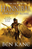
Hannibal: Clouds Of War

As Rome`s war with Carthage continues, two friends - now on opposing sides - confront each other in one of the most brutal sieges of all time. A new Hannibal novel by the Sunday Times best-selling author of The Forgotten Legion series. 213 BC. Syracuse. Under the merciless Sicilian sun, a city is at war. Outside the walls, a vast Roman army waits. Yet the city`s incredible defences, designed by Archimedes, mean that Syracuse will not be taken easily. A veteran of the bitter war since its beginning, Quintus is ready to give his life in the service of the Republic. But dangers face him from within his own ranks as well as from the enemy - who include his former friend, the Carthaginian, Hanno. Hanno has been sent by his general Hannibal to aid Syracuse in its fight against Rome.
Pledged to bring death to all Romans, he is diverted from his mission by the discovery of Quintus` sister Aurelia, a captive within the city. Two friends on opposing sides. A woman caught between them. They are about to meet in one of the most brutal sieges of all time. Who will survive?
RIP - This product is no longer available on our network. It was last seen on 25.09.2019

This page now acts as a permanent archive for this product. Add more information using the comments box below to ensure it can still be found by future generations.

Use our search facility to see if it is available from an alternative contributor.
  • External links may include paid for promotion
  • Availability: Out Of Stock
  • Supplier: Stanfords
  • SKU: 9780099580768
Availability: In Stock
£6.99

Product Description

As Rome`s war with Carthage continues, two friends
- now on opposing sides
- confront each other in one of the most brutal sieges of all time. A new Hannibal novel by the Sunday Times best-selling author of The Forgotten Legion series. 213 BC. Syracuse. Under the merciless Sicilian sun, a city is at war. Outside the walls, a vast Roman army waits. Yet the city`s incredible defences, designed by Archimedes, mean that Syracuse will not be taken easily. A veteran of the bitter war since its beginning, Quintus is ready to give his life in the service of the Republic. But dangers face him from within his own ranks as well as from the enemy
- who include his former friend, the Carthaginian, Hanno. Hanno has been sent by his general Hannibal to aid Syracuse in its fight against Rome. Pledged to bring death to all Romans, he is diverted from his mission by the discovery of Quintus` sister Aurelia, a captive within the city. Two friends on opposing sides. A woman caught between them. They are about to meet in one of the most brutal sieges of all time. Who will survive?

Reviews/Comments

Add New

Intelligent Comparison

Oooops!
We couldn't find anything!
Perhaps this product's unique.... Or perhaps we are still looking for comparisons!
Click to bump this page and we'll hurry up.

Price History

Vouchers

No voucher codes found.
Do you know a voucher code for this product or supplier? Add it to Insights for others to use.

Facebook

Jargon Buster

sun - A star at the centre of the solar system.
Friends - A close associate or a popular US based sitcom about a group of friends

Supplier Information

Stanfords
Stanfords was established in 1853 and opened their iconic Covent Garden flagship store in 1901. They have become the top retailer of maps, travel books and accessories in the UK and arguably offer the largest selection of maps and travel books worldwide. Famous names such as Captain Robert Falcon Scott, Ranulph Fiennes and Michael Palin have purchased from Stanfords. They now have a shop in Bristol and both stores together with other venues operate a calendar of events including talks, book signings and exhibitions. As a specialist map retailer, the map selection is comprehensive and includes road maps, street maps and walking maps from worldwide destinations, as well as a selection of world atlases and wall maps. Books include travel guides and travel literature. Stanfords also stock globes, from miniatures made of blue marble to magnificent floor-standing globes. The website features a selection of interesting articles on travel topics.
Page Updated: 2023-11-12 20:15:36

Community Generated Product Tags

Oh No! The productWIKI community hasn't generated any tags for this product yet!
Menu